Faso-benkadi is a village in the Tansila Department of Banwa Province in western Burkina Faso. As of 2005 it had a population of 917. Liste des villages...
3 KB (57 words) - 03:32, 5 December 2017

are traditional hunters in northern Côte d'Ivoire, southeast Mali, and Burkina Faso, and members of a co-fraternity containing initiated hunters and sons...
14 KB (1,789 words) - 11:25, 11 May 2024

Mande Samo, is a dialect cluster of Niger–Congo languages spoken in Burkina Faso and Mali. Intelligibility between Samo varieties is low. The following...
6 KB (179 words) - 10:13, 9 July 2024

from France (djembefola with Sokan), and Melissa Hie from Burkina Faso (lead djembefola of Benkadi). Djembe sound sample Djembe at medium pitch Problems playing...
61 KB (6,665 words) - 21:58, 24 June 2024
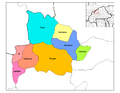
Di Department (category Departments of Burkina Faso)
of Sourou Province in north-western Burkina Faso. Its capital lies at the town of Di. Di (5 795 inhabitants) Benkadi (959 inhabitants) Bossé (1 227 inhabitants)...
4 KB (96 words) - 00:13, 10 September 2017

Mali, Burkina Faso, Guinea, Côte d'Ivoire, Senegal and Togo. The previous meeting took place in December 2003 in Bobo-Dioulasso in Burkina Faso. The young...
14 KB (710 words) - 10:00, 7 July 2023
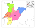
Tansila Department (category Departments of Burkina Faso)
107 inhabitants) Douma (1 154 inhabitants) Driko (1 050 inhabitants) Faso-benkadi (917 inhabitants) Féléwé (144 inhabitants) Gui (660 inhabitants) Kéllé...
5 KB (171 words) - 14:48, 16 July 2018
featuring people from outlying villages, immigrants from Côte d'Ivoire and Burkina Faso and refugees. The southwest corner of the Sikasso region is traditionally...
6 KB (356 words) - 10:42, 5 May 2023

Burkina Faso, Sikasso acts as a crossroads between the coastal countries (Togo, Bénin, Ghana, Côte d'Ivoire) and the landlocked Mali and Burkina Faso...
17 KB (821 words) - 11:07, 1 April 2024
on the N7, the small road that links Sikasso with Bobo-Dioulasso in Burkina Faso. Common and Fundamental Operational Datasets Registry: Mali, United Nations...
6 KB (208 words) - 04:59, 21 June 2022
commune, is 43 km northeast of Kadiolo and 8 km from the border with Burkina Faso The primary language is Senufo, specifically Suppire. Common and Fundamental...
5 KB (205 words) - 14:21, 15 June 2022
to the north of the road, the D14, that links Yorosso with Sanaba in Burkina Faso. Common and Fundamental Operational Datasets Registry: Mali, United Nations...
6 KB (211 words) - 18:57, 21 October 2023
the Ivory Coast. It lies close to Mount Tenakourou on the border with Burkina Faso, the highest point of that country. Common and Fundamental Operational...
6 KB (231 words) - 08:07, 21 June 2022
main road linking Koutiala in Mali with the town of Bobo-Dioulasso in Burkina Faso. Common and Fundamental Operational Datasets Registry: Mali, United Nations...
6 KB (213 words) - 12:22, 15 June 2022

Sikasso and Koutiala. It is also about 30 km west of the border with Burkina Faso. Katierla Koumbala Kouoro Makono Sokourani Sougoula Koloni The French...
8 KB (539 words) - 14:17, 23 January 2024
Mahou, Mali (category Burkina Faso–Mali border crossings)
center (chef-lieu), is 30 km southeast of Yorosso on the border with Burkina Faso. Common and Fundamental Operational Datasets Registry: Mali, United Nations...
6 KB (196 words) - 01:32, 26 June 2022