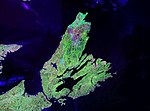
Bras d'Or Lake (Mi'kmawi'simk: Pitupaq) is an irregular estuary in the centre of Cape Breton Island in Nova Scotia, Canada. It has a connection to the...
14 KB (1,139 words) - 11:37, 20 July 2024
HMCS Bras d'Or is a name used by the Royal Canadian Navy and Canadian Forces MARCOM for several ships, named after Bras d'Or Lake. HMCS Bras d'Or (1919)...
508 bytes (91 words) - 22:46, 25 January 2023
overruns later led to the project's cancellation. Bras d'Or was named in honour of Bras d'Or Lake on Nova Scotia's Cape Breton Island, where inventor...
11 KB (1,112 words) - 22:33, 6 September 2024
Bras d'Or Lake, the name of which means arms of gold or golden arms, is a saltwater lake on Cape Breton Island. Bras d'Or can also refer to: Bras d'Or...
1 KB (221 words) - 13:25, 19 July 2022
Bras d'Or Lake Biosphere Reserve (established 2011) is a UNESCO Biosphere Reserve located at Bras d'Or Lake, Cape Breton Island, Nova Scotia, Canada....
5 KB (521 words) - 19:49, 20 September 2024
Nova Scotia Railway across Cape Breton Island, at times within view of Bras d'Or Lake, after which the train is named. "National Timetable". Via Rail. 29...
3 KB (124 words) - 21:08, 5 October 2024
farmland that was available, as well as the nearby fish stocks in the Bras d’Or Lake. By June, 1812, Donald, James, Alexander, Roderick, and John MacNeil...
9 KB (1,003 words) - 19:06, 2 December 2023
The bridge is a through arch design and crosses the Great Bras d'Or channel of Bras d'Or Lake, connecting Boularderie Centre, Boularderie Island on the...
11 KB (1,076 words) - 16:46, 29 January 2024
The Bras d'Or Lakes Scenic Drive is a scenic roadway on Nova Scotia's Cape Breton Island. It extends around the perimeter of Bras d'Or Lake. Highway 105...
4 KB (168 words) - 01:20, 5 December 2022
Bras d'Or (R-103) was a small experimental hydrofoil built for the Royal Canadian Navy (RCN) during the 1950s. It led to the development of HMCS Bras...
3 KB (200 words) - 15:04, 23 July 2024
List of rivers of Nova Scotia (section Bras d'Or Lake)
Nova Scotia's rivers all flow into the Atlantic Ocean through four unique watersheds: the Gulf of Maine, the Northumberland Strait, the Gulf of Saint Lawrence...
6 KB (717 words) - 23:25, 15 July 2024
Cape Breton Island (redirect from Scotch Lake (Nova Scotia))
marine vessels may also enter Bras d'Or Lake through the Great Bras d'Or channel, and small craft can use the Little Bras d'Or channel or St. Peters Canal...
67 KB (7,117 words) - 14:49, 23 October 2024
(secondary coordinates) Bras d'Or Lake 45°51′37″N 60°46′44″W / 45.86028°N 60.77889°W / 45.86028; -60.77889 (Bras d'Or Lake) Beaver Lake 44°29′57″N 64°55′14″W...
63 KB (522 words) - 17:26, 20 October 2024
List of marinas (section Bras d'Or Lake)
Narrows), Grand Narrows (Barra Strait) Ben Eoin Marina, Ben Eoin (East Bay) Bras d'Or Yacht Club, Baddeck Cape Breton Boatyard (Baddeck), Baddeck St Peter's...
42 KB (3,376 words) - 16:57, 25 October 2024
started building an estate on a point across from Baddeck, overlooking Bras d'Or Lake. By 1889, a large house, christened The Lodge was completed and two...
142 KB (16,419 words) - 18:13, 27 October 2024
section passes through the Margaree River valley before passing along Bras d'Or Lake. The route is within the county municipalities of Victoria and Inverness...
5 KB (407 words) - 22:26, 8 August 2024
Sea Lake Turkana in Kenya and Ethiopia Bras d'Or Lake on Cape Breton Island in Nova Scotia, Canada Laguna de Oviedo in the Dominican Republic Lake Charles...
7 KB (679 words) - 12:54, 21 November 2023
HMCS Bras d'Or was an auxiliary minesweeper that served in the Royal Canadian Navy (RCN) between 1939 and 1940, when she sank with all hands in a storm...
8 KB (816 words) - 15:22, 16 October 2024
660 ft). Like the other major channels of the Bras d'Or Lake (St. Patricks, Great Bras d’Or, Little Bras d’Or and St. Andrews), East Bay has a northeast...
21 KB (2,005 words) - 03:51, 3 May 2024
Breton Island. Two outlets of Bras d'Or Lake run on each side of the island to the Atlantic Ocean: the Great Bras d'Or channel runs along the island's...
5 KB (423 words) - 10:38, 19 April 2024
It refers to a peninsula jutting into Cape Breton Island's scenic Bras d'Or Lake approximately three kilometres (two miles) southeast of the village...
8 KB (849 words) - 23:07, 22 July 2024
This is a list of lakes of the Northwest Territories with an area larger than 400 km2 (150 sq mi). Bras d'Or Lake is the largest lake in Nova Scotia with...
40 KB (864 words) - 14:59, 13 June 2024
Bras d'Or Lake 165 metres (541 ft) below. Small-scale farming is practised in some areas of the East Bay Hills. Fishing the waters of the Bras d'Or Lake...
8 KB (867 words) - 20:02, 17 November 2021
Nova Scotia, a small town East Bay (Nova Scotia), the east arm of the Bras d'Or Lake East Bay (Nunavut), a waterway in the Kivalliq Region East Bay (Argyll...
1 KB (209 words) - 20:14, 8 June 2024
property in Baddeck, Cape Breton, Nova Scotia, Canada, overlooking the Bras d'Or Lakes. The site is a unit of Parks Canada, the national park system, and...
6 KB (481 words) - 10:19, 24 August 2024
Valleys, and is the highest point on Cape Breton Island south of the Bras d'Or Lake with its summit at 222 m (728 ft). Thirty kilometres (19 miles) west...
7 KB (637 words) - 01:59, 23 October 2024
located where the Skye River flows into St. Patrick's Channel, an arm of Bras d'Or Lake in the central part of Cape Breton Island, next to the Whycocomagh 2...
2 KB (147 words) - 01:14, 3 July 2024
north and east, the Gulf of St. Lawrence on the north and west, and Bras d'Or Lake to the south. Elevations average 350 metres at the edges of the plateau...
7 KB (543 words) - 20:34, 24 October 2024
north shore of Bras d'Or Lake and accesses the northern part of CBRM, whereas Trunk 4 extends along the southern part of Bras d'Or Lake and accesses the...
64 KB (4,419 words) - 00:55, 20 October 2024
Eagle River Green Lake Lake Geneva Madeline Island Manitowish Waters Minocqua Twin Lakes Cavendish, Prince Edward Island Bras d'Or Lake Annapolis Royal...
14 KB (1,029 words) - 10:18, 23 September 2024


