
April 1996, merging with its neighbouring district of Preseli Pembrokeshire to form a reconstituted Pembrokeshire unitary authority. The council's old offices...
5 KB (456 words) - 23:14, 28 February 2023
Preseli / South Pembrokeshire District Council. The boundaries were identical to those of the same ward on the previous Preseli / South Pembrokeshire...
41 KB (263 words) - 12:46, 29 June 2024

Haverfordwest (redirect from Albert Town, Pembrokeshire)
Borough was abolished in 1974, becoming part of the district of Preseli (renamed Preseli Pembrokeshire in 1987) within the county of Dyfed. A community covering...
53 KB (5,645 words) - 05:00, 4 May 2024

Nevern (category Villages in Pembrokeshire)
Bayvil. The small village lies in the Nevern valley near the Preseli Hills of the Pembrokeshire Coast National Park 2 miles (3 km) east of Newport on the...
13 KB (1,346 words) - 18:47, 30 April 2023

Prendergast is a former village and parish in Pembrokeshire, Wales, now a suburb of Haverfordwest, Pembrokeshire's county town. The name survives as an electoral...
12 KB (1,222 words) - 04:17, 4 May 2024

Tenby (redirect from Tenby, Pembrokeshire)
county of Pembrokeshire, Wales. It lies within Carmarthen Bay. Notable features include 3 miles (4.8 km) of sandy beaches and the Pembrokeshire Coast Path...
30 KB (3,119 words) - 22:53, 6 July 2024

Solva (redirect from Solva, Pembrokeshire)
north side of St Bride's Bay, in North Pembrokeshire in the Pembrokeshire Coast National Park and on the Pembrokeshire Coast Path. It lies on a deep valley...
13 KB (1,187 words) - 20:22, 26 April 2024

Dale is both a small village and a community in Pembrokeshire, Wales, located on the peninsula which forms the northern side of the entrance to the Milford...
7 KB (537 words) - 16:30, 28 November 2023
Carmarthen, Ceredigion, Dinefwr, Llanelli, Preseli Pembrokeshire (named Preseli until 1987), South Pembrokeshire Gwent — Blaenau Gwent, Islwyn, Monmouth...
9 KB (597 words) - 21:26, 25 March 2024

Little Haven (category Beaches of Pembrokeshire)
village at the south-east corner of St Bride's Bay, Pembrokeshire, Wales. It is in the Pembrokeshire Coast National Park. Together with Broad Haven to the...
5 KB (476 words) - 20:01, 31 May 2024
Milford Haven Waterway (category Geography of Pembrokeshire)
cottages. Parts of the Haven are within the Pembrokeshire Coast National Park. The northern side is within the Preseli Environmentally Sensitive Area. The area...
22 KB (2,510 words) - 16:11, 22 May 2024

Emlyn (category History of Pembrokeshire)
Norman magnates. Sweeping south from Ceredigion, Arnulf de Montgomery took the lands between the Preseli Hills and Cambrian Mountains - Emlyn - and, passing...
11 KB (1,443 words) - 03:49, 5 August 2023

Walton East (redirect from Walton East, Pembrokeshire)
Norman owner, Walter de Wale, thus its name: "Wale's town", or Walton. It is marked as just Walton on a 1578 parish map of Pembrokeshire. Until the 16th century...
6 KB (586 words) - 04:46, 29 September 2021

South Pembrokeshire Canol a De Sir Benfro 76,820 985 Preseli Pembrokeshire (part) Pembrokeshire New constituency Carmarthen West and South Pembrokeshire (part)...
49 KB (1,224 words) - 21:55, 14 July 2024

Milford Haven (category Towns in Pembrokeshire)
headquarters. Milford Haven Urban District was abolished in 1974, becoming part of Preseli (renamed Preseli Pembrokeshire in 1987) within the county of Dyfed...
92 KB (9,344 words) - 07:35, 7 July 2024
Pentre Galar (category Villages in Pembrokeshire)
Pentre-Galar) is a small settlement in the Preseli Mountains south of the village of Crymych, north Pembrokeshire, Wales, on the A478 Cardigan to Tenby road...
9 KB (882 words) - 09:49, 15 November 2023

Mynyddoedd Duon), Preseli Hills (Y Preseli) England: Cheviot Hills, Chilterns, Cotswolds, Dartmoor, Lincolnshire Wolds, Exmoor, Lake District, Malvern Hills...
44 KB (5,014 words) - 10:33, 7 June 2024
Llandeilo Llwydarth (category Districts of Pembrokeshire)
ancient area and parish in the Preseli Hills between Llangolman and Maenclochog in the community of Maenclochog, Pembrokeshire, Wales. The area is rich in...
6 KB (587 words) - 01:19, 14 March 2023
History of Milford Haven (category History of Pembrokeshire)
those who decided to relocate to the town were faced with what the Preseli District Council called in 1977 "the area's serious unemployment problem". In...
38 KB (4,868 words) - 23:03, 23 September 2023

Etholaethau a Rhanbarthau etholiadol Senedd Cymru) are the electoral districts used to elect members of the Senedd (MS; Welsh: Aelodau'r Senedd or AS)...
31 KB (1,795 words) - 16:09, 1 June 2024
constituencies except in Northern Ireland. However, a number of local councils and districts released the referendum results by electoral ward or constituency, while...
342 KB (702 words) - 06:48, 29 May 2024

dolerite) which form the lintels of Stonehenge were sourced in the Preseli Hills of Pembrokeshire around 2500 BC. Bronze Age and Iron Age peoples made extensive...
30 KB (3,850 words) - 09:05, 14 July 2024
Wales that became rural districts when the Local Government Act 1894 came into force from December 1894. Initially 690 rural districts were created under the...
126 KB (1,034 words) - 18:49, 25 February 2024

It is also likely that bluestone axes were exported from the Preseli hills in Pembrokeshire. The industry was also widely developed elsewhere in the world...
19 KB (2,030 words) - 00:01, 18 March 2024
Dunwoody - former Labour Member of the National Assembly for Wales for Preseli Pembrokeshire; former minister in the Welsh Assembly Government Natalie Elphicke...
26 KB (2,808 words) - 18:07, 12 July 2024

was titled the Secretary of State for Social Services. The Department was de-merged in 1988, creating the separate Department of Health and Department...
39 KB (644 words) - 16:21, 9 July 2024

Plaid Cymru hold Montgomeryshire Mick Bates Liberal Democrats hold Preseli Pembrokeshire Tamsin Dunwoody Labour hold Brecon and Radnorshire Kirsty Williams...
32 KB (210 words) - 10:50, 13 June 2024

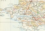
Tavernspite via Whitland. B4329 A487 W of Eglwyswrw A40 at Haverfordwest Crosses Preseli Mountains N to S, reaching 404 metres (1,325 ft); scenic views across south...
135 KB (82 words) - 16:10, 8 July 2024
Urban districts were a form of local government in England and Wales between 1894 and 1974, typically used for smaller and medium sized towns. They were...
116 KB (1,923 words) - 12:15, 4 June 2024

South Wales East (Welsh: Dwyrain De Cymru) is an electoral region of the Senedd, consisting of eight constituencies. The region elects 12 members, eight...
38 KB (569 words) - 11:46, 18 December 2022