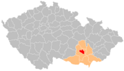
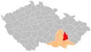
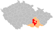
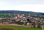
Drahany is a market town in Prostějov District in the Olomouc Region of the Czech Republic. It has about 500 inhabitants. According to one theory, the...
6 KB (447 words) - 06:24, 22 August 2024
nad Sázavou (544) Ročov (543) Olbramkostel (532) Uhelná Příbram (521) Drahany (517) Čachrov (512) Zdislavice (509) Podhradí (490) Litenčice (483) Staré...
25 KB (2,178 words) - 07:14, 4 June 2024
Morava Valley. The western tip of the municipal territory extends into the Drahany Highlands and includes the highest point of Prostějov at 368 m (1,207 ft)...
17 KB (1,635 words) - 08:05, 21 October 2024
Highlands (west and centre), Dyje–Svratka Valley (south and east), and Drahany Highlands (north). The highest point of the district is a contour line...
5 KB (312 words) - 06:01, 23 August 2024
(4 mi) south of Blansko and 10 km (6 mi) north of Brno. It lies in the Drahany Highlands, on the border of the Moravian Karst Protected Landscape Area...
7 KB (487 words) - 22:05, 23 October 2024
mesoregions of Boskovice Furrow, Bobrava Highlands and Drahany Highlands. The highest part is Drahany Higlands, which include Skalky – the highest peak of...
3 KB (292 words) - 06:15, 9 January 2024
Literatur-Lexikon is a references in the field of German literature. Born in Drahany in Moravia, Kosch died in Vienna in 1960 at age 81. A. Stifter. Festschrift...
4 KB (343 words) - 00:08, 25 June 2024
Dozitz (Doschitz): Dožice, p. of Mladý Smolivec Drachkau: Drahkov Drahan: Drahany Drahanowitz: Drahanovice Drahenitz: Drahenice Drahenz: Drahonice Drahomischl:...
261 KB (29,420 words) - 19:00, 21 October 2024
Blansko is located about 16 kilometres (10 mi) north of Brno. It lies in the Drahany Highlands. The highest point is the hill Bukovec with an altitude of 596...
10 KB (926 words) - 01:11, 24 October 2024
(21 mi) north of Brno. It lies on the border of the Boskovice Furrow and Drahany Highlands. The Boskovice Reservoir is largely located in the municipal...
13 KB (1,149 words) - 18:46, 23 October 2024
not born with certainty. Dědice is located at the southern foot of the Drahany Hills at the confluence of the Velká Haná and Malá Haná streams into the...
68 KB (7,894 words) - 11:54, 25 August 2024
Gate. The northwestern part of the municipal territory extends into the Drahany Highlands and includes the highest point of Vyškov, the Kuchlov hill at...
14 KB (1,303 words) - 06:43, 24 October 2024
Highlands, the eastern part of the municipal territory extends into the Drahany Highlands. The highest point is the hill Kuřimská hora with an elevation...
8 KB (571 words) - 23:35, 23 October 2024
(11 mi) west of Prostějov and 31 km (19 mi) west of Olomouc. It lies in the Drahany Highlands. The highest point is the hill Skály at 724 m (2,375 ft) above...
5 KB (260 words) - 07:04, 22 August 2024
Miroslav Hřib 2016 – R. D. Aleš Vrzala Church of Saint John the Baptist, Drahany Church of Saint Bartholomew, Krumsín Rectory and Church of Saint John the...
6 KB (108 words) - 17:27, 31 October 2024
Čelechovice na Hané - Dětkovice - Dobrochov - Dobromilice - Doloplazy - Drahany - Dřevnovice - Držovice - Dzbel - Hačky - Hluchov - Horní Štěpánov - Hradčany-Kobeřice...
11 KB (627 words) - 09:56, 18 October 2024
Vyškov Gate. The western tip of the municipal territory extends into the Drahany Highlands and includes the highest point of Brodek u Prostějova at 319 m...
6 KB (331 words) - 04:10, 27 October 2024
geomorphological mesoregions: Drahany Highlands (north), Litenčice Hills (west and east), Vyškov Gate (a strip between Drahany Highlands and Litenčice Hills)...
11 KB (659 words) - 06:01, 23 August 2024
northwest of Vyškov and 20 km (12 mi) northeast of Brno. It lies in the Drahany Highlands. The highest point is at 554 m (1,818 ft) above sea level. The...
5 KB (227 words) - 13:18, 29 August 2024
Bobrava Highlands (Bobravská vrchovina) IID-2 371 316.7 479 (Kopeček) Drahany Highlands (Drahanská vrchovina) IID-3 1,183 462.8 735 (Skalky) Ore Mountains...
17 KB (292 words) - 04:08, 24 July 2024
(6 mi) northeast of Blansko and 24 km (15 mi) north of Brno. It lies in the Drahany Highlands. The highest point is the hill Bučí at 653 m (2,142 ft) above...
6 KB (352 words) - 07:44, 27 August 2024
(14 mi) east of Brno. It lies on the border between the Vyškov Gate and Drahany Highlands, on the edge of the fertile Haná region. The highest point is...
6 KB (456 words) - 14:12, 27 October 2024
21 km (13 mi) northeast of Brno. It lies in an elevated plateau in the Drahany Highlands. The highest point is at 523 m (1,716 ft) above sea level. The...
5 KB (309 words) - 07:30, 27 August 2024
Furrow (a strip along the Bobrava Highlands across the territory) and Drahany Highlands (east). The highest point of the district is the hill Sýkoř in...
14 KB (860 words) - 12:35, 30 September 2024
located about 10 kilometres (6 mi) east of Brno. It lies mostly in the Drahany Highlands, only the southern part of the municipal territory lies in the...
5 KB (313 words) - 06:19, 10 September 2024
field he explored a territory of over 600 square kilometres of his native Drahany Upland (Drahanská vrchovina) to discover 62 decayed medieval settlements...
4 KB (517 words) - 14:20, 31 July 2023
(7 mi) east of Blansko and 20 km (12 mi) northeast of Brno. It lies in the Drahany Highlands. The highest point is below the summit of the hill Kojál at 598 m...
5 KB (324 words) - 07:44, 27 August 2024
Vranov is located about 10 kilometres (6 mi) north of Brno. It lies in the Drahany Highlands. The highest point is the Zavíravá hill at 525 m (1,722 ft) above...
6 KB (337 words) - 07:28, 10 September 2024
Prostějov and 25 km (16 mi) west of Olomouc. It lies on the border between the Drahany Highlands and Zábřeh Highlands. The highest point is the hill Runářovský...
6 KB (427 words) - 23:15, 23 October 2024
highlands. The territory extends into four geomorphological mesoregions: Drahany Highlands (most of the territory), Upper Svratka Highlands (northwest)...
12 KB (663 words) - 06:00, 23 August 2024


