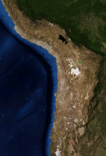
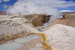
El Tatio is a geothermal field with many geysers located in the Andes Mountains of northern Chile at 4,320 metres (14,170 ft) above mean sea level. It...
106 KB (12,355 words) - 22:20, 20 March 2024
Geyser (section El Tatio, Chile)
recently[quantify] been observed to be active. The name "El Tatio" comes from the Quechua word for oven. El Tatio is located in the high valleys of the Andes in...
50 KB (5,082 words) - 13:55, 28 October 2024
Atacama Desert (section El Tatio Geyser)
2020). "El bosque de la Pampa del Tamarugal y la industria salitrera: El problema de la deforestación, los proyectos para su manejo sustentable y el debate...
58 KB (5,988 words) - 17:33, 29 October 2024
900 metres (16,100 ft) elevation, south of Laguna Colorada and east of El Tatio geothermal field. The field is located within the Eduardo Avaroa Andean...
18 KB (1,939 words) - 22:02, 3 May 2024
Kentucky (Yonker, R. 2003). In 2002, Glennon led an American expedition to El Tatio Geyser Field, Chile. The team produced the first comprehensive inventory...
5 KB (487 words) - 01:55, 20 March 2023
Geothermal power in Chile (section El Tatio)
main areas with potential are, from north to south: Puchuldiza, Apacheta, El Tatio-La Torta, Calabozos, Nevados de Chillán and Cordón Caulle. In 2005 the...
11 KB (1,191 words) - 00:20, 31 May 2024
Geyser (Minas Gerais)[citation needed] Sapareva Geyser (Sapareva Banya) El Tatio, Northern Chile Geysir Strokkur Maguarichi (Chihuahua) Diamond Geyser (Orakei...
2 KB (181 words) - 00:35, 8 October 2024
and vicuña (1914) A vicuña on rocky terrain (2008) Vicuñas on road to El Tatio geysers, San Pedro de Atacama, Antofagasta Region, Chile (2011) Vicuña...
22 KB (2,342 words) - 21:36, 13 October 2024
shield. Likewise, the "Tatio formation" at El Tatio originates from eruptions at Laguna Colorada; the 700,000 years old Tatio ignimbrite however is considered...
8 KB (872 words) - 07:55, 5 February 2024
geothermal activity which may be connected to that of the neighbouring El Tatio geothermal field. Tocorpuri lies in northern Chile, about 100 kilometres...
28 KB (2,887 words) - 11:21, 2 September 2024
limestones of Miocene Astoria Formation in Washington, silicified ignimbrite in El Tatio Geyser Field in Chile, and Tertiary siliceous sedimentary rocks in western...
31 KB (3,436 words) - 12:04, 27 September 2023
San Pedro de Atacama (category Populated places in El Loa Province)
National Reserve in the Salar de Atacama, inhabited by pink flamingos. El Tatio, a geyser field with over 80 active geysers. Llano de Chajnantor Observatory...
14 KB (1,181 words) - 02:17, 26 September 2024
List of hot springs (section El Salvador)
in Chile. North Zone, Chile, Atacama Desert Mamiña Pica Puritama Socos El Tatio Central Zone, Chile, near Santiago Cauquenes Chillán Corazón Jahuel South...
71 KB (6,414 words) - 00:26, 27 October 2024
A culpeo feasting on the carcass of a vicuña at El Tatio, San Pedro de Atacama, the Antofagasta Region...
15 KB (1,476 words) - 11:48, 28 June 2024
Archived 2013-11-10 at the Wayback Machine, retrieved on 10 November 2013 El Tatío Archived 2013-11-10 at the Wayback Machine, retrieved on 10 November 2013...
39 KB (596 words) - 02:45, 25 October 2024
spectrum observed through stellar classification. In northern Chile at El Tatio he compares the three states of water to the states found in the universe...
17 KB (1,857 words) - 15:29, 6 February 2024
slopes of the mountains that flank it. Also found within Norte Chico is El Tatio Geyser Field, the largest geyser fields in the Southern Hemisphere and...
58 KB (5,624 words) - 05:31, 4 June 2024
formation and large scale eruptive activity. Other active centres include the El Tatio and Sol de Mañana geothermal fields and the fields within Cerro Guacha...
45 KB (5,806 words) - 03:00, 28 October 2024
has vast geothermal potential, estimated at 16,000 MW. This includes the El Tatio geyser field, with 8% of the world's geysers. Chile's (and South America's)...
13 KB (1,391 words) - 03:35, 9 October 2024
crustal layers. Present day activity is limited to geothermal phenomena in El Tatio, Sol de Manana and Guacha, with recent activity encompassing the extrusion...
25 KB (3,121 words) - 14:23, 14 September 2024
the original on 16 September 2018. Retrieved 10 August 2016. Bansal, Agam; el al (July 2018). "Selfies: A boon or bane?". Journal of Family Medicine and...
181 KB (7,688 words) - 16:25, 8 October 2024
there were plans to create a protected area including Licancabur and El Tatio, but as of 2018[update] no progress had been made. The volcano formed mostly...
60 KB (6,352 words) - 23:01, 22 October 2024
and Enel requested a concession to develop geothermal resources in the El Tatio region in the North. In August 2020 Chile had 45 MW of installed geothermal...
41 KB (4,434 words) - 20:39, 11 July 2024
characteristic town of Toconao, Los Flamencos National Reserve and the El Tatio Geysers. The Puritama Hot Springs were known for centuries and used for...
6 KB (495 words) - 00:25, 24 July 2024
5,606 metres (18,392 ft) high volcano in Chile, just northeast of the El Tatio geothermal field. Deslinde was glaciated during the Pleistocene, with moraines...
2 KB (185 words) - 17:37, 6 December 2023
in the Chilean Andes was pioneered in the 1960s, although the site of El Tatio was investigated previously in the 1920s. Compared to neighboring Central...
23 KB (2,748 words) - 15:46, 28 October 2024
deposits on Mars with features resembling hot spring biosignatures at El Tatio in Chile". Nature Communications. 7: 13554. Bibcode:2016NatCo...713554R...
212 KB (20,673 words) - 15:49, 31 October 2024
21-kilometre (13 mi) long mining dirt road with a single lane leads from the El Tatio highway to Sairecabur. Sairecabur is since 2003 the site of the 0.8-metre...
37 KB (4,062 words) - 12:57, 28 October 2024
Calama, Chile (category Populated places in El Loa Province)
and commune in the Atacama Desert in northern Chile. It is the capital of El Loa Province, part of the Antofagasta Region. Calama is one of the driest...
19 KB (1,440 words) - 03:01, 1 October 2024


