The Generals Highway is a highway that connects State Route 180 and State Route 198 through Sequoia National Park, Sequoia National Forest, Giant Sequoia...
7 KB (511 words) - 02:13, 3 August 2023
The Generals' Highway Stone Bridges, built in 1930, are part of the Generals' Highway from the General Grant Grove of giant sequoias in Kings Canyon National...
5 KB (414 words) - 21:00, 6 August 2023
(11 km) northwest of Annapolis, the state capital. Maryland Route 178 (Generals Highway) runs through the center of the CDP, and Interstate 97 forms the southwestern...
12 KB (1,101 words) - 10:27, 10 September 2023
General's Highway Corridor Park is located at 1758 Crownsville Road, in the town of Crownsville, Maryland, United States. It is located near the site...
2 KB (157 words) - 03:53, 29 July 2024
large quartzite rock in Sequoia National Park, located just off of the Generals Highway, on the Middle Fork of the Kaweah River. Hospital Rock was once home...
3 KB (250 words) - 00:32, 7 August 2023
Defense Highways, commonly known as the Interstate Highway System, or the Eisenhower Interstate System, is a network of controlled-access highways that forms...
129 KB (12,968 words) - 20:44, 5 December 2024
Maryland Route 178 (redirect from Maryland State Highway 178)
Maryland Route 178 (MD 178) is a state highway in the U.S. state of Maryland. Known as Generals Highway, the highway runs 8.06 miles (12.97 km) from MD 450...
12 KB (1,513 words) - 05:00, 25 December 2022
Roads in Kazakhstan (redirect from A10 Highway (Kazakhstan))
transliteration is not required (for example writing "P" as "R"). The highways of general government ("Republican") Significance are divided into three groups...
21 KB (363 words) - 07:43, 22 December 2024
California State Route 198 (redirect from California State Highway 198)
near Lake Kaweah, where the road continues through the park as the Generals Highway. This is one of the main routes providing access to Sequoia National...
18 KB (1,529 words) - 01:56, 19 October 2023
California, NRHP-listed Cabin Creek Ranger Residence and Dormitory, Generals Highway in Sequoia National Park, southeast of Wilsonia, California (National...
2 KB (179 words) - 13:06, 31 January 2024
and Bridges" for additional documentation See also HAER No. CA-140, "Generals Highway" for additional documentation See also HAER No. CA-271, "Los Angeles...
55 KB (163 words) - 13:31, 9 May 2024
given. Atlanta: State Highway Department of Georgia. Retrieved March 13, 2017. State Highway Department of Georgia (1954). State Highway System and Other Principal...
301 KB (3,329 words) - 03:22, 28 July 2024
Arkansas Highway 59 is a north–south state highway in Northwest Arkansas. The route runs 93.24 miles (150.06 km) from Arkansas Highway 22 in Barling north...
13 KB (632 words) - 16:28, 16 February 2024
state highway system includes and has included many state highway spurs that connect through highways with places that are not along a through highway. The...
203 KB (17,757 words) - 22:09, 4 August 2024
tree trunk originally sat at the corner of West Street and Route 178 (Generals Highway). The concrete block that held the twisted stump of the tree is still...
4 KB (466 words) - 11:44, 9 August 2022
Arkansas Highway 16 (AR 16) is a designation for three state highways in Arkansas. One segment of 24.13 miles (38.83 km) runs from U.S. Route 412 (US 412)...
34 KB (2,539 words) - 19:12, 3 December 2024
U.S. Route 412 (redirect from United States Highway 412)
U.S. Route 412 is an east–west United States highway, first commissioned in 1982. U.S. 412 overlaps expressway-grade Cimarron Turnpike from Tulsa west...
23 KB (2,284 words) - 07:38, 14 November 2024
A highway is any public or private road or other public way on land. It includes not just major roads, but also other public roads and rights of way....
48 KB (4,838 words) - 22:10, 21 December 2024
Inventory-Nomination: Generals' Highway Stone Bridges" (pdf). National Park Service. {{cite journal}}: Cite journal requires |journal= (help) "Generals Highway, Lodgepole...
10 KB (982 words) - 07:11, 28 November 2024
Kings Canyon National Park (redirect from General Grant National Park)
miles (97 km) east of Fresno via Highway 180. In addition to Highway 180 from the west, Highway 198, the Generals Highway, provides access from Sequoia National...
96 KB (10,831 words) - 21:19, 9 November 2024
Maryland Route 450 (redirect from Maryland State Highway 450)
highway expands to four lanes with a center turn lane. The highway turns southeast onto West Street at its intersection with MD 178 (Generals Highway);...
41 KB (4,734 words) - 04:02, 9 October 2024
Interstate 530 (redirect from Highway 530 (Arkansas))
Interstate highway system, traveling 46.65 miles (75.08 km) from Pine Bluff north-northwest to Little Rock at an interchange of I-30 and I-440. The highway also...
19 KB (1,155 words) - 19:34, 21 December 2024
U.S. Route 278 (redirect from United States Highway 278)
overlaps Highway 26 for 0.09 miles (0.14 km) at Center Point. Further south the route continues into Nashville. The route overlaps US 371 and later Highway 27...
24 KB (2,601 words) - 22:59, 14 October 2024
The Overseas Highway is a 113-mile (181.9 km) highway carrying U.S. Route 1 (US 1) through the Florida Keys to Key West. Large parts of it were built on...
54 KB (4,515 words) - 02:54, 24 November 2024
Mississippi State Highway Department. General Highway Map Panola County Mississippi. (Map) 1981. Mississippi State Highway Department. General Highway Map Tallahatchie...
5 KB (642 words) - 21:26, 22 November 2024
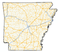
of state highways in the U.S. state of Arkansas. The state does not use a numbering convention. Generally, the two-digit odd numbered highways run north–south...
254 KB (1,766 words) - 16:05, 10 December 2024
Department of the Interior. Perry County, Arkansas General Highway Map (PDF) (Map). Arkansas State Highway and Transportation Department. January 4, 2008...
3 KB (122 words) - 07:13, 18 August 2024
Georgia State Route 5 (redirect from Georgia Highway 5)
State Route 5 (SR 5) is a 155.325-mile-long (249.971 km) state highway that travels south-to-north through portions of Carroll, Douglas, Cobb, Cherokee...
70 KB (7,322 words) - 04:26, 13 July 2024
Interstate 40 in Arkansas (category Interstate Highways in Arkansas)
Interstate 40 (I-40) is an east–west Interstate Highway that has a 284.69-mile (458.16 km) section in the U.S. state of Arkansas, connecting Oklahoma...
29 KB (1,229 words) - 19:49, 8 December 2024
Fort Moore (redirect from Commanding generals of Fort Benning, GA)
was one of the ten U.S. Army installations named for former Confederate generals that were renamed on 11 May 2023. As a result of national protests following...
52 KB (5,069 words) - 16:47, 11 December 2024


