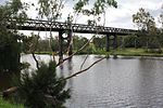
Gwydir River /ɡwaɪdər/ (locally [gwɑe̯də]), a major inland perennial river of the Barwon catchment within the Murray–Darling basin, is located in the Northern...
14 KB (1,187 words) - 01:23, 1 September 2024
Gwydir Highway is a 568-kilometre (353 mi) state highway in northern New South Wales, Australia. The highway was named after the Gwydir River, which in...
14 KB (913 words) - 09:46, 20 October 2024
(Ornithorhynchus anatinus) – in 2021, a leucistic example was found in the Gwydir River, near Armidale, New South Wales, Australia. Genes that, when mutated...
10 KB (884 words) - 12:18, 8 November 2024
Bingara, New South Wales (category Gwydir Shire)
Bingara (Aboriginal for 'creek') is a small town on the Gwydir River in Murchison County in the New England region of New South Wales, Australia. Bingara...
12 KB (912 words) - 00:27, 19 January 2024
Gwydir may refer to: Australia Division of Gwydir, electoral division Gwydir by-election, 1989 Gwydir Highway, New South Wales Gwydir River, New South...
660 bytes (116 words) - 15:01, 19 September 2022
of 13 September 2006, Gwydir was abolished and ceased to exist at the 2007 federal election. Gwydir was named for the Gwydir River (which in turn was named...
9 KB (312 words) - 05:24, 27 April 2024
plains to the Gwydir River near Moree. The team then spent several weeks charting the tributaries between the Gwydir and the Barwon Rivers. Hamilton Collins...
37 KB (4,233 words) - 02:42, 22 July 2024
It is located on the banks of the Mehi River, in the centre of the rich black-soil plains. Newell and Gwydir highways intersect at the town. It can also...
43 KB (4,273 words) - 11:43, 17 October 2024
with nine radial gates and a gated concrete chute spillway across the Gwydir River upstream of Bingara in the New England region of New South Wales, Australia...
11 KB (929 words) - 05:17, 23 September 2023
separate incidents, on recently established pastoral runs on the upper Gwydir River area of New South Wales. After two months the mounted police, consisting...
11 KB (1,360 words) - 08:10, 28 October 2024
Keera is a locality on the upper Gwydir River in Murchison County in the New England region of New South Wales, Australia. The nearest town is Bingara...
5 KB (582 words) - 06:37, 29 November 2023
Australia. The town is located on Thunderbolts Way and on the banks of the Gwydir River, in the Uralla Shire local government area, 563 kilometres (350 mi) from...
8 KB (791 words) - 02:59, 15 February 2023
Moonie, Gwydir, Mehi, Namoi, Macquarie, Bokhara and Bogan rivers. During major flooding, overflow from the Narran Lakes and the Narran River also flows...
11 KB (867 words) - 08:15, 12 August 2024
Gravesend, New South Wales (category Gwydir Shire)
The town is located 25 km west of Warialda on the Gwydir Highway near the Gwydir River and in the Gwydir Shire local government area, 615 kilometres (382 mi)...
4 KB (323 words) - 11:52, 22 July 2024
Rocky River, a watercourse of the Gwydir catchment within the Murray–Darling basin, is located in the Northern Tablelands district of New South Wales,...
4 KB (161 words) - 15:18, 1 September 2024
crosses the Gwydir River shortly before reaching the Kingstown Road intersection and then the village of Bundarra. Once again the Gwydir River is crossed...
16 KB (1,388 words) - 06:46, 13 August 2024
Hall advanced further north and took up the 'Bingara' leasehold on the Gwydir River. When establishing 'Bingara', the local Aborigines resisted Hall's incursion...
12 KB (1,480 words) - 22:02, 5 June 2024
in the Orana district of New South Wales, Australia. The river rises from the Gwydir River west of Pallamallawa, and flows generally west and west-southwest...
7 KB (638 words) - 08:32, 22 June 2024
of the year at Gwydir River. A "war of extirpation", according to local magistrate Edward Denny Day, was waged all along the Gwydir River in mid-1838. "Aborigines...
139 KB (16,783 words) - 10:06, 2 November 2024
of the floodplain of the river Conwy, and overlooked from the west by the now-forested slopes of Gwydir Forest. The name Gwydir derives from the Welsh gwo-...
13 KB (1,695 words) - 20:20, 15 May 2024
district around the Gwydir River in the northwest of the state. It elected two members simultaneously. In 1859, Liverpool Plains and Gwydir was divided into...
3 KB (253 words) - 01:17, 18 July 2022
River and its tributaries such as the Dumaresq River and the Severn Rivers (there are two – one on either side of the state border); the Gwydir River;...
20 KB (1,869 words) - 04:40, 18 July 2024
Coedwig Gwydyr). Certainly as early as 1536, Leland wrote: "Gwydir lieth two bowshots above the River Conwy. It is a pretty place." The forest broadly encircles...
13 KB (1,769 words) - 20:32, 13 August 2024
Namoi River snapping turtle or Bell's turtle (Elseya belli) is a species of turtle found only in the upper reaches of the Namoi River, Gwydir River and...
6 KB (352 words) - 11:19, 23 November 2023
and 36 elected. The district was named after the Liverpool Plains and Gwydir River and covered what is now known as the North West Slopes region. On its...
3 KB (258 words) - 11:32, 30 December 2023
B1), leading to brain damage in sheep and horses. During floods in the Gwydir River basin 2,200 sheep died after eating nardoo. Three-quarters of the sheep...
18 KB (736 words) - 23:15, 28 October 2024
The Gwydir Wetlands comprise a system of irregularly inundated wetlands associated with the Gwydir River in the North West Slopes region of north-eastern...
5 KB (504 words) - 14:38, 2 June 2022
Murray–Darling basin (redirect from Murray-Darling river)
of the Murray River, Australia's longest river, and the Darling River, a right tributary of the Murray and Australia's third-longest river. The Basin, which...
54 KB (3,950 words) - 22:40, 14 October 2024
Gwydir Shire is a local government area located in the New England region of New South Wales, Australia. The northern boundary of the Shire is located...
14 KB (925 words) - 02:58, 27 September 2024
February 1900 as far as Gravesend, then more of the line in 1901 before the Gwydir River bridge was finally finished and the line completed in 1902. It was progressively...
11 KB (1,118 words) - 21:46, 22 January 2021


