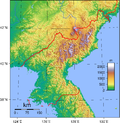
Mount Kumgang (redirect from Kŭmgangsan)
Mount Kumgang (Korean: 금강산; RR: Geumgangsan; MR: Kŭmgangsan; lit. Diamond Mountain) or the Kumgang Mountains is a mountain massif, with a 1,638-metre-high...
19 KB (2,116 words) - 23:26, 29 September 2024
Mount Kumgang Tourist Region (redirect from Kŭmgangsan Tourist Region)
longer possible, says Kim Jong-un". Guardian. 15 January 2024. Korea Post: Kŭmgangsan "In photos: What's become of the Mount Kumgang tourism resort? | NK News"...
13 KB (1,336 words) - 13:39, 20 July 2024
The Kŭmgangsan Ch'ŏngnyŏn Line is an electrified standard-gauge trunk line of the Korean State Railway in North Korea running from Anbyŏn to Kamho. The...
12 KB (366 words) - 11:19, 24 September 2024
The Kŭmgangsan Electric Railway, later known as the Kŭmgangsan Line, was a railway line that formerly ran between Ch'ŏrwŏn to Naegŭmgang, on the inner...
39 KB (3,712 words) - 11:03, 24 September 2024
Kŭmgangsan Ch'ŏngnyŏn station is a railway station in Kosŏng county, Kangwŏn province, North Korea on the Kŭmgangsan Ch'ŏngnyŏn Line of the Korean State...
3 KB (225 words) - 15:09, 16 September 2024
March 2016. Retrieved 20 April 2015. "Outline for Development of Wonsan-Kumgangsan Tourist Region Revealed". Institute for Far Eastern Studies. 26 March...
101 KB (8,630 words) - 05:32, 27 September 2024
a rare surname from Seongju), and 怾 (기; Gi, an old name referring to Kumgangsan). Further examples include 巭 (부 bu), 頉 (탈 tal), 䭏 (편 pyeon), 哛 (뿐 ppun)...
48 KB (5,609 words) - 05:01, 1 October 2024
are issued with green plates with white characters bearing the word 'Kŭmgangsan' (Mount Kumgang) in Chosongul, followed by four digits. Vehicles used...
9 KB (743 words) - 06:58, 8 August 2024
Chilbo (Ch'ilbosan) Lake Pujon National Park Mount Myohyang Mount Kŭmgang (Kŭmgangsan / the Diamond Mountains) Kuwŏlsan National Parks of the Republic of Korea...
738 bytes (35 words) - 11:15, 21 March 2024
areas. Nevertheless, Hyundai began South Korean tourism to North Korea's Kumgangsan. In 1999, Hyundai Asan was established to operating Kumgang tourism, the...
13 KB (1,258 words) - 02:27, 14 September 2024
Prominent peaks of the range include Mount Seoraksan (1,708 m), Mount Kumgangsan (1,638 m), Mount Taebaeksan (1,566.7 m) and Mount Odaesan (1,563 m). To...
3 KB (340 words) - 13:53, 1 August 2024
– Sri Lanka Kondyor Massif – Russia Kugitangtau Ridge – Turkmenistan Kumgangsan – North Korea Logar ultrabasite massif – Afghanistan Mount Ararat – Turkey...
9 KB (733 words) - 00:32, 31 July 2024
the Fatherland, the Korean People's Cooperation Administration, and the Kumgangsan International Tourism Administration. On March 1, 2024, the government...
69 KB (7,873 words) - 01:24, 3 October 2024
Committee for the Peaceful Reunification of the Country and to shutter the Kumgangsan International Travel "and other organizations concerned as any cooperation...
34 KB (3,072 words) - 21:12, 24 September 2024
the Fatherland, the Korean People’s Cooperation Administration, and the Kumgangsan International Tourism Administration. One of the symbols of this was the...
96 KB (8,806 words) - 23:09, 24 September 2024
Basin, interrupt the rugged terrain. The highest point is Piryubong on Kŭmgangsan. The chief local stream is the Pukhan River, which flows south and east...
4 KB (210 words) - 16:02, 4 February 2024
North Korea Kanggye Line, between Hwangp'o and Simrip'yŏng stations Kŭmgangsan Electric Railway, between Tanballyŏng and Malhwiri (Kŭmganggu) stations...
17 KB (1,927 words) - 15:12, 30 April 2024
Ulsanbawi comes from the city of Ulsan in the south east of Korea. As Kumgangsan (금강산) was built, Ulsanbawi walked to the north as the representative of...
11 KB (1,120 words) - 05:04, 9 July 2024
the terminus of the P'yongyang-Wonsan Tourist Motorway and the Wonsan-Kŭmgangsan Highway. A trolleybus system with two lines is currently in operation...
33 KB (3,333 words) - 14:44, 11 August 2024
the Gyeongwon Line served Wonsan on the east coast. Another line—the Kumgangsan Electric Railway—connected the town of Cheorwon, now on the border of...
25 KB (2,217 words) - 09:34, 10 September 2024
reunification with the South, the National Economic Cooperation Bureau and the Kumgangsan International Tourism Administration. South Korean reports indicated that...
8 KB (658 words) - 23:48, 28 August 2024
T'ongch'ŏn-ŭp, T'ongch'ŏn county, Kangwŏn province, North Korea on the Kŭmgangsan Ch'ŏngnyŏn Line of the Korean State Railway. The station, originally called...
2 KB (110 words) - 15:33, 16 September 2024
railway station in T'ongch'ŏn county, Kangwŏn province, North Korea on the Kŭmgangsan Ch'ŏngnyŏn Line of the Korean State Railway. The station, originally called...
2 KB (99 words) - 15:34, 16 September 2024
is presently split between the North's Kŭmgangsan Ch'ŏngnyŏn Line from Anbyŏn on the Kangwŏn Line via Kŭmgangsan to the DMZ, and the southern section of...
92 KB (10,351 words) - 09:07, 3 September 2024
insisted that at least some aspects of the Sunshine Policy, including the Kumgangsan Tourist Region and the Kaesong Industrial Region would continue. From...
52 KB (5,673 words) - 10:07, 27 September 2024
include Mount Sobaek or Sobaeksan (1,439 m or 4,721 ft), Mount Kumgang or Kumgangsan (1,638 m or 5,374 ft), Mount Seorak or Seoraksan (1,708 m or 5,604 ft)...
11 KB (1,251 words) - 08:24, 9 September 2024
stores on the rise". North Korean Economy Watch. Retrieved July 6, 2013. "Kumgangsan Tour". Koryo Tour Group. Archived from the original on April 11, 2013...
10 KB (850 words) - 07:55, 20 July 2024
North and South, with the section from Anbyeon to Samilpo becoming the Kŭmgangsan Ch'ŏngnyŏn Line in the north, while the section from Chogu to Yangyang...
7 KB (191 words) - 11:20, 24 September 2024
P'aech'ŏl-li, T'ongch'ŏn county, Kangwŏn province, North Korea on the Kŭmgangsan Ch'ŏngnyŏn Line of the Korean State Railway. The station, originally called...
2 KB (105 words) - 15:08, 16 September 2024
up until 2008 was used to cater for South Korean tourists to the DPRK. Kumgangsan Hotel North Korean hotel rejuvenated by South Korean workers, located...
16 KB (609 words) - 20:22, 8 September 2024


