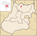
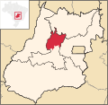
Teresina de Goiás Defect Boys is a municipality in northern Goiás state, Brazil. It is part of the region of the statistical micro-region of Chapada dos...
5 KB (309 words) - 20:08, 14 December 2022
5 sq mi). The microregion consists of the following municipalities: Largest area: Cavalcante with 6,979.5 km2 Smallest area: Teresina de Goiás with 777...
5 KB (285 words) - 21:29, 11 July 2023
municipality in the Microregion of Picos, in the northeastern Brazilian State of Piauí. According to the Instituto Brasileiro de Geografia e Estatística...
6 KB (297 words) - 02:10, 25 July 2024
district in the municipality of Aurilândia, finally becoming independent in 1953. List of municipalities in Goiás Microregions of Goiás IBGE 2020 Frigoletto...
5 KB (309 words) - 02:23, 13 September 2022
de Goiás with 2,909.4 km2 and the smallest is Diorama with 689.6 km2. List of municipalities in Goiás Microregions of Goiás Instituto Brasileiro de Geografia...
2 KB (110 words) - 21:28, 25 September 2021
with boundaries of statistical Immediate Geographic Areas (formerly microregions) defined by IBGE, or with the broader definition of built-up urban area...
10 KB (312 words) - 19:40, 15 March 2024
dismembered from Planaltina de Goiás in 1989. Água Fria is located in the microregion called Entorno do Distrito Federal, although it is almost 156 kilometers...
6 KB (473 words) - 18:46, 26 July 2024
through Anápolis, and then taking GO-330. IBGE statistical microregion: Anápolis Microregion Population density in 2007: 35.83 inhabitants/km2 Urban population...
4 KB (216 words) - 18:27, 20 February 2022
Buriti de Goiás is a municipality in eastern Goiás state, Brazil. Distance to regional center (São Luís de Montes Belos): 58 km. Highway connections are...
5 KB (269 words) - 18:27, 20 February 2022
Santa Tereza de Goias is a municipality in north Goiás state, Brazil. Santa Tereza de Goiás is often spelled "Santa Teresa de Goiás". Santa Tereza is located...
5 KB (331 words) - 18:27, 20 February 2022
Population is from 2007. List of municipalities in Goiás Microregions of Goiás Instituto Brasileiro de Geografia e Estatística[permanent dead link], territorial...
3 KB (203 words) - 21:27, 25 September 2021
Luís de Montes Belos (also written São Luis de Montes Belos) is a municipality in the State of Goiás, Brazil. It is located in the Anicuns Microregion, 123...
6 KB (618 words) - 18:27, 20 February 2022
the municipality of Trindade and got city status in 1963. Source: Sepin List of municipalities in Goiás Microregions of Goiás IBGE 2020 Frigoletto Sepin...
5 KB (321 words) - 18:27, 20 February 2022
Irreligious residents in Brazil. Teresina, Fortaleza, and Florianópolis were the most Roman Catholic in the country. Greater Rio de Janeiro, not including the...
288 KB (25,351 words) - 01:30, 2 November 2024
Goiás Microregions of Goiás IBGE 2022 www.VALTV.org - MULTIMÍDIA DE VALPARAÍSO DE GOIÁS E ENTORNO www.VALTV.org - MULTIMÍDIA DE VALPARAÍSO DE GOIÁS E...
6 KB (515 words) - 17:06, 3 July 2024
Other neighboring municipalities of Alto Paraíso de Goiás are: Northbound: Cavalcante and Teresina de Goiás; Southbound: São João d'Aliança; Eastbound:...
15 KB (1,630 words) - 13:49, 20 August 2023
south of the border with Tocantins. G0-118 connects it with Teresina de Goiás and Campos Belos de Goiás. It is 568 kilometers from the state capital, Goiânia...
6 KB (584 words) - 16:36, 21 September 2023
GO-118 / BR-010 / São João da Aliança / Alto Paraíso de Goiás / Teresina de Goiás / Monte Alegre de Goiás / GO-447 / Vazante. (64 km. unpaved road). It...
6 KB (505 words) - 18:27, 20 February 2022
Terezópolis de Goiás is a municipality in central Goiás state, Brazil. Terezópolis is located in the Goiânia Microregion, 28 kilometers northeast of the...
5 KB (320 words) - 18:27, 20 February 2022
(out of 5,507 municipalities). For the complete list see frigoletto.com.br List of municipalities in Goiás Microregions of Goiás IBGE 2020 Frigoletto...
5 KB (406 words) - 06:18, 9 August 2024
Piauí is divided into 224 municipalities, which are grouped into 15 microregions, which are grouped into 4 mesoregions. Mesoregions Centro-Norte Piauiense...
8 KB (51 words) - 20:41, 2 January 2023
has rivers and waterfalls that promise future touristic development. List of municipalities in Goiás Microregions of Goiás IBGE 2020 Frigoletto Sepin...
6 KB (531 words) - 18:27, 20 February 2022
Campestre de Goiás is a municipality in central Goiás state, Brazil. There are municipal boundaries with: north: Santa Bárbara de Goiás south: Guapó east:...
4 KB (287 words) - 18:27, 20 February 2022
Corumbá de Goiás is a municipality in central Goiás state, Brazil. It is one of the oldest cities in the state and still preserves vestiges of its colonial...
7 KB (619 words) - 18:27, 20 February 2022
national ranking of 2,728 (out of 5,507 municipalities). List of municipalities in Goiás Microregions of Goiás Anápolis Microregion IBGE 2020 Frigoletto...
5 KB (304 words) - 18:27, 20 February 2022
Bom Jesus de Goiás is a municipality in south Goiás state, Brazil. It is a large producer of soybeans. The distance to the state capital, Goiânia, is 223 km...
6 KB (467 words) - 15:10, 20 June 2024
Morro Agudo de Goiás is a municipality in northeastern Goiás state, Brazil. Monte Agudo de Goiás is located in the north-eastern region of the state near...
5 KB (419 words) - 19:09, 8 September 2023
Flores de Goiás is a municipality in northeastern Goiás state, Brazil. Located in the Vão do Paranã statistical micro-region, Flores has boundaries with...
6 KB (490 words) - 18:27, 20 February 2022
municipalities in 2000) List of municipalities in Goiás Microregions of Goiás IBGE 2020 Unidade de Conservação: Parque Estadual dos Pirineus (in Portuguese)...
6 KB (510 words) - 08:13, 23 October 2023
soybeans, and poultry. Santa Helena is located in the Sudoeste de Goiás Microregion, 31 kilometers east of the important city of Rio Verde. It is 32...
6 KB (494 words) - 22:02, 25 May 2024


