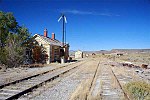
Pequop or Pequop Siding is a ghost town in Elko County, Nevada, United States. It was located west of Toano on the route around the north end of the Pequop...
4 KB (289 words) - 21:53, 27 July 2023
The Pequop Mountains are a mountain range located in eastern Elko County, Nevada, United States. The range runs generally north-south for approximately...
4 KB (324 words) - 03:09, 25 October 2024
The Pequop Formation is a geologic formation in Nevada. It preserves fossils dating back to the Permian period. Earth sciences portal United States portal...
1 KB (58 words) - 14:18, 13 February 2024
Range, via Silver Zone Pass, across the Goshute Valley, tunnels under the Pequop Mountains and then skirts the northern edge of the Ruby Mountains. The line...
36 KB (2,441 words) - 07:25, 20 October 2024
Arthur Bullion Cobre Dinner Station Hunter Huntington Metropolis Patsville Pequop San Jacinto Shafter Its school district is the Elko County School District...
25 KB (2,150 words) - 19:18, 11 October 2024
east, a low section of hills connects the mountain to the south end of the Pequop Mountains. US Route 93 passes the southwest end of the mountain. The peak...
3 KB (266 words) - 21:09, 7 July 2023
before arriving at the Great Salt Lake Desert. The first is the Pequop Mountains via Pequop Summit, elevation 6,967 feet (2,124 m)—the highest point on I-80...
32 KB (1,625 words) - 17:23, 22 October 2024
Industrial Lead trestle Promontory Point trestle Lakeside Overland Route Tecoma Montello Nevada Northern Railway Cobre Pequop Holborn Wells Shafter Subdivision...
17 KB (1,832 words) - 02:41, 24 October 2024
NGVD 29 to NAVD 88. The summit of Spruce Mountain is the highest point of the Pequop Mountains. The elevation of Columbus Mountain includes an adjustment of...
166 KB (13,958 words) - 21:32, 6 October 2024
River and abandoned their wagons in Nevada at Big Spring at the foot of the Pequop Mountains. They continued west using their oxen and mules as pack animals...
214 KB (31,610 words) - 19:22, 13 October 2024
steep-sided canyon in the Pequop Mountains of Elko County, Nevada, United States. Interstate 80 traverses the canyon as it ascends the Pequop Mountains from the...
1 KB (59 words) - 21:10, 21 October 2020
Range Paradise Range Park Range Paymaster Ridge Peavine Mountain Peko Hills Pequop Mountains Petersen Mountain Pilot Mountains Pilot Range Pine Forest Range...
8 KB (89 words) - 23:50, 24 September 2024
Industrial Lead trestle Promontory Point trestle Lakeside Overland Route Tecoma Montello Nevada Northern Railway Cobre Pequop Holborn Wells Shafter Subdivision...
23 KB (2,830 words) - 13:40, 29 June 2024
approximately $41,000. The same train was robbed for a second time near Pequop, Nevada in Elko County. Verdi is located at 39°31′6″N 119°59′19″W / 39...
12 KB (981 words) - 15:29, 6 October 2024
Oasis is a high desert community located in the Goshute Valley between the Pequop Mountains and the Toano Range at an elevation of approximately 5,870 feet...
8 KB (219 words) - 14:30, 13 August 2024
Spruce Mountain, attached to the southwest of the Pequop Mountains; Goshute Valley lies east of the Pequop's but turns southwest at the northeast foothills...
3 KB (218 words) - 21:57, 15 January 2021
follows the historical route of the Hastings Cutoff, tunneling underneath the Pequop Mountains and crossing the Toano Range via Silver Zone Pass. The eastern...
11 KB (1,165 words) - 16:30, 1 October 2024
Shoshone Mountains. The summit of Spruce Mountain is the highest point of the Pequop Mountains. The summit of Morey Peak is the highest point of the Hot Creek...
52 KB (4,596 words) - 17:27, 13 January 2024
South Fork Owyhee River 7,842 acres (31.74 km2) September 1992 Nevada South Pequop 41,090 acres (166.3 km2) September 1992 Nevada South Reveille 106,200 acres...
43 KB (112 words) - 18:23, 23 June 2023
Range Antelope Valley Dolly Varden Mountains Currie Hills Steptoe Valley Pequop Mountains Coordinates 40°46′13″N 114°24′48″W / 40.7702°N 114.4134°W /...
3 KB (238 words) - 20:56, 13 December 2021
rocks that are now exposed as metamorphic core complexes such as in the Pequop Mountains of Nevada, as well as plutonic rocks including batholiths. Based...
36 KB (4,086 words) - 07:09, 4 September 2024
route is 5,901 feet (1,799 m) at Hogan's Tunnel, under Flower Pass in the Pequop Mountains. The line also crosses the Toano Range at Silver Zone and has...
4 KB (509 words) - 16:17, 21 November 2023
corridor east of Wells. The historical route went around the north end of the Pequop Mountains, towards the north shore of the Great Salt Lake. Modern I-80 directly...
5 KB (456 words) - 15:46, 16 February 2024
from the original on August 17, 2016. Retrieved August 1, 2016. "Spruce-Pequop – Bureau of Land Management Wild Horse and Burro Internet Adoption". Bureau...
195 KB (9,094 words) - 22:00, 10 October 2024
Group/Gerster Formation Permian Park City Group/Plympton Formation Permian Pequop Formation Permian Perkins Canyon Formation Ordovician Phosphoria Formation...
9 KB (54 words) - 17:11, 26 February 2023


