Pittwater Road is a 21-kilometre-long (13 mi) major arterial road along the coast of the Northern Beaches suburbs of Sydney, Australia, the majority of...
12 KB (1,041 words) - 03:54, 29 April 2024
since 1903 was to be extended from Brookvale on to Collaroy Beach via Pittwater Road, and soon after to Narrabeen. The line opened on 3 August 1912 with...
28 KB (3,220 words) - 15:39, 27 July 2024

citybound bus stop is located on Pittwater Road, north of William Street. The northbound bus stop is located on Pittwater Road, adjacent to Westfield Warringah...
21 KB (1,727 words) - 12:36, 24 July 2024
New South Wales state electorate Pittwater Council, local government area Pittwater Park Pittwater Road Pittwater (Tasmania) This disambiguation page...
316 bytes (67 words) - 15:26, 11 March 2019

The council seat was located in Warringah Civic Centre in Dee Why on Pittwater Road. The following suburbs were located within Warringah Council: Allambie...
41 KB (4,173 words) - 05:14, 26 June 2024
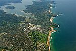
Pittwater is a semi-mature tide dominated drowned valley estuary, located about 40 kilometres (25 mi) north of the Sydney central business district, New...
14 KB (1,123 words) - 12:19, 12 June 2024
Pittwater High School, (abbreviation PHS) is a school located in Mona Vale, New South Wales, Australia, on Mona Street and Pittwater Road. It is a co-educational...
7 KB (592 words) - 10:27, 29 June 2024

A38 (Sydney) (category Pages using infobox Australian road with a mapframe parameter)
linking M2 Hills Motorway in North Ryde and Pittwater Road (A8) in Dee Why. This name covers a few consecutive roads and is widely known to most drivers, but...
14 KB (1,060 words) - 06:25, 26 May 2024

renamed Collaroy Plateau in 1996. The beach and housing near the beach on Pittwater Road were badly affected by weather in early June 2016. A strip of houses...
9 KB (807 words) - 04:32, 27 June 2024

A3 (Sydney) (redirect from Mona Vale Road)
intersection of Pittwater Road at Mona Vale and heads in a southwesterly direction as Mona Vale Road as a two-lane, single carriageway road, widening to...
27 KB (2,200 words) - 15:19, 15 July 2024

Pittwater Council was a local government area on the Northern Beaches of Sydney, in the state of New South Wales, Australia. It covered a region adjacent...
26 KB (1,951 words) - 02:46, 18 December 2023
dual-carriageway road, and then to six lanes immediately afterwards, to eventually terminate at the intersection with Pittwater Road in Mona Vale. The...
10 KB (833 words) - 19:50, 26 September 2023

Christian School Fisher Road School Galstaun College Northern Beaches Christian School Oxford Falls Grammar School The Pittwater House Schools St Luke's...
17 KB (1,369 words) - 15:40, 2 June 2024

known as the Northern Beaches. Formerly the administrative centre of Pittwater Council, it is now located in the local government area of Northern Beaches...
8 KB (833 words) - 04:53, 27 June 2024

North Ryde, New South Wales (section Cox's Road)
Electric Lighting Substation No. 79 Also Known as the 'Magdala Road Substation' 293 Pittwater Road East Ryde NSW 2113. Noel Bell Ridley Smith & Partners Architects...
40 KB (4,988 words) - 19:42, 25 July 2024

Why, a suburb of Sydney. It stands in the centre of Dee Why, along Pittwater Road. Designed in the Brutalist style by Christopher Kringas and Colin Madigan...
8 KB (864 words) - 19:59, 24 November 2023

A8 (Sydney) (category Pages using infobox Australian road with a mapframe parameter)
its constituent parts: Pittwater Road, Condamine Street, Burnt Bridge Creek Deviation, Manly Road, Spit Road and Military Road. The A8 is a major transport...
15 KB (1,341 words) - 03:54, 29 April 2024

wetlands and are characterised by large, modern homes (mainly along Pittwater Road). The whole area between the Parramatta and Lane Cove Rivers was originally...
15 KB (1,802 words) - 09:26, 2 March 2024
Keolis Downer Northern Beaches's Brookvale Bus Depot is located on Pittwater Road. Brookvale Oval is the home ground of the Manly-Warringah Sea Eagles...
6 KB (702 words) - 04:31, 27 June 2024

Wolseley Road is a road in the Sydney suburb of Point Piper. It is one kilometre long. It starts at New South Head Road and curves around the west side...
6 KB (471 words) - 21:44, 27 September 2023
south along Lane Cove, Pittwater and Wicks Road through Ryde, and continuing north via St. Ives to the intersection with Pittwater Road in Mona Vale) on 8...
10 KB (841 words) - 12:40, 5 January 2024

shelters located on both sides of Pittwater Road and a dedicated two-storey commuter car park on the eastern side of the road. The 185, 182 are the main buses...
6 KB (641 words) - 04:59, 27 June 2024

View Rd, 1920 Simpson's Garden Estate Church Point Pittwater – Baroona Rd, Bay View Rd, Eastview Road, 1921 According to the 2021 census, there were 1,066...
5 KB (433 words) - 04:31, 27 June 2024

Park in the west, bounded by the Parramatta River in the south and Pittwater Road and the Lane Cove River in the east, with the M2 Motorway, Devlins Creek...
24 KB (2,090 words) - 04:05, 27 June 2024

Beacon Hill, Dee Why & Pittwater Road 169X: PM peak service to Manly via Wakehurst Parkway, Beacon Hill, Dee Why & Pittwater Road 171X: PM peak service...
21 KB (1,803 words) - 15:42, 27 July 2024
Falcon Street, Military Road, Spit Road, Spit Bridge, Manly Road, Burnt Bridge Creek Deviation, Condamine Street & Pittwater Road (Metroad 10) (Decommissioned)"...
119 KB (2,044 words) - 00:25, 3 July 2024

Hills Road, Ryde Road, Epping Road, Mona Vale Road, Victoria Road, Beecroft Road, Pittwater Road and Wakehurst Parkway. Epping railway station Huntleys Point...
22 KB (1,811 words) - 15:03, 23 June 2024
of Darling and Curtis Road Every Saturday Third-oldest in Sydney The Beaches Market Warriewood Pittwater Park, 1472 Pittwater Road Every Friday, 8 am –...
18 KB (190 words) - 07:48, 7 May 2024
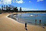
Pittwater Park is a rugby stadium in Warriewood, New South Wales, Australia. It is located 500 metres from North Narrabeen beach within the reserve of...
2 KB (158 words) - 07:10, 26 August 2021
Road King Street Lane Cove Road New South Head Road Norton Street Old South Head Road Old Windsor Road Parramatta Road Pennant Hills Road Pittwater Road...
3 KB (216 words) - 11:13, 15 April 2024