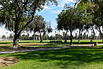
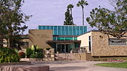
West Whittier-Los Nietos (pronunciation) is a census-designated place (CDP) in Los Angeles County, California, near the San Gabriel River and the San Gabriel...
13 KB (1,280 words) - 15:35, 30 September 2024
home to Whittier College. The city is surrounded by three unincorporated areas sharing the Whittier name, West Whittier-Los Nietos, South Whittier, and East...
65 KB (6,428 words) - 22:25, 29 December 2024
Hills and West Whittier-Los Nietos, most of Whittier and South Whittier, and parts of the following: City of Industry, Downey, East Whittier, La Habra...
4 KB (324 words) - 07:45, 1 May 2024
California. Rancho Los Nietos was awarded to Manuel Nieto in 1784. After an appeal by the San Gabriel Mission padres, Rancho Los Nietos was later reduced...
6 KB (435 words) - 06:41, 11 November 2024
Pioneer High School is a public school in West Whittier-Los Nietos, a census-designated place in unincorporated Los Angeles County, California. Pioneer High...
6 KB (382 words) - 04:58, 29 December 2024
Los Nietos School District is a K-8 school district in West Whittier-Los Nietos, California, that also serves portions of Whittier, California and Santa...
1 KB (133 words) - 22:43, 9 October 2024
Rivera, Los Nietos and Whittier. In early days the western portion of Washington was known as the Ballona Road. The far eastern end was known as the Los Angeles...
12 KB (578 words) - 15:13, 24 December 2024
California's 38th congressional district (category Whittier, California)
Whittier. As well the unincorporated communities of: Rowland Heights, Hacienda Heights, Los Nietos, East Whittier, North Whittier, and South Whittier...
59 KB (985 words) - 21:21, 23 November 2024
areas south of the Whittier Narrows and Puente Hills south to present-day Long Beach, centered on the early settlement at Los Nietos. Some of this area...
130 KB (7,909 words) - 09:59, 26 December 2024
Los Nietos gradually built up around the Nietos adobe home, which was near the Indian village of Sejat on the San Jose Creek. Today, the area of West...
3 KB (322 words) - 06:47, 4 November 2024
Area code 562 (category Los Angeles County, California)
code and small portion in the 310/424 area code) South Whittier West Whittier-Los Nietos Whittier Brea (mostly in the 657/714 area code) Buena Park (mostly...
7 KB (747 words) - 04:15, 26 September 2024
Vernon, and Whittier; the communities of East Whittier, Rose Hills, South Whittier, Walnut Park, and West Whittier-Los Nietos; and the Los Angeles neighborhoods...
21 KB (925 words) - 15:55, 5 December 2024
Slauson Avenue (category Whittier, California)
Heights, View Park-Windsor Hills, South Los Angeles, Huntington Park, Maywood, Commerce, Montebello, Pico Rivera, Whittier, and Santa Fe Springs. The street...
6 KB (522 words) - 02:10, 16 June 2024
Road. Whittier Downs Shopping Center was a 200,000-square-foot (19,000 m2) shopping center that served the community of West Whittier-Los Nietos, California...
7 KB (441 words) - 07:15, 25 October 2024
Interstate 605 (category Roads in Los Angeles County, California)
north through the Gateway Cities of the Los Angeles Basin. It then shifts north-northeast, crossing the Whittier Narrows and across the San Gabriel Valley...
16 KB (1,093 words) - 22:43, 23 December 2024
Elementary School District Little Lake City Elementary School District Los Nietos Elementary School District Lowell Joint Elementary School District Mountain...
6 KB (553 words) - 15:52, 19 March 2023
Turnbull Canyon (category Landforms of Los Angeles County, California)
Turnbull Canyon near Whittier, California is an east–west canyon with relatively steep drainage. The canyon has a creek at its bottom that supports a narrow...
5 KB (541 words) - 20:44, 28 November 2024
demographics of Los Angeles County include a diverse people by race, ethnicity, and nationality. The 2010 United States Census reported that Los Angeles County...
91 KB (1,509 words) - 18:56, 29 June 2024
Angeles National Forest and the Los Padres National Forest, in the northwestern portion of Los Angeles County. It is to the west of Interstate 5 (I-5) south...
9 KB (784 words) - 06:16, 22 November 2024
Pass, Transit Corridor, Dam), Verdugo (Mountains, Wash), Walnut, West Whittier-Los Nietos, et al. Rancho boundaries define a portion of the county boundary...
79 KB (3,169 words) - 00:41, 28 November 2024
Today it links downtown Los Angeles with Pasadena, the west San Gabriel Valley and the San Gabriel Mountains. By 1886 the Los Angeles and San Gabriel...
39 KB (3,526 words) - 10:08, 9 November 2024
Santa Fe Springs, California (category Cities in Los Angeles County, California)
bordered by the unincorporated West Whittier-Los Nietos to the north, Pico Rivera to the northwest, Downey to the west, Norwalk to the southwest, Cerritos...
23 KB (2,356 words) - 23:44, 23 December 2024
Elementary School, Whittier Daniel Phelan Language Academy, West Whittier Christian Sorensen Elementary School, West Whittier West Whittier Elementary School...
3 KB (228 words) - 15:36, 30 September 2024
shuttle system serving East Los Angeles. Sunshine Shuttle is the shuttle system serving South Whittier. Los Angeles portal Los Angeles County Department...
20 KB (1,431 words) - 04:02, 19 December 2024
(94.8%) South Whittier (77.1%) Stanton (50.8%) Tulare (57.5%) Wasco (76.7%) Watsonville (81.4%) West Whittier-Los Nietos (87.6%) Whittier (65.7%) Willowbrook...
19 KB (121 words) - 18:40, 31 July 2024
The Los Angeles County Board of Supervisors (LACBOS) is the five-member governing body of Los Angeles County, California, United States. On April 1, 1850...
41 KB (2,842 words) - 04:13, 9 December 2024
The estimated population of unincorporated areas in Los Angeles County, California, is 1,095,592, out of a total of 10,160,000 of the entire county. This...
10 KB (236 words) - 05:30, 18 April 2024
Pico Rivera, California (category Cities in Los Angeles County, California)
In 1902, they were joined by the Pacific Electric's Whittier Line through Rivera. The Los Nietos Townsite Company was established by J. Fletcher Isbell...
34 KB (3,176 words) - 03:43, 1 January 2025
LA County Library (redirect from Los Angeles County Public Library)
States which serves residents living in 49 of the 88 incorporated cities of Los Angeles County, California. United States, and those living in unincorporated...
25 KB (1,002 words) - 04:43, 20 October 2024
Santa Monica Bay (category Bodies of water of Los Angeles County, California)
shore forms the western boundary of the Los Angeles Westside and South Bay regions. Although it was fed by the Los Angeles River until the river's catastrophic...
6 KB (660 words) - 10:58, 15 August 2024


