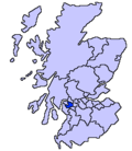
Clydebank. The River Cart itself is very short, being formed from the confluence of the Black Cart Water (from the west) and the White Cart Water (from the south...
18 KB (1,972 words) - 19:16, 24 September 2024
White Cart Bridge is a Scherzer rolling lift bascule bridge situated on the A8 road in Renfrew, Scotland. The bridge crosses White Cart Water at the confluence...
7 KB (532 words) - 16:50, 3 September 2024
borders the city of Glasgow to the east, and straddles the banks of the White Cart Water, a tributary of the River Clyde. Paisley serves as the administrative...
92 KB (9,229 words) - 11:44, 13 October 2024
Parliament[which?] obtained in 1753 authorised improvements to the White Cart Water, to make it navigable, and so assist the developing cotton industry...
11 KB (1,261 words) - 11:32, 16 September 2024
Battlefield, Mount Florida, King's Park, Muirend and Newlands. The White Cart Water flows through Cathcart, downstream from Linn Park. In 2014, it was...
8 KB (713 words) - 21:23, 19 October 2024
city centre, on a hill overlooking the Levern Water, just before its confluence with the White Cart Water. Crookston Castle was built by the Stewarts of...
9 KB (1,084 words) - 18:33, 19 October 2024
is half in East Renfrewshire. Both Linn and Pollok parks have the White Cart Water flowing through them. Some areas in the park are unsuitable for prams...
8 KB (786 words) - 09:48, 17 April 2023
although it is not administratively part of the city. It lies on the White Cart Water six miles (ten kilometres) south of Glasgow city centre and 3⁄4 mile...
8 KB (938 words) - 15:56, 30 August 2024
a parish church of the Church of Scotland on the east bank of the White Cart Water in the centre of the town of Paisley, Renfrewshire, about 7 miles (11...
23 KB (2,083 words) - 20:51, 30 July 2024
Renfrewshire. The town ends close to the White Cart Water to the west and is bounded by the Rotten Calder Water to the east. Immediately to the north of...
56 KB (5,730 words) - 11:21, 25 October 2024
character. Shawlands and Langside lie to the north of the district (the White Cart Water forming the boundary), Pollokshaws and Auldhouse to the west, Giffnock...
4 KB (279 words) - 21:26, 23 October 2024
neighbourhoods about 1 mile (1.6 km) apart on opposite sides of the White Cart Water are known by the Crookston name, owing to factors in their development...
24 KB (2,432 words) - 02:06, 2 June 2024
railway and the open lands of Pollok Country Park to the west. The White Cart Water flows through the area. The housing stock consists of some sandstone...
16 KB (1,535 words) - 04:42, 12 October 2024
across the White Cart Water in Linn Park MacQuisten Bridge Newlands and Shawlands 1832 Cat C Road bridge (A77) across the White Cart Water Millbrae Bridge...
69 KB (258 words) - 13:05, 8 October 2024
aqueduct to carry the Glasgow, Paisley and Johnstone Canal over the White Cart Water. Following the closure of the canal in 1881, it was converted to a...
5 KB (419 words) - 19:56, 24 September 2023
lies to the southwest of the city and is bounded to the south by the White Cart Water. The area was part of Renfrewshire until 1926 when the villages of...
13 KB (1,619 words) - 17:43, 25 September 2024
East Renfrewshire, Scotland. It is situated on the west bank of the White Cart Water about 4 miles (6.5 km) south of Glasgow city centre. Part of the Greater...
15 KB (1,607 words) - 23:39, 22 August 2021
Greater Glasgow conurbation, it is situated on the west bank of the White Cart Water about 4.5 miles (7.2 km) south of Glasgow city centre, and just outside...
8 KB (719 words) - 19:33, 15 September 2024
18th century. The stone arch bridge leading to the house over the White Cart Water was constructed in 1757. The heraldic lions on the gate piers were...
7 KB (633 words) - 11:28, 28 September 2024
River Clyde along the banks of the Auldhouse Burn, a tributary of the White Cart Water. The housing stock mostly consists of inter-war sandstone terraces...
3 KB (230 words) - 04:42, 12 October 2024
from Paisley, is named after him. The St Mirin Burn flows into the White Cart Water close to the town centre. He is also commemorated by St Mirren Street...
8 KB (900 words) - 04:44, 11 August 2024
plans drawn up to encourage more visitors. The park, through which the White Cart Water flows towards Paisley, is the largest within the city of Glasgow. It...
10 KB (984 words) - 22:27, 5 October 2024
boundary), Abbotsinch is bordered by the Black Cart Water to the north and west, and the White Cart Water to the east. Its southern edge was delineated...
2 KB (259 words) - 17:34, 4 July 2024
requires the capability to move large loads by river. The bridge crosses White Cart Water and onto the River Clyde. Inchinnan hosts an art deco style category...
12 KB (1,269 words) - 13:48, 7 May 2024
Glasgow's major indoor retail complexes. The country park and the White Cart Water which flows through it form the northern and eastern boundary of the...
16 KB (1,563 words) - 23:13, 23 October 2024
extrapolated from Clyde at Daldowie, Kelvin at Killermont, White Cart Water at Hawkhead, and Black Cart Water at Milliken Park gauge stations South Eastern River...
261 KB (9,219 words) - 22:13, 1 November 2024
"White Cart Bridge, Inchinnan Road, Over Part Of White Cart Water: Listed Building Report". Historic Scotland. "Rolling Lift Bridge Over White Cart Water:...
22 KB (781 words) - 00:48, 16 October 2024
Abbey Bridge is grade B listed road-bridge over the White Cart Water in the centre of Paisley in Scotland. It was erected in 1879, widened in 1933, and...
4 KB (423 words) - 20:41, 19 September 2024
Golf Course and extends beyond the Paisley Canal railway line to the White Cart Water at Ross Hall Mains farm. Ralston's northern boundary falls close to...
15 KB (2,032 words) - 12:19, 6 July 2024
to 1932, when the site at Abbotsinch, between the Black Cart Water and the White Cart Water, near Paisley in Renfrewshire, was opened. In 1933 the Royal...
58 KB (4,710 words) - 01:27, 4 November 2024


