
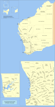
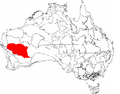
The Shire of Wiluna is a local government area in the Goldfields-Esperance region (since 2021) of Western Australia, about 950 kilometres (590 mi) northeast...
7 KB (494 words) - 02:41, 27 September 2023
Australian Government Railways. Shire of Wiluna, a local government area in the Mid West region of Western Australia. Wiluna Gold Mine, a gold mine in Western...
383 bytes (83 words) - 13:52, 16 January 2010

Wiluna is a small town in the Goldfields-Esperance region (since 2021) of Western Australia. It is situated on the edge of the Western Desert at the gateway...
18 KB (1,709 words) - 15:50, 11 July 2024
Australia. As of 2023[update], 38 places are heritage-listed in the Shire of Wiluna, of which two are on the State Register of Heritage Places. The Western...
3 KB (123 words) - 22:08, 6 July 2024
The Meekatharra to Wiluna railway was a 113-mile (182 km) branch line of the Western Australian Government Railways that extended the Mullewa – Meekatharra...
9 KB (723 words) - 18:18, 26 August 2024
Wiluna Airport (IATA: WUN, ICAO: YWLU) is an airport located 2.5 nautical miles (4.6 km; 2.9 mi) south of Wiluna, Western Australia, with two runways (one...
2 KB (99 words) - 18:07, 31 May 2023

Government Boundaries Commission in 1992. The Shire of Wiluna was divided with the eastern area becoming the new Shire. It is a community of interest within the...
11 KB (931 words) - 22:06, 6 July 2024
plus seven significant regional centres Shire – predominantly rural or outer suburban areas, plus the Shire of Peppermint Grove Town – predominantly...
59 KB (1,456 words) - 23:12, 21 June 2024
Leinster Nickel Mine (category Shire of Leonora)
Keith, Wiluna Shire, Western Australia, Australia". www.mindat.org. Mindat.org. Retrieved 10 March 2023. "Perseverance Mine, Leinster, Leonora Shire, Western...
13 KB (1,442 words) - 01:45, 12 July 2024
February 1905. In the 1920s, it was proposed to extend the railway line to Wiluna but instead, a line from Meekatharra was built and completed in 1932. The...
11 KB (973 words) - 10:10, 28 August 2024
Metals Pty Ltd) operates Paroo Station Mine (formerly Magellan Mine) at Wiluna in Western Australia. Rosslyn Hill Mining is wholly owned by and the principal...
21 KB (2,336 words) - 13:09, 26 August 2024

The Shire of Cocos (Keeling) Islands is a local government area which manages local affairs on the Australian external territory of Cocos (Keeling) Islands...
7 KB (613 words) - 14:41, 3 March 2024
the Shire of Sandstone, the Shire of Meekatharra, the Shire of Wiluna and the Shire of Leonora. The climate is arid, with rainfall predominantly in the...
8 KB (768 words) - 13:13, 31 July 2023

Wyalkatchem and Yilgarn and the Mid West Shire of Wiluna from the seat of Durack, while it would also receive the Wheatbelt Shire of Beverley from the seat of Pearce...
11 KB (655 words) - 18:01, 28 April 2024

September meeting". Broken Hill City Council. Retrieved 5 December 2020. "Byron Shire Council declares a State of Climate Emergency - will Eurobodalla Council...
82 KB (2,829 words) - 01:38, 27 April 2024

The Shire of Meekatharra is a local government area in the Mid West region of Western Australia, about halfway between the town of Port Hedland and the...
7 KB (449 words) - 02:42, 23 February 2023
(Shire of Wagin) Williams Public Library (Shire of Williams) Wiluna Library (Shire of Wiluna) Christmas Island Public Library (Christmas Island) Cocos Home...
13 KB (1,193 words) - 07:15, 23 May 2024
Aboriginal community, located 10 km east of Wiluna in the Mid West region of Western Australia, within the Shire of Wiluna. In the 2001 census, Bondini had a population...
3 KB (203 words) - 04:55, 30 June 2022
40 km north of Wiluna, Western Australia in the Mid West region, within the Shire of Wiluna. The community is located within the Wiluna (WAD6164/98) native...
4 KB (163 words) - 09:40, 8 November 2023
Kalgoorlie–Boulder, Laverton, Leonora, Menzies, Ngaanyatjarraku, Ravensthorpe and Wiluna. It also incorporates the area along the Great Australian Bight to the South...
9 KB (898 words) - 22:00, 6 July 2024
was made to keep the Burakin to Bonnie Rock railway line open, as was the Wiluna to Meekatharra line, because the state government was concerned about the...
14 KB (1,250 words) - 10:06, 28 August 2024

The Shire of Laverton is a local government area in the Goldfields-Esperance region of Western Australia, about 370 kilometres (230 mi) northeast of the...
7 KB (510 words) - 22:06, 6 July 2024
The Wiluna uranium mine is a proposed uranium mine in Western Australia. The mine project, owned by Toro Energy Ltd, is located 30 kilometres (19 mi) south...
3 KB (324 words) - 07:58, 15 May 2022

850 km through the Great Sandy Desert until the southern end of the route at Wiluna. The town functions as a major hub for the local Indigenous population and...
17 KB (1,537 words) - 03:09, 8 October 2023
Shire of Serpentine-Jarrahdale: The following places are heritage listed in the Shire of Serpentine–Jarrahdale but are not State registered: "Shire of...
19 KB (144 words) - 14:15, 20 June 2024

house are on the Shire of Meekatharra heritage list. Meekatharra's rail infrastructure was actually enlarged after the line to Wiluna closed in 1957 as...
18 KB (1,572 words) - 12:49, 23 August 2024

The Shire of Plantagenet is a local government area in the Great Southern region of Western Australia, managed from the town of Mount Barker, 360 kilometres...
13 KB (1,135 words) - 04:10, 29 July 2024

Lake Carnegie is a large ephemeral lake in the Shire of Wiluna in the Goldfields-Esperance region of Western Australia. The lake is named after David...
10 KB (730 words) - 22:05, 6 July 2024

The Shire of Wyndham East Kimberley is one of the four local government areas in the Kimberley region of northern Western Australia, covering an area...
15 KB (1,237 words) - 06:05, 6 November 2023

Shoemaker impact structure (category Shire of Wiluna)
arid central Western Australia, about 100 km (62 mi) north-northeast of Wiluna. It is named in honour of planetary geologist Eugene Shoemaker. The prominent...
5 KB (455 words) - 23:37, 21 February 2024