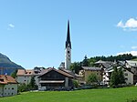
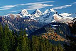
La Punt Chamues-ch (Romansh pronunciation: [lɐ ˈpʊnt tɕaˈmweːʃtɕ] ; Italian and official name until 1943: Ponte-Campovasto) is a municipality in the Maloja...
10 KB (997 words) - 01:19, 26 October 2024
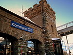
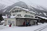
La Punt Chamues-ch railway station is a railway station on the Bever–Scuol-Tarasp line in the Engadin valley of the eastern Swiss Alps in southeastern...
4 KB (154 words) - 01:54, 17 December 2023
Piz Üertsch (category La Punt Chamues-ch)
Piz Üertsch is a mountain of the Albula Alps, overlooking the Albula Pass, in the Swiss canton of Graubünden. It is located south-west of Piz Kesch. Swisstopo...
1 KB (40 words) - 14:06, 1 May 2022
Cup alpine ski racer and Olympic gold medalist. From the village of La Punt Chamues-ch, near St. Moritz in the canton of Graubünden, he made his World Cup...
7 KB (216 words) - 21:29, 22 October 2024
La Liste which initially was a list of the 1,000 best restaurants in the world is privately owned and was launched in Paris in December 2015. This French...
22 KB (433 words) - 13:47, 28 December 2024
Inn (river) (category La Punt Chamues-ch)
January 2016. "Elektrizitäts-Produktion" (in German). www.stmoritz-energie.ch. Archived from the original on 2 December 2015. Retrieved 18 January 2016...
15 KB (1,062 words) - 10:51, 25 October 2024
several villages became independent of Zuoz. S-chanf left in 1518, La Punt Chamues-ch in 1528 and Madulain in 1534. In 1554, Zuoz joined the Protestant...
13 KB (1,460 words) - 15:18, 27 October 2024
Albula Pass (category La Punt Chamues-ch)
Graubünden to Engadin. It is traversed by a paved road from Thusis to La Punt, via Bergün. It is also traversed by the Albula Railway, although at a...
4 KB (340 words) - 02:55, 28 October 2024
Fürstenau Grono Grüsch Ilanz/Glion Jenaz Jenins Klosters-Serneus Küblis La Punt Chamues-ch Laax Landquart Lantsch/Lenz Lostallo Lumnezia Luzein Madulain Maienfeld...
7 KB (632 words) - 00:18, 21 August 2024
List of cultural property of national significance in Switzerland: Graubünden (section La Punt Chamues-ch)
Albertini La Punt 324, 325 790.596 161.683 46°34′45″N 9°55′32″E / 46.579233°N 9.925525°E / 46.579233; 9.925525 3159 Chesa Merleda La Punt 345 790.665...
67 KB (191 words) - 17:05, 20 December 2024
the Maloja Region. It consists of the village of Samedan and the hamlet of Punt Muragl, the upper section of the Val Bever as well as an exclave that includes...
20 KB (1,465 words) - 20:20, 22 December 2024
8353 Flüela Pass Davos to Susch road 2389 7838 Albula Pass Bergün to La Punt Chamues-ch road 2315 7595 Septimer Pass Bivio to Val Bregaglia bridle path 2311...
7 KB (370 words) - 16:32, 3 November 2024
institutionellen Gliederungen, Geburtsort und Staatsangehörigkeit". bfs.admin.ch (in German). Swiss Federal Statistical Office - STAT-TAB. 31 December 2020...
4 KB (120 words) - 20:35, 22 December 2024
Piz Languard (category La Punt Chamues-ch)
Piz Languard is a mountain of the Livigno Alps, overlooking Pontresina in the canton of Graubünden. With a height of 3,262 metres (10,702 ft) above sea...
2 KB (108 words) - 11:47, 2 May 2022
Donatyre Écoteaux Épesses Goumoens-le-Jux Malapalud Oron-la-Ville Palézieux Saint-Légier-La Chiésaz Sassel Sévery Rüschlikon Zollikon "Geschichte, Wappen"...
104 KB (543 words) - 00:40, 23 December 2024
Piz Mezzaun (category La Punt Chamues-ch)
m) is a mountain in the Livigno Range of the Alps, located east of La Punt Chamues-ch in the canton of Graubünden. It lies on the range north of the Chamuera...
1 KB (69 words) - 12:11, 2 May 2022
ISBN 978-3-89494-130-7. "Bergün/Bravuogn - Preda - Albulapass - La Punt - Chamues-ch (Rufbus)" (PDF) (in German). Bundesamt für Verkehr. 17 October 2019...
4 KB (154 words) - 01:46, 17 December 2023
l'Aiguillette à la Singla Mountain hut 3,176 m (10,420 ft) Valais Bagnes Georgy Hut Mountain hut 3,175 m (10,417 ft) Graubünden La Punt Chamues-ch/Pontresina...
10 KB (105 words) - 00:45, 14 March 2023
located on the Albula river and along the Albula Pass road. Lai da Ravais-ch is within the village. It consists of the linear village of Bergün/Bravuogn...
11 KB (1,080 words) - 03:35, 27 October 2024
in the district. It is located in the upper Engadin valley between La Punt Chamues-ch and Zuoz about 15 minutes from St. Moritz on the Inn River. It consists...
15 KB (1,502 words) - 12:35, 8 May 2024
institutionellen Gliederungen, Geburtsort und Staatsangehörigkeit". bfs.admin.ch (in German). Swiss Federal Statistical Office - STAT-TAB. 31 December 2020...
15 KB (1,580 words) - 20:16, 22 December 2024
Prezio or Parezzo* La Punt Chamues-ch Ponte Campovasto Ramosch Ramoggia, Ramoscio* Reischen Reseno* Riom Riamio* Reichenau Ponte or la Punt* Rhäzüns Razeno...
88 KB (3,540 words) - 22:53, 24 December 2024
Andermatt–Chur Tschamut La Punt Chamues-ch 1,697 m (5,568 ft) Graubünden La Punt Chamues-ch Pontresina–Scuol-Tarasp La Punt Madulain 1,697 m (5,568 ft)...
28 KB (248 words) - 08:35, 27 October 2024
Munt Cotschen (category La Punt Chamues-ch)
Switzerland. It lies on the range lying between the Val Chamuera (above Chamues-ch in Graubünden) and the Livigno valley (Lombardy). Swisstopo map Munt Cotschen...
1 KB (49 words) - 20:14, 15 May 2022
Neuchâtel La Ferrière Bern La Grande Béroche Neuchâtel La Neuveville Bern La Praz Vaud La Punt Chamues-ch Graubünden La Rippe Vaud La Roche Fribourg La Sagne...
72 KB (50 words) - 19:02, 4 October 2024
conditions are available on the websites of Switzerland Tourism and Bergfex. langlauf.ch Langlaufpass Switzerland Tourism ski report Bergfex ski report...
21 KB (77 words) - 04:57, 7 April 2024
of the Upper Engadine at a 2.0% gradient through the stations of La Punt Chamues-ch, Madulain, Zuoz und S-chanf to Cinuos-chel-Brail. The halt of S-chanf...
24 KB (2,528 words) - 07:15, 18 August 2024
institutionellen Gliederungen, Geburtsort und Staatsangehörigkeit". bfs.admin.ch (in German). Swiss Federal Statistical Office - STAT-TAB. 31 December 2020...
6 KB (224 words) - 01:26, 26 October 2024
campaign began with a victory on 12 March 1799 at La Punt Chamues-ch. By 2 May Lecourbe was back at La Punt and on 13 May he arrived at Bellinzona, having...
25 KB (3,054 words) - 02:48, 25 February 2023
Railway Following station Samedan towards St. Moritz RE 3 Zuoz towards Landquart Samedan towards Pontresina R 15 La Punt Chamues-ch towards Scuol-Tarasp...
4 KB (188 words) - 16:00, 11 August 2024


