
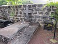
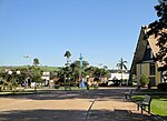
Cananéia is the southernmost city in the state of São Paulo, Brazil, near where the Tordesilhas Line passed. The population in 2020 was 12,541 and its...
7 KB (417 words) - 05:50, 19 July 2024
in areas of the Atlantic Forest on Ilha do Cardoso within Cananéia, Brazil. Geoplana cananeia is a flatworm around 66 mm in length and 5 mm in width. The...
2 KB (278 words) - 04:59, 8 July 2024

The Iguape-Cananéia-Paranaguá estuary lagoon complex (Portuguese: Complexo Estuarino Lagunar de Iguape-Cananéia-Paranaguá) is a stretch of interconnected...
8 KB (880 words) - 16:42, 9 January 2022

the merger of the parts of Ilha Comprida that belonged to the city of Cananéia with the sections of the island that were administered by the city of Iguape...
7 KB (381 words) - 00:22, 14 June 2024

historical evidence that the map represents land south of present-day Cananéia. A disproven 20th-century hypothesis identified the southern landmass with...
58 KB (6,795 words) - 22:37, 17 August 2024

area of 359 km2. The elevation is 39 m. Nearest cities are Registro and Cananéia. The municipality contains the 3,200 hectares (7,900 acres) Campina do...
4 KB (168 words) - 06:59, 28 May 2024

Gippsland Lakes Port Jackson (Sydney Harbour) Spencer Gulf Amazon River Iguape-Cananéia-Paranaguá estuary lagoon complex Lagoa dos Patos and Lagoon Mirim Mearim...
41 KB (4,820 words) - 22:32, 16 August 2024
Cananéia, São Paulo. It has an area of 1,176 hectares (2,910 acres). It lies on the coast of the Mar Pequeno, and is partly contained in the Cananéia-Iguape-Peruíbe...
7 KB (655 words) - 20:00, 6 July 2024

Itariri Mongaguá Pedro de Toledo Peruíbe Registro Barra do Turvo Cajati Cananéia Eldorado Iguape Ilha Comprida Jacupiranga Juquiá Miracatu Pariquera-Açu...
250 KB (21,178 words) - 06:29, 24 August 2024
Cananéia-Iguape-Peruíbe Environmental Protection Area (Portuguese: Área de Proteção Ambiental de Cananéia-Iguapé-Peruíbe) is a protected area in the State...
7 KB (589 words) - 00:32, 3 November 2019

state due to its historical importance for the country, especially in Cananeia (considered one of the largest marine life nurseries on the planet), Itanhaém...
182 KB (17,492 words) - 23:18, 23 August 2024

Cananéia State Park (Portuguese: Parque Estadual do Lagamar de Cananéia) is a state park in the state of São Paulo, Brazil. The Lagamar de Cananéia State...
4 KB (386 words) - 18:13, 1 June 2023
Ilha do Cardoso (Cardoso Island) is an island belonging to the city of Cananéia, São Paulo, Brazil. It is the southernmost point of the state of São Paulo...
823 bytes (94 words) - 23:54, 3 August 2021
centered on the settlement of São Vicente, extending along the coastline from Cananéia to Bertioga (within present-day São Paulo state) the other extended from...
3 KB (317 words) - 03:10, 30 May 2023

Madeira, Portugal Flag of the Chief-of-Staff of the Portuguese Navy Flag of Cananéia, Brazil Flag of Capim, Brazil Coat of arms of the 4th Aviation Battalion...
8 KB (677 words) - 14:02, 20 December 2023

Tinharé islands in Cairu Ilha do Algodoal in Maracanã Ilha do Cardoso in Cananéia Ilha de Cotijuba [pt] in Belém Ilha do Mel in Paranaguá Ilha Grande in...
14 KB (699 words) - 20:51, 11 May 2024
and Ubatuba, where ten pirates were killed, La Louise took shelter in Cananeia for some days. There Levasseur was informed of a rich French merchantman...
20 KB (2,629 words) - 19:02, 23 August 2024

historical evidence that the map represents land south of present-day Cananéia. A disproven 20th-century hypothesis identified the southern landmass with...
47 KB (5,188 words) - 18:10, 22 August 2024

Coastal basins of the Iguape-Cananéia-Paranaguá estuary lagoon complex are: Vertente Marítima Sul in the municipalities of Cananéia and Ilha Comprida Vertente...
12 KB (1,120 words) - 11:00, 10 October 2022
(Name) Photo Displacement N.B. Carioca class Gunboat Brazil 1890–1912 Cananéia 210 ton Participation in Naval Revolt by the Loyalist Fleet. It was sunk...
53 KB (144 words) - 19:43, 21 August 2024

Tupiniquim again (Tupi, on the São Paulo coast from Santos/Bertioga down to Cananéia; aggressive expansionists, they were recent arrivals imposing themselves...
69 KB (7,392 words) - 20:30, 22 August 2024

Itariri Mongaguá Pedro de Toledo Peruíbe Registro Barra do Turvo Cajati Cananéia Eldorado Iguape Ilha Comprida Jacupiranga Juquiá Miracatu Pariquera-Açu...
43 KB (4,132 words) - 01:34, 9 August 2024
testing 246 specimens available in the area of Cabo de São Tomé (22°S) and Cananéia (25°S) at depths down to 200 m (660 ft) from 1991 to 2005. The amount of...
2 KB (213 words) - 10:53, 7 March 2024
Orange National Park 202,307 499,910 Environmental Protection Area of Cananéia-Iguape-Peruíbe 657,328 1,624,290 Fernando de Noronha Archipelago 10,929...
242 KB (220 words) - 03:54, 22 August 2024

Itariri Mongaguá Pedro de Toledo Peruíbe Registro Barra do Turvo Cajati Cananéia Eldorado Iguape Ilha Comprida Jacupiranga Juquiá Miracatu Pariquera-Açu...
21 KB (93 words) - 20:26, 8 May 2024
Itariri Mongaguá Pedro de Toledo Peruíbe Registro Barra do Turvo Cajati Cananéia Eldorado Iguape Ilha Comprida Jacupiranga Juquiá Miracatu Pariquera-Açu...
5 KB (211 words) - 04:29, 21 July 2024
701 0.858 0.620 469 São João das Duas Pontes 0.720 0.675 0.806 0.686 469 Cananéia 0.720 0.677 0.806 0.649 469 São Bento do Sapucaí 0.720 0.719 0.812 0.638...
126 KB (310 words) - 10:07, 14 February 2024

Itariri Mongaguá Pedro de Toledo Peruíbe Registro Barra do Turvo Cajati Cananéia Eldorado Iguape Ilha Comprida Jacupiranga Juquiá Miracatu Pariquera-Açu...
5 KB (198 words) - 02:22, 4 June 2024

between two stretches between Peruíbe (SP) and Iguape (SP), and between Cananéia (SP) and Garuva (SC). Between Curitiba and Garuva (SC), the highway was...
11 KB (994 words) - 23:57, 24 January 2024

Itariri Mongaguá Pedro de Toledo Peruíbe Registro Barra do Turvo Cajati Cananéia Eldorado Iguape Ilha Comprida Jacupiranga Juquiá Miracatu Pariquera-Açu...
33 KB (2,567 words) - 02:06, 9 August 2024