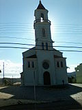
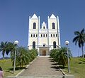
Those born in Água Doce do Norte are called Agua-docences. The municipality is currently made up of five districts: Água Doce do Norte, Governador Lacerda...
4 KB (270 words) - 02:13, 26 August 2024
40°37′22″W / 19.14444°S 40.62278°W / -19.14444; -40.62278 São Domingos do Norte is a municipality located in the Brazilian state of Espírito Santo. Its...
612 bytes (55 words) - 02:50, 26 August 2024
Bom Jesus do Norte is a municipality located in the Brazilian state of Espírito Santo. Its population was 9,962 (2020) and its area is 89.0 km². IBGE 2020...
3 KB (34 words) - 19:02, 26 August 2024
(north) Barra de São Francisco and Nova Venécia. (south) São Domingos do Norte. (east) São Gabriel da Palha. The municipality is in a markedly mountainous...
4 KB (153 words) - 02:50, 26 August 2024
Tubarão (formerly CST) and mining company Vale (formerly Companhia Vale do Rio Doce, CVRD). Vitória's GDP corresponds to 20% of the state economy. The tertiary...
35 KB (3,151 words) - 18:28, 30 December 2024
characterized by undulating lowlands and numerous lakes. The town sits on the Doce River amidst its 69 lakes. The climate is hot, tropical, and humid, typically...
10 KB (500 words) - 17:04, 22 December 2024
Mutum Preto. The main watercourse through the municipality is the Rio Doce river ("Doce" means sweet in Portuguese) whose basin (of 83,500 square kilometers)...
8 KB (821 words) - 02:46, 26 August 2024
Água Doce is a municipality in the state of Santa Catarina in the South region of Brazil. The Morro do Capão Doce is situated in its territory. List of...
5 KB (179 words) - 05:21, 10 May 2023
the trainline from Vitória to Minas Gerais. It lies on the banks of the Doce River, through which as much as 700 cubic meters of water per second may...
4 KB (230 words) - 02:46, 26 August 2024
Cachoeiro de Itapemirim (redirect from Cachoeiro do Itapemirim)
120 acres) Itabira Natural Monument. The city is nicknamed A capital oculta do mundo, meaning "the secret capital of the world". Bujica (Marcelo Ribeiro)...
9 KB (591 words) - 16:08, 22 September 2024
works. The latter two are concentrated around Cariacica and the Vale do Rio Doce ironworks. Vitória is an important port for the exporting of iron and...
47 KB (4,753 words) - 20:18, 1 January 2025
Conceição do Castelo is a municipality in central Espírito Santo, Brazil. Its population was 12,806 (2020) and its area is 369 km2. The municipality was...
3 KB (95 words) - 14:44, 21 December 2024
Barra de São Francisco Água Doce do Norte Barra de São Francisco Ecoporanga Mantenópolis Colatina Alto Rio Novo Baixo Guandu Colatina Governador Lindenberg...
5 KB (346 words) - 19:58, 23 August 2024
20°51′46″S 40°56′09″W / 20.86278°S 40.93583°W / -20.86278; -40.93583 Rio Novo do Sul is a municipality located in the Brazilian state of Espírito Santo. Its...
753 bytes (71 words) - 19:54, 23 August 2024
grouped into 4 mesoregions. Mesoregions Central Espirito-Santense Litoral Norte Espirito-Santense Noroeste Espirito-Santense Sul Espirito-Santense Geography...
4 KB (62 words) - 15:25, 29 November 2024
21°01′30″S 41°39′14″W / 21.02500°S 41.65389°W / -21.02500; -41.65389 São José do Calçado is a municipality located in the Brazilian state of Espírito Santo...
1 KB (59 words) - 19:33, 27 August 2024
minerals, but the region of the Doce River was practically uninhabited till 1925, it was then that the first bridge over the Doce River was built, called Florian...
3 KB (302 words) - 02:49, 26 August 2024
19°44′20″S 40°39′25″W / 19.73889°S 40.65694°W / -19.73889; -40.65694 São Roque do Canaã is a municipality located in the Brazilian state of Espírito Santo....
726 bytes (71 words) - 19:57, 23 August 2024
Barra de São Francisco Água Doce do Norte Barra de São Francisco Ecoporanga Mantenópolis Colatina Alto Rio Novo Baixo Guandu Colatina Governador Lindenberg...
3 KB (30 words) - 18:59, 26 August 2024
meters above sea level. Bordering municipalities include Castelo, Venda Nova do Imigrante and Afonso Claudio to the west, Santa Maria de Jetiba and Santa...
8 KB (557 words) - 18:53, 23 August 2024
Barra de São Francisco Água Doce do Norte Barra de São Francisco Ecoporanga Mantenópolis Colatina Alto Rio Novo Baixo Guandu Colatina Governador Lindenberg...
4 KB (305 words) - 17:01, 22 December 2024
2016-10-26. Retrieved 2016-10-26. "Heavy Minerals". Industrias Nucleares do Brasil. Archived from the original on 2012-11-27. Retrieved 2012-08-06. "High...
9 KB (634 words) - 03:01, 3 January 2025
29, 1997. Its colonization was made primarily through the access of the Doce River, by Italian immigrants, who settled there during the 19th century....
1 KB (141 words) - 03:08, 26 August 2024
Floriano and Domingos Martins, (west) Vargem Alta, (south) Iconha and Rio Novo do Sul. The municipality is mountainous, though not very high in general. Its...
4 KB (146 words) - 18:55, 23 August 2024
main city and contains the mangrove estuary of the Jucu River. The Morro do Penedo Natural Monument protects a granite rock mass about 132 metres (433 ft)...
8 KB (568 words) - 18:31, 30 December 2024
Barra de São Francisco Água Doce do Norte Barra de São Francisco Ecoporanga Mantenópolis Colatina Alto Rio Novo Baixo Guandu Colatina Governador Lindenberg...
688 bytes (58 words) - 06:57, 1 September 2024
receiving municipal autonomy only in 1764. Originally, it was called Povoado do Cricaré, being renamed in the year 1566 by Father José de Anchieta after Saint...
10 KB (442 words) - 17:07, 22 December 2024
Barra de São Francisco Água Doce do Norte Barra de São Francisco Ecoporanga Mantenópolis Colatina Alto Rio Novo Baixo Guandu Colatina Governador Lindenberg...
3 KB (53 words) - 18:58, 26 August 2024
Barra de São Francisco Água Doce do Norte Barra de São Francisco Ecoporanga Mantenópolis Colatina Alto Rio Novo Baixo Guandu Colatina Governador Lindenberg...
3 KB (30 words) - 18:58, 26 August 2024
Barra de São Francisco Água Doce do Norte Barra de São Francisco Ecoporanga Mantenópolis Colatina Alto Rio Novo Baixo Guandu Colatina Governador Lindenberg...
6 KB (33 words) - 18:59, 26 August 2024


