Grautskåla Cirque (71°37′S 11°22′E / 71.617°S 11.367°E / -71.617; 11.367 (Grautskåla Cirque)) is a cirque immediately north of The Altar in the Humboldt...
4 KB (505 words) - 19:01, 18 February 2024
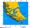
Puerto Williams. Puerto Williams (54°56′S 67°37′W / 54.933°S 67.617°W / -54.933; -67.617, population: 1,868), located on Isla Navarino, is the southernmost...
20 KB (1,041 words) - 08:09, 24 July 2024
Themis Nunatak (71°37′S 69°6′W / 71.617°S 69.100°W / -71.617; -69.100) is a very large, flat-topped nunatak lying 6 nautical miles (11 km) west-southwest...
939 bytes (130 words) - 20:20, 13 April 2023

"Moscow, 71-608K — Roster". transphoto.org. Retrieved 26 May 2021. "Moscow, 71-608KM — Roster". transphoto.org. Retrieved 26 May 2021. "71-617". transphoto...
20 KB (1,637 words) - 00:49, 24 June 2024
further south and Thompson Peak at the south end. 71°37′S 165°29′E / 71.617°S 165.483°E / -71.617; 165.483. A peak in the east-central portion of the...
8 KB (580 words) - 13:47, 10 March 2024

facility on Darby Road near Chopmist Hill (41°49′11″N 71°38′43″W / 41.8198°N 71.6453°W / 41.8198; -71.6453) intercepted German HF communications. Because...
18 KB (1,832 words) - 15:25, 19 July 2024

Referee: John Paterson July 31, 1976 Olympic Stadium, Montreal Attendance: 71.617 Referee: Ramón Barreto Poland – Silver Medal Men Individual finals July...
64 KB (657 words) - 00:23, 21 April 2023
Dawn. Karachi, Pakistan: Pakistan Herald Publications. 2017-01-29. Retrieved 2018-04-09. 34°38′N 71°37′E / 34.633°N 71.617°E / 34.633; 71.617 v t e...
3 KB (98 words) - 23:57, 10 November 2023
wintered at South Pole Station in 1958 and 1961. 71°37′S 159°59′E / 71.617°S 159.983°E / -71.617; 159.983. A prominent, largely ice-free nunatak, 2...
18 KB (2,491 words) - 02:33, 19 March 2024

1956-60, and named Smørstabben (the churnstaff). 71°37′S 11°37′E / 71.617°S 11.617°E / -71.617; 11.617. A ridge about 8 nautical miles (15 km; 9.2 mi)...
4 KB (559 words) - 19:19, 18 February 2024
Vystrel Mountain (71°37′S 15°4′E / 71.617°S 15.067°E / -71.617; 15.067) is a partly snow-covered mountain, 1,995 m, standing 1 nautical mile (1.9 km)...
701 bytes (105 words) - 20:50, 26 March 2020

9% 4,009.47 5.1 Halton Regional municipality 596,637 548,435 +8.8% 965.71 617.8 Hastings County 41,580 39,628 +4.9% 5,198.73 8.0 Huron County 61,366 59...
145 KB (2,155 words) - 00:23, 1 July 2024

State Route 617 (SR 617) in the U.S. state of Virginia is a secondary route designation applied to multiple discontinuous road segments among the many...
38 KB (1,830 words) - 00:40, 14 October 2022

http://edgewaternj.org/DocumentCenter/View/7158/11-16-2020-Mayor--Council-Regulardocx 19°25′19″N 71°36′54″W / 19.422°N 71.615°W / 19.422; -71.615 v t e...
4 KB (304 words) - 21:11, 18 April 2024
and mapping party to the'Lassiter Coast area, 1970-71. 71°37′S 62°20′W / 71.617°S 62.333°W / -71.617; -62.333. An island-like mountain massif in the east...
8 KB (1,217 words) - 22:32, 28 April 2024

66% 89 1.53% 1,874 32.13% 5,833 Carter 663 87.35% 46 6.06% 37 4.87% 13 1.71% 617 81.29% 759 Cascade 15,634 53.76% 6,397 22.00% 6,638 22.83% 410 1.41% 8...
60 KB (2,003 words) - 06:31, 18 June 2024
Number 617 Squadron is a Royal Air Force aircraft squadron, originally based at RAF Scampton in Lincolnshire and currently based at RAF Marham in Norfolk...
50 KB (5,078 words) - 19:23, 12 July 2024

Nearest city Villa La Angostura Coordinates 40°50′S 71°37′W / 40.833°S 71.617°W / -40.833; -71.617 Area 17.53 km2 (6.77 sq mi) Established 1971 Governing body...
3 KB (312 words) - 08:26, 10 May 2023
Schneider Peak (71°37′S 62°41′W / 71.617°S 62.683°W / -71.617; -62.683) is a peak rising to about 1,300 m near the head of Rankin Glacier, 6 nautical...
3 KB (596 words) - 06:11, 20 July 2022

Borchgrevink, who named it for the Duke of York. 71°37′S 170°04′E / 71.617°S 170.067°E / -71.617; 170.067. A cove in the northeast side of Duke of...
17 KB (2,857 words) - 21:59, 9 March 2024
Evison, New Zealand's first professor of geophysics. 71°37′S 163°50′E / 71.617°S 163.833°E / -71.617; 163.833. A line of mostly snow-covered hills and...
5 KB (856 words) - 14:50, 19 July 2024
Manager of Publications. p. 41.{{cite book}}: CS1 maint: multiple names: authors list (link) 33°32′N 71°37′E / 33.533°N 71.617°E / 33.533; 71.617 v t e...
941 bytes (97 words) - 02:28, 12 March 2024
Heftye Island (71°59′S 171°6′E / 71.983°S 171.100°E / -71.983; 171.100) Hélène Island (66°37′S 139°44′E / 66.617°S 139.733°E / -66.617; 139.733) Henderson...
74 KB (12,543 words) - 10:20, 25 June 2024

Cooper's NZARP geological party to the area, 1981-82. 71°37′S 163°07′E / 71.617°S 163.117°E / -71.617; 163.117. A prominent mountain, 2,420 metres (7,940 ft)...
10 KB (1,277 words) - 15:45, 2 May 2024

number Total number Year retired 1959 GM TDH5106 40 ft 96in Detroit Diesel 6-71 617 1 1982 19xx GM TDHxxxx 92,395,435-436 4 GM TDH4517 35 ft 96 in Detroit Diesel...
23 KB (1,887 words) - 04:38, 28 July 2024

Hitchcock Lake Stowe Information on the Pemigewasset River Archived 2012-07-30 at the Wayback Machine 43°20′N 71°37′W / 43.333°N 71.617°W / 43.333; -71.617...
2 KB (132 words) - 18:02, 2 June 2023
71, but 71 is not one more than a multiple of 9. It is part of the last known pair (71, 7) of Brown numbers, since 71 2 = 7 ! + 1 {\displaystyle 71^{2}=7...
2 KB (352 words) - 17:34, 6 August 2024

which faces the Ross Sea, are (from north to south): 71°37′S 170°36′E / 71.617°S 170.600°E / -71.617; 170.600. A line of precipitous basalt cliffs rising...
10 KB (1,546 words) - 06:01, 5 April 2024

Location in central Quebec. Coordinates: 46°51′N 71°37′W / 46.850°N 71.617°W / 46.850; -71.617 Country Canada Province Quebec Region Capitale-Nationale...
8 KB (366 words) - 06:44, 6 February 2024

Statistics (Israel). Current Plans for Developing the Negev: A Critical Perspective Adva Center 30°37′N 34°48′E / 30.617°N 34.800°E / 30.617; 34.800 v t e...
7 KB (270 words) - 08:28, 26 June 2024