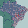
BR-262 is an east-west highway connecting the Brazilian states of Espírito Santo, Minas Gerais, São Paulo and Mato Grosso do Sul. The highway runs from...
6 KB (528 words) - 15:55, 8 November 2024
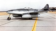
The Messerschmitt Me 262, nicknamed Schwalbe (German: "Swallow") in fighter versions, or Sturmvogel (German: "Storm Bird") in fighter-bomber versions...
98 KB (12,269 words) - 15:05, 23 November 2024
List of federal highways in Brazil (redirect from BR-600 (Brazil highway))
in 1973. Brazilian federal road names are composed of the ISO 3166 code "BR", a dash and three numbers. State highways in the country are classified as...
22 KB (675 words) - 16:25, 16 January 2024
at an elevation of 675 meters a short distance south of federal highway BR-262. The São Francisco River lies to the east. Neighboring municipalities are:...
8 KB (733 words) - 06:34, 2 September 2024
50 km2. Bom Despacho: 102 km (north on BR-494 then west on BR-262) Uberaba: 423 km (north on BR-494 then west on BR-262) Formiga: 76 km southwest on MG-050...
13 KB (1,082 words) - 15:18, 6 November 2024
Minas Gerais (redirect from BR-MG)
states of São Paulo and Goiás, near Uberaba and Uberlândia). Some parts of BR-262 are also duplicated. The state, however, presents, in general, a duplication...
123 KB (13,223 words) - 05:43, 25 December 2024
Juiz de Fora, Conselheiro Lafaiete, Barbacena, Sete Lagoas, and Paracatu. BR-262 begins in Mato Grosso do Sul and ends in Espírito Santo, crossing Minas...
86 KB (7,816 words) - 23:11, 16 December 2024
BR-116 is part of the Brazilian Highway System. With at total length of 4,542 km (2,822 mi) it is the longest highway in the country. It is also the longest...
8 KB (714 words) - 00:49, 29 December 2024
numbered 262: BR-262 Manitoba Provincial Road 262 Prince Edward Island Route 262 Road to Herradura (1–262) Japan National Route 262 Arkansas Highway 262 California...
2 KB (151 words) - 13:58, 8 September 2024
Espírito Santo (redirect from BR-ES)
inconsistencies were found and construction was halted.[citation needed] BR-101 BR-259 BR-262 BR-482 Vehicles: 1,811,993 (December 2016) Mobile phones: 4,417,825...
47 KB (4,753 words) - 20:18, 1 January 2025
Mato Grosso do Sul (redirect from BR-MS)
crossing the entire state. Other important highways in the state are BR-262, BR-060 and BR-267. As it is a state that only became more populated in the 1970s...
30 KB (2,643 words) - 05:54, 20 December 2024
Belo Horizonte, it is near the important road junction of BR 262 (Belo Horizonte-Vitória) and BR 116 (Rio-Bahia). The total area of the municipality is 629 km2...
6 KB (505 words) - 03:51, 20 November 2024
1968 BR-262 20°46′44.7″S 51°37′49.3″W / 20.779083°S 51.630361°W / -20.779083; -51.630361 Paulicéia-Brasilândia Bridge Brasilândia-Pauliceia 2009 BR-158...
25 KB (1,347 words) - 03:22, 24 November 2024
at Campo Grande. BR-262 links Campo Grande to Corumbá and Bolivia to the west, and the Brazilian State of São Paulo to the east. BR-163 connects Campo...
27 KB (2,084 words) - 12:24, 9 November 2024
Brazilian Highway System (redirect from Br 101)
and toll-collection. Currently, the longest National Highway in Brazil is BR-116 with 4,486 km (2,787 mi). As of 2023[update], the system consists of 1...
37 KB (3,808 words) - 16:52, 13 December 2024
Vitória, Espírito Santo (category CS1 Brazilian Portuguese-language sources (pt-br))
roads are the BR-101, a motorway linking the Brazilian south and northeast with the Metropolitan Region of Greater Vitória, the BR-262 that connects the...
35 KB (3,151 words) - 18:28, 30 December 2024
The BR-101 (also called Translitorânea (transcoastal), officially named Rodovia Governador Mário Covas. and nicknamed Briói in some regions) is a longitudinal...
11 KB (994 words) - 23:57, 24 January 2024
on state highway MG-170, 8 km south of its junction with federal highway BR-262. Neighboring municipalities are: Cedro do Abaeté and Abaeté (N), Martinho...
4 KB (530 words) - 07:21, 23 November 2024
areas by Avenida Presidente Carlos Luz. The first area is bounded by the BR-262 ring road, the Army Ministry CPOR facility, the Nuclear Energy Commission...
4 KB (363 words) - 22:32, 1 November 2024
de Minas, Varjão de Minas(W). Patos de Minas: 110 km São Gotardo: 50 km (BR-262) Belo Horizonte: 365 km The region was first settled during the Portuguese...
5 KB (591 words) - 02:23, 29 November 2024
Ribeirão Preto Anel Viário Sul (SP-333), Ribeirão Preto Anel Rodoviário (BR-262), Belo Horizonte Contorno Oeste, Boa Vista Américo Vespucio Avenue, Santiago...
71 KB (6,907 words) - 17:35, 2 December 2024
Geral to the west. Patos de Minas: 101 km Araxá: 163 km Estalagem: 55 km (BR-262) Rio Paranaíba: 20 km Matutina: 22 km Tiros: 43 km Arapua:50 km Belo Horizonte:...
5 KB (638 words) - 02:23, 29 November 2024
Guanambi (category CS1 Brazilian Portuguese-language sources (pt-br))
south-west of Salvador, the capital being connected by the roads BR-030, BR-262 and BR-324, representing a strong influence in the commercial. The city...
3 KB (151 words) - 00:27, 21 August 2024
Belo Horizonte Metro (category CS1 Brazilian Portuguese-language sources (pt-br))
Gerais - SEINFRA". www.infraestrutura.mg.gov.br. Retrieved 28 August 2024. "L8693". www.planalto.gov.br. Retrieved 28 August 2024. Minas, Estado de (19...
38 KB (4,469 words) - 17:10, 31 December 2024
Sacramento is connected to Uberaba by state highway MG-190 and national highway BR-262. The distance to Uberaba is 72 kilometers; Conquista is 22 km to the southwest;...
4 KB (520 words) - 02:12, 29 November 2024
Bellator 262: Velasquez vs. Kielholtz was a mixed martial arts event produced by Bellator MMA that took place on July 16, 2021 at Mohegan Sun Arena in...
8 KB (569 words) - 23:48, 9 April 2024
Frutal: 91 km Belo Horizonte: 692 km The highways of access are: BR-262, BR-050, MG-427, BR-364, and MG-255. The town had its origins in an Indian village...
4 KB (527 words) - 02:16, 29 November 2024
British Rail Class 156 (redirect from BR Class 156)
locomotive-hauled passenger trains. By the beginning of the 1980s, British Rail (BR) operated a large fleet of first generation DMUs, which had been constructed...
49 KB (4,305 words) - 00:38, 31 December 2024
Uberaba (category CS1 Brazilian Portuguese-language sources (pt-br))
to Uberaba is provided by BR-050, connecting the city to the federal capital Brasília and São Paulo, as well as by BR-262, linking it to the state capital...
27 KB (2,009 words) - 02:12, 24 December 2024
on state highway MG-170, 8 km south of its junction with federal highway BR-262. Neighboring municipalities are: Bom Despacho (N)and (E), Santo Antônio...
4 KB (483 words) - 07:21, 23 November 2024


