
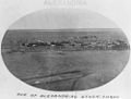
(all coordinates) GPX (primary coordinates) GPX (secondary coordinates) Camooweal is an outback town and locality in the City of Mount Isa, Queensland,...
37 KB (3,605 words) - 05:15, 7 July 2024

Freckleton's Stores is a heritage-listed group of shops at Barkly Street, Camooweal, City of Mount Isa, Queensland, Australia. It was built from c. 1895 to...
9 KB (1,191 words) - 01:02, 12 January 2024

Community Hall is a heritage-listed former town hall at Barkly Highway, Camooweal, City of Mount Isa, Queensland, Australia. It was designed by Rooney Brothers...
10 KB (1,350 words) - 01:03, 12 January 2024

Camooweal Caves is a national park in Queensland, Australia, 15 km southeast of Camooweal and 1720 km northwest of Brisbane. The traditional name of this...
4 KB (284 words) - 23:12, 25 December 2023
Australian Labor Party Tree of Knowledge, Camooweal, a tree associated with knowledge exchange in Camooweal, Queensland, Australia Kidman's Tree of Knowledge...
2 KB (238 words) - 18:43, 17 November 2023

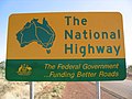
Governor of Victoria. The highway runs between Cloncurry via Mount Isa and Camooweal to the Stuart Highway north of Tennant Creek, at the junction known as...
13 KB (829 words) - 12:40, 24 June 2024

Camooweal Airport (IATA: CML, ICAO: YCMW) is located 0.4 nautical miles (0.74 km; 0.46 mi) northeast of Camooweal, Queensland, Australia. The airport...
3 KB (218 words) - 20:42, 29 January 2024

Tree of Knowledge is a heritage-listed tree on the Barkly Highway, Camooweal, City of Mount Isa, Queensland, Australia. It was added to the Queensland...
8 KB (1,001 words) - 01:01, 12 January 2024

heritage-listed sites, including: Underground Hospital, Camooweal Street Tent House, Camooweal Street Spinifex State College Junior Campus, 6–12 Fifth...
60 KB (6,047 words) - 11:34, 12 October 2024
two tracks from his side project The Aints. The album includes a song, "Camooweal", that had originally been recorded for the Slim Dusty tribute album Not...
8 KB (163 words) - 08:21, 16 June 2023

Kalgoorlie, Perth, Geraldton, Port Hedland, Broome, Wyndham, Darwin, Camooweal, Townsville and then down the East coast. Webmaster. "Georgine Clarsen...
4 KB (371 words) - 17:50, 27 March 2023

Charleville 3. Blackall 4. Longreach 5. Winton 6. Cloncurry 7. Mt. Isa 8. Camooweal 9. Brunette Downs 10. Newcastle Waters 11. Daly Waters 12. Darwin 13....
76 KB (5,685 words) - 07:12, 3 October 2024

that name. With its headwaters rising in the Barkly Tableland, north of Camooweal in Queensland, and in the extreme east of the Northern Territory beyond...
17 KB (1,662 words) - 19:12, 30 May 2024

Caves Timor Caves Yarangobilly St Michaels Cave Wee Jasper Wombeyan Caves Camooweal Caves Five O’Clock Cave Four Mile East Cave Great Nowranie Cave Little...
10 KB (913 words) - 01:33, 23 August 2024
Bogantungan Boonah Bouldercombe Boulia Bowen Bray Park Calliope Cambooya Camooweal Capella Cardwell Cashmere Charleville Childers Chillagoe Chinchilla Clermont...
18 KB (735 words) - 20:21, 8 May 2024
Music Festival". Caloundra Music Festival. Retrieved 14 October 2012. "Camooweal Drovers Camp". Droverscamp.com.au. Retrieved 14 October 2012. Capricorn...
103 KB (2,043 words) - 10:52, 17 September 2024
awarded by the Associated Locksmiths of America 950 in Roman numerals Camooweal Airport, IATA airport code "CML" A common mistyping of XML in computing...
2 KB (288 words) - 20:03, 12 March 2024

783888888889°S 150.73166666667°E / -22.783888888889; 150.73166666667 1988 Camooweal Caves National Park 20°01′09″S 138°11′24″E / 20.01916667°S 138.19°E...
74 KB (431 words) - 11:20, 28 February 2024
Airport Caloundra West / Sunshine Coast YCDR CUD Caloundra Airport Camooweal YCMW CML Camooweal Airport Cape Flattery CQP Cape Flattery Airport Carpentaria Downs...
66 KB (245 words) - 18:50, 30 August 2024
atavia-Sourabaya-Bima-Koepang-Bathurst Island-Darwin-Newcastle Waters-Camooweal-Cloncurry-Longreach-Roma-Toowoomba reaching Eagle Farm, Brisbane on 23...
49 KB (4,783 words) - 00:00, 16 July 2024

Boulia Bowen Brisbane Bundaberg Burketown Caboolture Cairns Caloundra Camooweal Charleville Charters Towers Chillagoe Chinchilla Clermont Cloncurry Coen...
30 KB (1,978 words) - 12:35, 10 October 2024

Boulia Bowen Brisbane Bundaberg Burketown Caboolture Cairns Caloundra Camooweal Charleville Charters Towers Chillagoe Chinchilla Clermont Cloncurry Coen...
38 KB (2,837 words) - 05:05, 9 October 2024

Queensland 1883 Narromine New South Wales 1884 Alpha Queensland 1884 Camooweal Queensland 1884 Karridale Western Australia 1884 Wyalong New South Wales...
38 KB (799 words) - 03:22, 2 August 2024

residences as well as certain towns, including Burketown, Urandangi, and Camooweal. The media covered the enormous road and property damage, as well as the...
129 KB (10,977 words) - 04:11, 1 October 2024

Patrol commenced was established in 1928 at its Gulf Mission Base in Camooweal. The amalgamation of the Presbyterian, Methodist and Congregational churches...
34 KB (2,819 words) - 02:47, 5 October 2024
National Highway 66/A2 Barcaldine to Camooweal Barkly Highway Cloncurry to Camooweal National Highway 66 Camooweal to Tennant Creek National Highway 87...
37 KB (2,681 words) - 06:45, 7 October 2024
Hills Station. It is located about 173 kilometres (107 mi) north west of Camooweal and 273 kilometres (170 mi) east of Tennant Creek in the Northern Territory...
12 KB (1,406 words) - 10:12, 9 September 2024

Australia. It is situated approximately 70 kilometres (43 mi) west of Camooweal and 250 kilometres (155 mi) north west of Mount Isa. The Station occupies...
8 KB (801 words) - 00:51, 11 March 2024

species. Small colonies have been recorded along the Victoria River and at Camooweal Caves NP. The range extends in association with rocky cliffs, gorges,...
34 KB (4,150 words) - 03:34, 9 January 2024
Bindegolly Mariala Narkoola Thrushton Tregole North West Boodjamulla Camooweal Caves Porcupine Gorge White Mountains Central West Astrebla Downs Bladensburg...
9 KB (784 words) - 22:59, 12 September 2024