Elend is a district of the town of Oberharz am Brocken in the Harz District, in Saxony-Anhalt, Germany. It lies in the Bode valley in the High Harz in...
8 KB (416 words) - 15:42, 20 July 2024
Elend may refer to: Elend, Saxony-Anhalt, a village at the foot of the Brocken, the highest mountain in the Harz in central Germany Elend (band), a French...
230 bytes (65 words) - 15:44, 2 October 2023

In 2009 the construction of a new stub line from Elend to Braunlage was discussed (see South Harz Railway Company). Behind Drei-Annen-Hohne the line...
14 KB (1,024 words) - 14:27, 31 August 2024
Harzer Hexenstieg (redirect from Harz Witches' Path)
The Harz Witches' Trail (German: Harzer Hexenstieg) is a footpath, just under 100 km long, in Germany that runs from Osterode through the Harz mountains...
4 KB (542 words) - 18:29, 12 July 2020
Birth-Death Birthplace Place of Death Working Period Friedrich Krebs 1832–1905 Elend (Harz) (Germany) Braunschweig (Germany) 1895–1905 Hermann Niehaus 1848–1932...
3 KB (258 words) - 21:23, 22 September 2024

Barenberg (Schierke) (category Mountains of the Harz)
Harz Mountains of Germany near the village of Schierke, Harz county, in the state of Saxony-Anhalt. The Barenberg rises in the Upper Harz (High Harz)...
4 KB (425 words) - 17:07, 27 March 2020

Helenenruh (redirect from Helenenruh Elend)
("Helen's Rest") is a 629 metre high rocky ridge near the village of Elend in the Harz Mountains of central Germany. Today there is a refuge hut and rest...
1 KB (143 words) - 21:38, 25 February 2018

Elbingerode (redirect from Elbingerode (Harz))
Elbingerode is an Ortsteil of Oberharz am Brocken in the Harz district, in the German state of Saxony-Anhalt. The former town was incorporated into the...
6 KB (602 words) - 17:13, 31 August 2024

Zillierbach Dam (category Dams in the Harz)
It supplies drinking water to several villages in the High Harz (Elbingerode, Elend (Harz), Schierke, teilweise Rübeland) as well as the town of Wernigerode;...
6 KB (644 words) - 10:55, 4 January 2020

Harzer Wandernadel (redirect from Harz Wandernadel)
The Harzer Wandernadel is a system of hiking awards in the Harz mountains in central Germany. Hikers (or mountain bikers) can earn awards at different...
15 KB (1,550 words) - 16:46, 26 August 2023
This is a list of rock formations in the Harz. They are known as the Harzklippen (literally "Harz crags" or "Harz cliffs") in German, which is the collective...
14 KB (1,532 words) - 20:45, 19 June 2024
hills of the Harz National Park and the nature parks of Harz (Lower Saxony), Harz/Saxony-Anhalt and the South Harz. Hills in the South Harz Karst Landscape...
175 KB (892 words) - 00:00, 11 January 2024

Brocken-Hochharz (category Harz district geography stubs)
of Harz, in Saxony-Anhalt, Germany. It was situated in the Harz mountains, southwest of Wernigerode. It was named after the highest peak of the Harz: Brocken...
2 KB (128 words) - 15:18, 20 August 2024
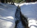
The Wormsgraben is a waterway in the Harz Mountains of central Germany in the state of Saxony-Anhalt. The Wormsgraben is located 1 to 3 km west of Drei...
3 KB (212 words) - 03:34, 16 April 2024

Wurmberg Gondola Lift (category Transport in the Harz)
Wurmbergklippen crags, the Kaffeehorst (checkpoint 18 in the Harzer Wandernadel) and Elend/Schierke, the Wurmberg Quarry (ca. 500 m), the Bärenbrücke bridge over the...
3 KB (366 words) - 06:47, 27 September 2024
on the K 1353 county road (Kreisstraße) (Sorge – Elend section) with the railway line of the Trans-Harz Railway. The source region of the "Big Allerbach"...
3 KB (169 words) - 07:36, 26 January 2022

Scherstorklippen (category Rock formations of the Harz)
694 m above sea level (NN)) in the Harz Mountains of central Germany. It is located near the village of Schierke in the county of Harz in the state of Saxony-Anhalt...
2 KB (229 words) - 23:33, 12 October 2015

Brocken (German pronunciation: [ˌoːbɐhaːɐ̯ts ʔam ˈbʁɔkŋ̍]) is a town in the Harz District, in Saxony-Anhalt, Germany. It was formed on 1 January 2010 by the...
4 KB (287 words) - 20:16, 20 August 2024

municipality in the Harz district, in the German state of Saxony-Anhalt. Since 1 July 2009, it is part of the town Wernigerode. Situated within the Harz mountain...
9 KB (1,090 words) - 15:39, 1 November 2022

Trudenstein (category Harz)
large parts of the East and South Harz. In good weather, the nearby Wurmberg mountain, the villages of Schierke and Elend and the Stöberhai mountain, 15...
4 KB (404 words) - 22:31, 30 December 2021

Braunlage (category Towns in the Harz)
close to the border with Elend in the state of Saxony-Anhalt. The municipal area stretches along the south-eastern rim of the Harz National Park from an...
12 KB (748 words) - 13:59, 20 August 2024

Kalte Bode (category Rivers of the Harz)
and Elend, the Kalte Bode has to carry the huge quantities of water that run into this short section of river in spring. A few kilometres beyond Elend it...
3 KB (208 words) - 16:24, 7 August 2023

Brocken (category Mountains of the Harz)
Höhenprofil der Brockenstraße (mit Anschluss bis Elend)[permanent dead link] (www.dw.com), Deutsche Welle. "The Harz Region – All around the Brocken | On Tour...
42 KB (4,915 words) - 07:12, 15 October 2024

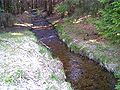
Wormke (category Rivers of the Harz)
100) road, on an embankment, and the tracks of the Harz Railway. Near Mandelholz [de] (a part of Elend) the river finally discharges into the Kalte Bode...
2 KB (155 words) - 03:35, 20 June 2024
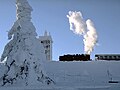
Brocken Railway (category Transport in the Harz)
leaves the station, however, it crosses the road to Schierke/Elend and then enters the Harz National Park. It then heads west to Schierke station (688 m)...
10 KB (1,153 words) - 15:56, 11 March 2024
Rauher Jakob (category Hills of the Harz)
Rauher Jakob (literally "Rough James") is a hilltop between Tanne and Elend in the Harz mountains of central Germany. It is 568.6 metres above sea level....
1 KB (75 words) - 18:50, 19 April 2017

Achtermannshöhe (category Mountains of the Harz)
called the Achtermann) in the Harz National Park is the third highest mountain in Lower Saxony and the fourth highest in the Harz mountains. It lies in the...
3 KB (225 words) - 06:59, 26 August 2023

Mandelholz Dam (category Dams in the Harz)
protection reservoir located between the villages of Elend and Königshütte near Wernigerode in the Harz mountains of Germany. It impounds the waters of the...
3 KB (212 words) - 08:57, 11 February 2019

Tarifgemeinschaft Ostharz ("Transport and Fare Community of the East Harz") is active in the Harz, but only for bus and tram operations. The MDV (Mitteldeutscher...
79 KB (387 words) - 18:49, 14 March 2022

Schnarcherklippen (category Rock formations of the Harz)
(up to 671 m above sea level) south of the village of Schierke in the High Harz mountains of Saxony-Anhalt in central Germany. The name translates roughly...
5 KB (369 words) - 20:45, 19 June 2024