
Satellite navigation (redirect from GNSS)
system with global coverage is termed global navigation satellite system (GNSS). As of 2024[update], four global systems are operational: the United States's...
42 KB (4,395 words) - 19:10, 30 July 2024
(IERS) International Geodynamics and Earth Tide Service (IGETS) International Gravity Field Service (IGFS) International GNSS Service (IGS) International Laser...
9 KB (689 words) - 03:09, 20 August 2024
Augmentation of a global navigation satellite system (GNSS) is a method of improving the navigation system's attributes, such as precision, reliability...
14 KB (1,505 words) - 00:10, 20 April 2024
page 53" (PDF). International GNSS Service. Retrieved 2023-08-03. Hatanaka, Yuki (2008). "A Compression Format and Tools for GNSS Observation Data"...
7 KB (651 words) - 03:19, 6 September 2024

used many versions of WGS 84 before), a little modified with International GNSS Service (IGS) implementation, IGS20. BeiDou Coordinate System, China Terrestrial...
9 KB (777 words) - 16:49, 25 May 2024

IGS20, the frame used by the International GNSS Service (IGS). G2139 was aligned with the IGb14 realization of the International Terrestrial Reference Frame...
24 KB (2,843 words) - 13:42, 3 August 2024
are precise measurements of the GNSS satellites' orbits, made by the geodetic community (the International GNSS Service and other public and private organizations)...
5 KB (724 words) - 22:20, 1 April 2023
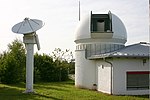
spacer International Glaciological Society International Graphonomics Society International GNSS Service Ilkley Grammar School International Grammar...
1 KB (139 words) - 02:00, 27 February 2024

large pulsar searches and other science. The WSRT is also an International GNSS Service site. WSRT observed galaxies in the Spitzer Infrared Nearby Galaxies...
5 KB (575 words) - 18:32, 16 June 2024

Satellite navigation device (redirect from GNSS phone)
equipment that uses one or more of several global navigation satellite systems (GNSS) to calculate the device's geographical position and provide navigational...
41 KB (4,388 words) - 06:50, 3 September 2024
acquisition of Hemisphere GNSS on October 12. Positioning Positioning and heading Peripherals Atlas GNSS-based global L-band correction service http://www.hemispheregnss...
5 KB (355 words) - 06:20, 23 October 2023

Station: ohi2". International GNSS Service. NASA. Archived from the original on 2009-06-26. "IGS Station: ohi3". International GNSS Service. NASA. Archived...
18 KB (1,863 words) - 16:23, 12 March 2024
2019, the International GNSS Service started providing precise orbits of BeiDou satellites in experimental products. To date, the military service has been...
66 KB (5,746 words) - 22:50, 4 September 2024
Global Navigation Satellite System (GNSS) receivers, using the GPS, GLONASS, Galileo or BeiDou system, are used in many applications. The first systems...
18 KB (2,379 words) - 23:00, 29 January 2024
Spoofing attack (redirect from GNSS spoofing)
system (GNSS) spoofing attack attempts to deceive a GNSS receiver by broadcasting fake GNSS signals, structured to resemble a set of normal GNSS signals...
32 KB (3,757 words) - 12:08, 3 September 2024

International Society for Photogrammetry & Remote Sensing, the International GNSS Service, Multi-GNSS Asia, Surveying & Spatial Science Institute, the NSW Institution...
14 KB (1,687 words) - 16:14, 17 March 2024
GNSS road pricing or GNSS-based tolling is the charging of road users using Global Navigation Satellite System (GNSS) sensors inside vehicles. Road pricing...
12 KB (1,271 words) - 16:52, 26 April 2024
World Data Center (category International scientific organizations)
Geophysical data-analysis Services, most of the legacy data centers and services continued under the WDS. CODATA International Polar Year data center Korsmo...
14 KB (482 words) - 00:30, 6 September 2024
UNAVCO (section GPS/GNSS Systems)
applications, and education. UNAVCO also provided support for the International GNSS Service (IGS). The UNAVCO GAGE Facility's Education and Community Engagement...
24 KB (3,160 words) - 06:50, 31 August 2024

Heiskanen Symposium in Geodesy, Oct 1-4, 2002, Columbus, OH, USA". International GNSS Service. Retrieved 17 March 2024. (See Proceedings) Grafarend, Erik W...
8 KB (754 words) - 20:45, 29 June 2024

(Global Transmission Services GTS-2) onboard International Space Station. However, in accordance to the ubiquitous availability, GNSS-satellite signals will...
8 KB (475 words) - 01:50, 9 June 2024
FAI Gliding Commission (redirect from GNSS Flight Recorders)
include a pressure altitude sensor and a Global Navigation Satellite System (GNSS) receiver. Data output is in a standard ASCII-based format, the "IGC flight...
16 KB (1,748 words) - 13:22, 11 March 2024

Panama Papers (redirect from International reactions to the Panama Papers)
the resources they need to provide vital public services and tackle rising inequality". International Monetary Fund (IMF) researchers estimated in July...
157 KB (14,374 words) - 21:58, 1 September 2024
Global Positioning System (redirect from Precise Positioning Service)
States Space Force. It is one of the global navigation satellite systems (GNSS) that provide geolocation and time information to a GPS receiver anywhere...
178 KB (18,553 words) - 16:14, 22 August 2024

based on global navigation satellite system (GNSS) services. Both horizontal and vertical accuracy of GNSS is just a few centimetres for baseline ≤ 5 km...
17 KB (2,070 words) - 18:35, 29 August 2024
upon criteria for defining the market size of location-based services, but the European GNSS Agency estimated that 40% of all computer applications used...
42 KB (4,703 words) - 18:45, 9 August 2024
Galileo is a global navigation satellite system (GNSS) that went live in 2016, created by the European Union through the European Space Agency (ESA), operated...
108 KB (10,706 words) - 15:55, 30 August 2024

300 m x 45 m). It was renumbered from 09/27 in late 2008. Pilots guided by GNSS take a more efficient approach than those operating under VFR. Local airport...
24 KB (2,108 words) - 11:09, 7 September 2024
A revenue service, revenue agency or taxation authority is a government agency responsible for the intake of government revenue, including taxes and sometimes...
12 KB (150 words) - 05:33, 7 August 2024
Satellite laser ranging (redirect from International Laser Ranging Service)
Grzegorz; Sośnica, Krzysztof; Zajdel, Radosław (December 2019). "Multi-GNSS orbit determination using satellite laser ranging". Journal of Geodesy. 93...
20 KB (1,994 words) - 20:35, 6 July 2024