
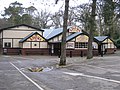
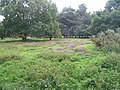
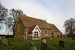
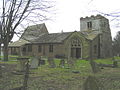
Kirkby on Bain is a village and civil parish in the East Lindsey district of Lincolnshire, England. It lies on the River Bain between Horncastle and Coningsby...
7 KB (524 words) - 17:28, 27 June 2024

east of Horncastle. After leaving Horncastle, the Bain flows through the villages of Kirkby on Bain, Coningsby and Tattershall, and joins the Witham at...
11 KB (476 words) - 03:24, 30 July 2024
Woodhall Spa (redirect from Tower on the Moor)
Tattershall Thorpe, Timberland, Martin, Stixwould and Woodhall, Roughton, and Kirkby on Bain. The village is served by the B1191 running west from Martin through...
47 KB (4,560 words) - 18:24, 10 July 2024
Academy Kirkby Kirkby-in-Furness, Cumbria Kirkby la Thorpe, Lincolnshire Kirkby on Bain, Lincolnshire Kirkby Fleetham, North Yorkshire Kirkby Ireleth...
2 KB (266 words) - 10:30, 29 January 2024
Horncastle Canal (category Commons category link is on Wikidata)
It was officially abandoned on 23 September 1889, but sand and gravel continued to be transported from Kirkby on Bain for another ten years, while the...
15 KB (1,603 words) - 13:37, 28 November 2023
central Lincolnshire between the villages of Woodhall Spa to the west and Kirkby on Bain to the east. Roughton Moor lies to the north and the former RAF Woodhall...
6 KB (605 words) - 19:44, 7 February 2024

February 1729/30) was an English clergyman. He was Vicar of Croft and Kirkby-on-Bain, Lincolnshire from 1719 to 1722, and Vicar of St. Mary's Church, Nottingham...
4 KB (504 words) - 23:08, 12 January 2024

New York, Lincolnshire (category Coordinates on Wikidata)
Lincolnshire, England, in the parish of Wildmore in the Lincolnshire Fens on the B1192 road near Coningsby, 11+1⁄2 miles (18.5 km) north of Boston. At...
3 KB (164 words) - 04:37, 30 May 2024
Kettlethorpe, Kexby, Kingerby, Kingthorpe, Kirkby cum Osgodby, Kirkby Green, Kirkby la Thorpe, Kirkby on Bain, Kirkby Underwood, Kirkstead, Kirmington, Kirmond...
24 KB (1,557 words) - 22:44, 26 January 2024
Nottinghamshire Kirkby-in-Ashfield Kirklington Northumberland Kirkharle Kirkhaugh Kirkheaton Kirknewton Kirkley, Suffolk Lincolnshire Kirkby on Bain Kirkstead...
5 KB (407 words) - 07:23, 30 April 2023

Saltfleetby (category Coordinates on Wikidata)
village and civil parish in the East Lindsey district of Lincolnshire, England on the coast of the North Sea, approximately 7 miles (11 km) east from Louth...
5 KB (401 words) - 15:39, 27 August 2023
Roughton Low Dar Wood Stixwould and Woodhall Ostler's Plantation Kirkby on Bain Forestry Commission Roughton Scrubs Roughton Wellsyke Wood Kirkby on Bain...
807 bytes (11 words) - 18:13, 21 March 2022
Latin; ME: Middle English; NF: Norman French; OE: Old English (Anglo-Saxon); ON: Old Norse; P: Pictish; S: Scots; SG: Scots Gaelic; W: Welsh English Place-Name...
48 KB (1,145 words) - 01:00, 10 August 2024

Lincolnshire (category Coordinates on Wikidata)
and Cretaceous chalk (north-east). The area around Woodhall Spa and Kirkby on Bain is dominated by gravel and sand. For much of prehistory, Lincolnshire...
96 KB (9,433 words) - 13:58, 11 August 2024
Horsington, Kirkby on Bain, Stixwould East Lindsey, North Kesteven LN11 LOUTH Louth East Lindsey LN12 MABLETHORPE Mablethorpe, Sutton-on-Sea, Theddlethorpe...
4 KB (145 words) - 20:07, 20 June 2024

Bolingbroke, Lincolnshire (category Coordinates on Wikidata)
into the village from the east. To the southwest another hill known as Kirkby Hill is topped with a former windmill that sits just within the parish boundary...
14 KB (1,277 words) - 10:45, 13 June 2024
married Arthur on 1 June 1918 and after several years living with her parents in 1929 they moved to a Council house in nearby Kirkby-on-Bain, a small village...
5 KB (696 words) - 03:50, 3 September 2023

Westville, Lincolnshire (category Coordinates on Wikidata)
of the West Fen in 1812, in 1866 Westville became a separate civil parish, on 1 April 2005 the parish was abolished and merged with Frithville to form "Frithville...
3 KB (237 words) - 19:42, 31 May 2024
Thornton, Lincolnshire (category Coordinates on Wikidata)
Roughton, in the East Lindsey district of Lincolnshire, England. It is situated on the B1191 road, 1 mile (1.6 km) west from the A153, and 1.5 miles (2.4 km)...
3 KB (184 words) - 04:02, 5 June 2024

Salmonby (category Coordinates on Wikidata)
photographs, remaining: In 1971 the civil parish had a population of 58. On 1 April 1987 the parish was abolished and merged with Tetford. The village...
5 KB (402 words) - 21:21, 22 November 2023
New Bolingbroke (category Coordinates on Wikidata)
Bartholomew Covenham St Mary Croft Cumberworth Dalby Donington on Bain East Barkwith East Keal East Kirkby Eastville Edlington with Wispington Elkington Farlesthorpe...
5 KB (400 words) - 23:03, 13 June 2024
Mablethorpe (category Coordinates on Wikidata)
population of 3,611. On 1 April 1974 the parish was changed to form "Mablethorpe and Sutton". The population including nearby Sutton-on-Sea was 12,531 at...
21 KB (1,977 words) - 19:05, 21 May 2024
Sandilands, Lincolnshire (category Coordinates on Wikidata)
Sandilands (once known as Sutton le Marsh) is a neighbourhood of Sutton-on-Sea, in the East Lindsey district of Lincolnshire, England. It forms part of...
3 KB (176 words) - 07:21, 18 August 2022
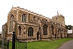
Horncastle (category Coordinates on Wikidata)
remains. Although fortified, Horncastle was not on any important Roman roads, which suggests that the River Bain was the principal route of access to it. Roman...
36 KB (3,329 words) - 17:01, 9 August 2024

River Bain Fulsby ? ? No longer exists Harrowby Mill River Witham Manthorpe 1702 II Only millhouse survives. Now private residence. Kirkby on Bain Mill...
2 KB (11 words) - 20:15, 9 February 2024
Minting (category Coordinates on Wikidata)
Bartholomew Covenham St Mary Croft Cumberworth Dalby Donington on Bain East Barkwith East Keal East Kirkby Eastville Edlington with Wispington Elkington Farlesthorpe...
3 KB (176 words) - 20:40, 30 August 2022

Seathorne (category Coordinates on Wikidata)
p. 8. Retrieved 4 December 2022 – via British Newspaper Archive. Progress on the estate was described as "phenomenal" by the Boston Guardian two years...
3 KB (206 words) - 10:31, 29 April 2024
0°42′54″W / 53.099217°N 0.714969°W / 53.099217; -0.714969 Reddings Woods, Kirkby on Bain, Lincolnshire, East Lindsey[citation needed] 53°08′46″N 0°09′18″W /...
132 KB (6,318 words) - 18:38, 7 August 2024

Ingoldmells (category Coordinates on Wikidata)
resort in the East Lindsey district of Lincolnshire, England. It is situated on the A52, and 3 miles (5 km) north from the resort town of Skegness. Most housing...
10 KB (1,041 words) - 07:28, 3 September 2023

Roughton, Lincolnshire (category Coordinates on Wikidata)
miles (8 km) south from Horncastle and near the hamlets of Thornton and Kirkby-on-Bain. Since 1936 the hamlets of Dalderby and Martin have been part of Roughton...
6 KB (411 words) - 16:34, 26 September 2023