Little Cottonwood Creek Valley was a census-designated place (CDP) in Salt Lake County, Utah. The 2000 Census population was 7,221, an increase over the...
6 KB (486 words) - 21:56, 22 June 2024

in the Salt Lake Valley's post-1847 history at a strategic point where escarpments on either side of the Little Cottonwood Creek valley create a narrow...
9 KB (1,288 words) - 18:43, 2 June 2021

separating the valleys of the Big and Little Cottonwood Creeks. At the eastern edge of the city, these valleys narrow into the Big and Little Cottonwood Canyons...
10 KB (648 words) - 06:27, 6 February 2024

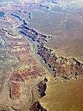
Little Cottonwood Canyon lies within the Wasatch-Cache National Forest along the eastern side of the Salt Lake Valley, roughly 15 miles from Salt Lake...
12 KB (1,386 words) - 19:50, 10 March 2024
around 9,600 feet. The creek flows through the Big Cottonwood Canyon in a westerly direction until it emerges into Salt Lake Valley about eighteen miles...
11 KB (1,123 words) - 13:31, 6 February 2024

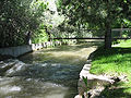
Little Cottonwood Creek is one of the principal streams entering Salt Lake Valley from the east. The creek rises near the summit of the Wasatch Mountains...
9 KB (1,036 words) - 16:38, 13 September 2022

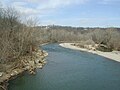
Cottonwood Creek is a major stream and tributary of the Sacramento River in Northern California. About 68 miles (109 km) long measured to its uppermost...
23 KB (2,496 words) - 07:39, 1 December 2023
South Carolina Kinney and Gourlays Improved City Plat, Utah Little Cottonwood Creek Valley, Utah Marine on St. Croix, Minnesota South Chicago Heights,...
47 KB (2,074 words) - 21:24, 2 September 2024

northeasterly to the Cottonwood River, with its waters then flowing to the Minnesota River and eventually the Mississippi River. Plum Creek lends its name to...
4 KB (228 words) - 22:35, 17 June 2022

List of rivers of California (section Redwood Creek)
River Yreka Creek Oregon Slough Little Shasta River Willow Creek Parks Creek Whitney Creek Cottonwood Creek Bogus Creek Jenny Creek Butte Creek (joins the...
69 KB (5,982 words) - 14:57, 24 June 2024
Cottonwood, Utah, has historically referred to a vaguely defined area between and around Big Cottonwood Creek and Little Cottonwood Creek in the Salt...
974 bytes (174 words) - 09:44, 3 June 2013

Utah State Route 210 (redirect from Little Cottonwood Canyon Scenic Byway)
straddles the southeastern edge of the Salt Lake Valley before it enters the mouth of Little Cottonwood Canyon. The highway heads south on Wasatch Boulevard...
7 KB (692 words) - 15:40, 16 February 2024

northeastern corner of Cottonwood County, and northern Brown County, past the communities of Sanborn and Springfield. It enters a wooded valley near its mouth...
9 KB (669 words) - 17:32, 25 February 2024

the Geology of the Wasatch Mountains: Mill Creek and Neffs Canyons, Mount Olympus, Big and Little Cottonwood and Bells Canyons, ISBN 978-0-87480-839-1...
22 KB (2,486 words) - 21:55, 14 August 2024

1920s when resorts were built around Stovepipe Wells and Furnace Creek. Death Valley National Monument was declared in 1933 and the park was substantially...
68 KB (7,084 words) - 14:43, 6 September 2024

depredations in future." They camped in the snow the first night, near Little Cottonwood Canyon, where a rider brought word that the horses had not actually...
12 KB (1,396 words) - 21:41, 7 July 2024

Bureau recorded a high temperature of 134 °F (56.7 °C) at Furnace Creek in Death Valley, which stands as the highest ambient air temperature ever recorded...
44 KB (4,021 words) - 12:10, 31 August 2024

but at river mile 24.7 (river kilometer 39.8) Little Salmon Falls, at the confluence with Round Valley Creek, marks the end of the limit for anadromous fish...
11 KB (1,051 words) - 04:10, 19 March 2024
City Creek Red Butte Emigration Creek Parley's Creek Mill Creek Big Cottonwood Creek Little Cottonwood Creek Bingham Creek Willow Creek Midas Creek Dry...
5 KB (416 words) - 17:34, 2 June 2024

selected the low or bottom lands along the streams of Little Cottonwood Creek and Big Cottonwood Creek. They found an abundance of grass for their cattle...
56 KB (6,494 words) - 09:05, 15 August 2024
(Churchill-Pershing Counties) Lahontan Valley North Valley Stingaree Valley Wyemaha Valley Bitter Spring Valley Cottonwood Valley Cottonwood Valley (Mojave Co., Arizona/Clark...
9 KB (879 words) - 23:50, 27 August 2024

Area code 530 (category Sacramento Valley)
Burney Cassel Castella Cottonwood Fall River Mills French Gulch Hat Creek Igo Lakehead-Lakeshore McArthur Millville Montgomery Creek Oak Run Old Station...
17 KB (770 words) - 05:21, 12 July 2024
Hemet Unified School District (redirect from Diamond Valley Middle School)
Board of Education. Hemet Preschool Bautista Creek Elementary School Cawston Elementary School Cottonwood School(K-8) Fruitvale Elementary School* Hamilton...
4 KB (184 words) - 15:27, 12 April 2023
York Big Cottonwood Canyon, Utah Black Canyon of the Gunnison, Colorado Black Hand Gorge, Ohio Blackwater Canyon, West Virginia Blue Creek Canyon, Colorado...
23 KB (2,196 words) - 14:21, 23 August 2024
List of rivers of Ohio (section Little Beaver Creek)
Turtle Creek South Branch Turtle Creek Toussaint River (Ohio) Rusha Creek Toussaint Creek Packer Creek Portage River Little Portage River Cottonwood Swale...
36 KB (4,315 words) - 02:24, 7 February 2024
Timbisha (redirect from Death Valley Timbisha Shoshone Band of California)
Spring area in Cottonwood Canyon uplands″) Napatüntsi (″People from Napatün, i.e. Cottonwood Canyon area west of Death Valley") Panamint Valley Band / Haüttangkatün...
32 KB (3,740 words) - 15:40, 31 August 2024

Panamint Range extending to the north and south; Death Valley to the east, with Furnace Creek and the salt flats of Badwater Basin to the southeast; and...
32 KB (4,096 words) - 08:28, 24 July 2024

River Lodgepole Creek Muddy Creek Cottonwood Creek Beaver Creek Bijou Creek East Bijou Creek West Bijou Creek Kiowa Creek Box Elder Creek Cache La Poudre...
42 KB (2,052 words) - 05:19, 14 November 2023
the Little Miami include Beaver Creek, Sugar Creek, the East Fork Little Miami, North Fork, Todd's Fork, Duck Creek, Caesar Creek, Massie Creek, and...
18 KB (1,751 words) - 20:52, 5 September 2024

Alamitos, the creek's name is derived from "little poplar", "alamo" being the Spanish word for "poplar" or "cottonwood". The Alamitos Creek banks were inhabited...
14 KB (1,388 words) - 22:18, 17 February 2024