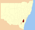
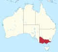
The Lower Goulburn National Park is a national park located in the Goulburn Valley district of Victoria, Australia. The 9,310-hectare (23,000-acre) linear...
3 KB (158 words) - 09:11, 23 November 2023
created the Lower Goulburn National Park to protect and enhance the River Red Gum forests in Victoria. Red River Gum forests line the Goulburn River for...
16 KB (1,087 words) - 23:16, 14 June 2024
Goulburn (/ˈɡoʊlbərn/ GOHL-bərn) is a regional city in the Southern Tablelands of New South Wales, Australia, approximately 195 kilometres (121 mi) south-west...
46 KB (5,092 words) - 22:49, 11 October 2024
tourism over summer is of great benefit to Nathalia. The Goulburn River and Lower Goulburn National Park is also a short drive from Nathalia and is a good fishing...
7 KB (693 words) - 10:05, 7 May 2023
of national parks within Australia that are managed by Australian, state and territory governments. The name may be a misnomer: nearly all parks are...
74 KB (431 words) - 11:20, 28 February 2024
Southern Highlands, the Southern Tablelands and Morton National Park lie within the Goulburn Mulwaree Council area. The oldest habitation sites discovered...
9 KB (734 words) - 09:53, 12 September 2024
river red gum national parks are the Gunbower National Park (created 2009), Hattah-Kulkyne National Park (1978), Lower Goulburn National Park (2009), Murray-Sunset...
78 KB (3,648 words) - 06:39, 29 October 2024
Delatite River (category Goulburn Broken catchment)
an inland perennial river of the Goulburn Broken catchment, part of the Murray-Darling basin, is located in the lower South Eastern Highlands bioregion...
6 KB (288 words) - 07:27, 22 October 2023
The Kosciuszko National Park (/ˌkɒziˈʌskoʊ/ KOZ-ee-USK-oh) is a 6,900-square-kilometre (2,700 sq mi) national park and contains mainland Australia's highest...
23 KB (2,314 words) - 12:09, 24 October 2024
The Werakata National Park is a protected national park that is located in the Lower Hunter Region of New South Wales, in eastern Australia. The 3,337-hectare...
6 KB (507 words) - 13:32, 17 December 2020
an inland perennial river of the Goulburn Broken catchment, part of the Murray-Darling basin, is located in the lower South Eastern Highlands bioregion...
5 KB (190 words) - 13:13, 31 January 2023
Budawang National Park is a national park in New South Wales, Australia, located approximately 200 kilometres (120 mi) southwest of Sydney and 25 kilometres...
4 KB (275 words) - 20:45, 29 October 2022
The Nightcap National Park is a national park situated within the Nightcap Range in the Northern Rivers region of New South Wales, Australia. The 8,080-hectare...
36 KB (3,828 words) - 17:46, 25 July 2024
Cadell Fault (section Goulburn)
through the Edward, with a lower amount travelling southward into the Murray itself. Similar to the Murray, the Goulburn River formerly followed a path...
12 KB (1,516 words) - 11:16, 28 October 2024
See templates for discussion to help reach a consensus. › The Nattai National Park is a protected area located in the Macarthur and Southern Highlands...
9 KB (971 words) - 13:10, 7 September 2024
The Scheyville National Park ( /ˌskaɪˈvɪl/) is a protected national park that is located in the northwestern suburbs of Sydney in New South Wales, in...
65 KB (9,224 words) - 22:18, 11 January 2024
The Goulburn to Sydney cycling race was a one-day road bicycle race. The first race was held in 1902 with the last in 2012. The route from Goulburn to...
46 KB (2,762 words) - 23:21, 14 June 2024
Hume Highway (category Goulburn)
to the tablelands west of Yass. From here the highway runs eastward, to Goulburn where it again turns northeast. Most of the New South Wales countryside...
94 KB (10,496 words) - 03:20, 29 October 2024
trains are: Goulburn Cootamundra Wagga Wagga Albury Wangaratta Melbourne Principal stations served by Xplorer trains are: Moss Vale Goulburn Queanbeyan...
36 KB (2,153 words) - 10:35, 9 November 2024
The Lane Cove National Park is a protected national park that is located within metropolitan Sydney, in New South Wales, Australia. The 670-hectare (1...
9 KB (920 words) - 17:13, 22 June 2024
of New South Wales Forestry and National Park Estate Act 1998 - Notice amending the Act (1999-128) pt 2.27 (nsw) Lower North Coast Region Achievement Report...
3 KB (136 words) - 23:05, 25 December 2023
Wilsons Promontory). Whereas on the downwind (eastern) slopes, Cooma, Omeo, Goulburn, Bowral, Bombala, Nimmitabel, and Canberra, are warmer and drier relative...
37 KB (3,142 words) - 16:32, 3 November 2024
The Yengo National Park is a protected national park that is located in the Lower Hunter region of New South Wales, in eastern Australia. The 154,328-hectare...
8 KB (732 words) - 22:20, 11 January 2024
Coast and lower Illawarra regions, via Kangaroo Valley; and the Pigeon House Mountain that is located west of Milton. The NSW National Parks and Wildlife...
5 KB (365 words) - 22:40, 3 October 2024
Livingstone is a national park and state conservation area located 30 kilometres (19 mi) south of Wagga Wagga and 10 kilometres (6.2 mi) east of Mangoplah...
25 KB (3,155 words) - 19:50, 8 November 2023
New South Wales (section National parks)
throughout the highlands. Major centres include Armidale, Bathurst, Bowral, Goulburn, Inverell, Orange, Queanbeyan and Tamworth.[citation needed] There are...
113 KB (10,164 words) - 22:18, 4 November 2024
Victorian Alps Hume Ovens and Murray Goulburn Valley Mallee Loddon-Campaspe Grampians Central Highlands Grampians National Park Wimmera Barwon South West Otway...
32 KB (1,782 words) - 17:04, 26 August 2024
Corporation Goulburn Valley Region Water Corporation Goulburn–Murray Rural Water Corporation Grampians Wimmera Mallee Water Corporation Lower Murray Urban...
13 KB (1,367 words) - 04:15, 28 October 2024
The Border Ranges National Park is a protected national park that is located in the Northern Rivers region of New South Wales, Australia. A small portion...
8 KB (626 words) - 19:31, 13 February 2024
Country/North Central region, the terms Central Murray, Lower Goulburn, Goulburn Valley, Upper Goulburn and Southern Riverina are sometimes used. In the Northeast...
13 KB (1,263 words) - 05:58, 28 February 2024


