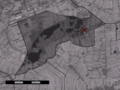
Kok-Bisschop. Rouveen, church Rouveen, hotel ANWB Topografische Atlas Nederland, Topografische Dienst and ANWB, 2005. 52°37′N 6°11′E / 52.617°N 6.183°E...
1 KB (76 words) - 10:40, 30 September 2024

unclear. The hamlet contains about 60 houses. ANWB Topografische Atlas Nederland, Topografische Dienst and ANWB, 2005. "Wateren - (geografische naam)"....
3 KB (79 words) - 17:11, 22 July 2022

Het Waterschapshuis. Retrieved 17 March 2022. ANWB Topografische Atlas Nederland, Topografische Dienst and ANWB, 2005. "Wetering - (geografische naam)"...
4 KB (138 words) - 04:13, 12 April 2023

Het Waterschapshuis. Retrieved 23 April 2022. ANWB Topografische Atlas Nederland, Topografische Dienst and ANWB, 2005. "Reuver - (geografische naam)". Etymologiebank...
5 KB (310 words) - 16:04, 24 August 2022

Het Waterschapshuis. Retrieved 13 April 2022. ANWB Topografische Atlas Nederland, Topografische Dienst and ANWB, 2005. "Inwoners - gemeente Oldebroek"....
5 KB (206 words) - 19:58, 5 February 2023

Staverden at Wikimedia Commons "CBS Statline". ANWB Topografische Atlas Nederland, Topografische Dienst and ANWB, 2005. "CBS Statline". "De kleinste stad...
2 KB (112 words) - 00:58, 15 January 2022

Het Waterschapshuis. Retrieved 9 April 2022. ANWB Topografische Atlas Nederland, Topografische Dienst and ANWB, 2005. "Martenshoek - (geografische naam)"...
5 KB (225 words) - 20:13, 25 September 2024
of the municipality of Nieuwkoop, and lies about 8 km north of Woerden. ANWB Topografische Atlas Nederland, Topografische Dienst and ANWB, 2005. v t e...
3 KB (40 words) - 07:58, 26 June 2020

Het Waterschapshuis. Retrieved 22 March 2022. ANWB Topografische Atlas Nederland, Topografische Dienst and ANWB, 2005. "Eefde - (geografische naam)". Etymologiebank...
4 KB (207 words) - 19:27, 22 March 2022

Het Waterschapshuis. Retrieved 16 April 2022. ANWB Topografische Atlas Nederland, Topografische Dienst and ANWB, 2005. Ad van der Meer and Onno Boonstra...
4 KB (137 words) - 21:17, 7 October 2023
Het Waterschapshuis. Retrieved 8 April 2022. ANWB Topografische Atlas Nederland, Topografische Dienst and ANWB, 2005. Media related to Kropswolde at Wikimedia...
5 KB (409 words) - 22:04, 24 August 2024
part of the new stadsdeel of Amsterdam-West. ANWB Topografische Atlas Nederland, Topografische Dienst and ANWB, 2005. Jones, Cass (22 April 2012). "Amsterdam...
6 KB (511 words) - 20:49, 25 September 2024

Het Waterschapshuis. Retrieved 24 March 2022. ANWB Topografische Atlas Nederland, Topografische Dienst and ANWB, 2005. "Aam". Plaatsengids. Retrieved 24...
4 KB (114 words) - 12:18, 24 March 2022

municipality of Schagen, and lies about 9 km northwest of Heerhugowaard. ANWB Topografische Atlas Nederland, Topografische Dienst and ANWB, 2005. v t e...
3 KB (43 words) - 03:58, 18 May 2020

Het Waterschapshuis. Retrieved 17 April 2022. ANWB Topografische Atlas Nederland, Topografische Dienst and ANWB, 2005. "Fijnaart (geografische naam)". Etymologiebank...
6 KB (400 words) - 19:52, 31 July 2024

Het Waterschapshuis. Retrieved 26 April 2022. ANWB Topografische Atlas Nederland, Topografische Dienst and ANWB, 2005. "Schin op Geul - (geografische naam)"...
5 KB (334 words) - 21:50, 24 August 2024

Het Waterschapshuis. Retrieved 13 April 2022. ANWB Topografische Atlas Nederland, Topografische Dienst and ANWB, 2005. "Daarlerveen". Plaatsengids (in Dutch)...
6 KB (333 words) - 22:45, 28 April 2023

adres (in Dutch). Retrieved 15 April 2022. ANWB Topografische Atlas Nederland, Topografische Dienst and ANWB, 2005. "Kerncijfers wijken en buurten 2021"...
4 KB (146 words) - 11:26, 15 April 2022

Het Waterschapshuis. Retrieved 22 March 2022. ANWB Topografische Atlas Nederland, Topografische Dienst and ANWB, 2005. "Kerncijfers wijken en buurten 2021"...
3 KB (114 words) - 19:04, 25 March 2022

Het Waterschapshuis. Retrieved 23 April 2022. ANWB Topografische Atlas Nederland, Topografische Dienst and ANWB, 2005. Ad van der Meer and Onno Boonstra...
7 KB (565 words) - 18:46, 27 July 2023

Het Waterschapshuis. Retrieved 26 April 2022. ANWB Topografische Atlas Nederland, Topografische Dienst and ANWB, 2005. "Elsloo - (geografische naam)". Etymologiebank...
5 KB (347 words) - 03:49, 19 March 2024

That route became obsolete when the Haarlemmertrekvaart was dug in 1631. ANWB Topografische Atlas Nederland, Topografische Dienst and ANWB, 2005. v t e...
3 KB (89 words) - 16:34, 1 January 2019
adres (in Dutch). Retrieved 18 April 2022. ANWB Topografische Atlas Nederland, Topografische Dienst and ANWB, 2005. "Kerncijfers wijken en buurten 2021"...
3 KB (135 words) - 06:51, 18 April 2022
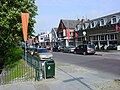
Krabbendijke Street view House in Krabbendijke ANWB Topografische Atlas Nederland, Topografische Dienst and ANWB, 2005. "Krabbendijke - (geografische naam)"...
4 KB (279 words) - 22:20, 11 April 2024
3 km southeast of the centre of Oosterhout. ANWB Topografische Atlas Nederland, Topografische Dienst and ANWB, 2005. 51°38′12″N 4°53′10″E / 51.63667°N...
578 bytes (58 words) - 03:16, 5 June 2024
population of 50 in the middle of the 19th century. ANWB Topografische Atlas Nederland, Topografische Dienst and ANWB, 2005. Abraham Jacob van der Aa, "Aardrijkskundig...
841 bytes (110 words) - 08:32, 5 October 2024

Het Waterschapshuis. Retrieved 1 May 2022. ANWB Topografische Atlas Nederland, Topografische Dienst and ANWB, 2005. "Spanbroek - (geografische naam)"...
5 KB (263 words) - 14:14, 1 May 2022

Hoogtebestand Nederland (in Dutch). Het Waterschapshuis. Retrieved 20 April 2022. ANWB Topografische Atlas Nederland, Topografische Dienst and ANWB, 2005. v t e...
4 KB (253 words) - 01:41, 8 July 2024
of Vught, 2 km west of the town of Helvoirt. ANWB Topografische Atlas Nederland, Topografische Dienst and ANWB, 2005. 51°38′0″N 5°12′0″E / 51.63333°N...
461 bytes (57 words) - 20:01, 4 January 2021
Sint Anthonis, about 1 km west of Wanroij. ANWB Topografische Atlas Nederland, Topografische Dienst and ANWB, 2005. 51°39′N 5°48′E / 51.650°N 5.800°E...
523 bytes (54 words) - 13:14, 29 November 2022