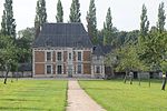
| Les Hauts de Caux, communes d'Autretot et Veauville-les-Baons". les-hauts-de-caux.fr. Retrieved 2024-02-13. "Patrimoine – Autretot | Les Hauts de Caux...
3 KB (173 words) - 20:12, 25 August 2024
2019, it was merged into the new commune Les Hauts-de-Caux. A farming village situated in the Pays de Caux, some 24 miles (39 km) northwest of Rouen...
2 KB (166 words) - 16:41, 8 October 2024
2019, it was merged into the new commune Les Hauts-de-Caux. A farming village situated in the Pays de Caux, some 23 miles (37 km) northwest of Rouen...
2 KB (131 words) - 05:24, 6 October 2024
Saint-Valery-en-Caux (French pronunciation: [sɛ̃ valʁi ɑ̃ ko:], literally Saint-Valery in Caux) is a commune in the Seine-Maritime department in the Normandy...
7 KB (599 words) - 10:23, 22 September 2024
de Caux, very close to the Prime Meridian. Le Havre is the most populous commune of Upper Normandy, although the total population of the greater Le Havre...
140 KB (15,615 words) - 02:56, 17 December 2024
(20 mi) northeast of Le Havre, at the junction of the D 940, D 11 and D 139 roads. It is located on the coast of the Pays de Caux area. Étretat is best...
12 KB (1,112 words) - 17:06, 27 December 2024
farming village situated on the coast of the English Channel in the Pays de Caux, some 12 miles (19 km) southwest of Dieppe at the junction of the D68,...
5 KB (488 words) - 19:59, 22 September 2024
Rouen (category CS1 German-language sources (de))
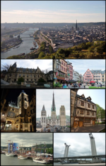
Courthouse Rue du Pré de la Bataille, public thoroughfare in Rouen named after a 934 medieval battle. "Répertoire national des élus: les maires" (in French)...
42 KB (3,844 words) - 16:17, 23 December 2024
Valmont, at the heart of the Pays de Caux, on the Alabaster Coast. It is around 35 kilometres (22 mi) northeast of Le Havre, and around 60 kilometres (37 mi)...
15 KB (1,690 words) - 23:21, 3 January 2025
Communes of the Seine-Maritime department "Répertoire national des élus: les maires". data.gouv.fr, Plateforme ouverte des données publiques françaises...
4 KB (321 words) - 11:17, 21 August 2024
situated at the heart of three valleys in the Pays de Caux, some 19 miles (31 km) northeast of Le Havre. It is the source of the river Commerce, though...
9 KB (927 words) - 10:43, 21 August 2024
Le Havre Seine Métropole Communauté d'agglomération Caux Seine Agglo Communauté d'agglomération de Fécamp Caux Littoral Communauté d'agglomération de...
33 KB (149 words) - 11:53, 11 November 2024
of its inhabitants are of Acadian descent. Dieppe belongs to the Pays de Caux, lying along the Alabaster Coast in the region of Normandy. It is located...
33 KB (2,954 words) - 06:11, 31 October 2024
Eu and Mers-les-Bains are known locally as the "Three Sisters". A small fishing port and light industrial town situated in the Pays de Caux, some 21 miles...
10 KB (995 words) - 17:36, 26 September 2024
England (1973) Osica de Sus, Romania (1991) Brzeg Dolny, Poland (2003) Rouko, Burkina Faso (2010) "Répertoire national des élus: les maires" (in French)...
7 KB (592 words) - 14:00, 26 October 2024
and farming situated by the banks of the river Austreberthe in the Pays de Caux, some 10 miles (16 km) northwest of Rouen at the junction of the D6015...
4 KB (324 words) - 11:19, 21 August 2024
level, Caux dominates the surroundings. Jean-Jacques Causse Dom Bédos de Celles Communes of the Hérault department "Répertoire national des élus: les maires"...
3 KB (173 words) - 18:11, 27 October 2024
Economic Studies. 28 December 2023. de Beaurepaire, François (1979). Les Noms des communes et anciennes paroisses de la Seine-Maritime (in French). Paris:...
7 KB (682 words) - 10:54, 21 August 2024
department in the Normandy region in northern France. It is the capital of the Caux region. The name Yvetot comes from the Germanic Yvo and the Old Norse -topt...
7 KB (698 words) - 11:29, 21 August 2024
region of Normandy, northern France A farming village situated in the Pays de Caux, some 20 miles (32 km) southwest of Dieppe, at the junction of the D108...
3 KB (142 words) - 20:51, 6 September 2024
Harfleur is now on the eastern edge of Le Havre's urban area. A light industrial town situated in the Pays de Caux by the banks of the Seine and Lézarde...
12 KB (1,380 words) - 10:45, 21 August 2024
Aumale (category CS1 German-language sources (de))
Seine-Maritime department Counts and Dukes of Aumale "Répertoire national des élus: les maires". data.gouv.fr, Plateforme ouverte des données publiques françaises...
6 KB (523 words) - 10:24, 21 August 2024
Routes, Seine-Maritime (category Le Havre geography stubs)
northern France. A small farming village in the Pays de Caux, some 33 miles (53 km) northeast of Le Havre, at the junction of the D88 and D420 roads. The...
2 KB (119 words) - 11:52, 11 November 2024
Les Ifs is a commune in the Seine-Maritime department in the Normandy region in northern France. A tiny farming village situated in the Pays de Caux, some...
2 KB (101 words) - 11:23, 30 August 2022
Saint-Vincent-Cramesnil (category Le Havre geography stubs)
the Pays de Caux, situated some 12 miles (19 km) east of Le Havre, at the junction of the D10 and D80 roads. It's on the route of the Tour de Normandie...
2 KB (156 words) - 10:34, 21 August 2024
farming village situated by the banks of the river Crevon in the Pays de Caux, some 10 miles (16 km) northeast of Rouen, at the junction of the D12,...
5 KB (477 words) - 16:21, 23 October 2024
(39 km) east of Le Havre. Before the Roman conquest of Gaul, the site was the capital of the Caletes tribe who gave their name to the Pays de Caux. It was destroyed...
7 KB (678 words) - 07:31, 22 August 2024
Hautot-sur-Seine (76350) Les Hauts-de-Caux (76041) Hénouville (76354) Héricourt-en-Caux (76355) Héronchelles (76359) Heurteauville (76362) Le Houlme (76366) Houppeville...
14 KB (977 words) - 12:53, 11 December 2024
Economic Studies. 28 December 2023. Des villages de Cassini aux communes d'aujourd'hui: Commune data sheet Le Petit-Quevilly, EHESS (in French). Population...
4 KB (291 words) - 11:07, 22 August 2024
situated between the valleys of the Scie and Varenne rivers in the Pays de Caux, some 12 miles (19 km) south of Dieppe at the junction of the D100 and...
2 KB (143 words) - 14:50, 25 August 2024


