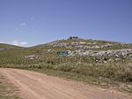
Cerro de las Ánimas ("Hill of the Souls", formerly known as Mirador Nacional) is a peak and the second highest point of Uruguay, with an altitude of 501 metres...
2 KB (133 words) - 08:57, 15 August 2024
California Cerro de las Ánimas, a peak and the second highest point in Uruguay Sierra de las Ánimas, a hill range Animas (disambiguation) Anima (disambiguation)...
839 bytes (139 words) - 19:29, 31 July 2020
are very common in the southern part of this country. Until 1973, Cerro de las Ánimas (formerly known as Mirador Nacional), with an elevation of 501 m...
5 KB (376 words) - 21:21, 11 September 2024
highest peaks of Uruguay, the top of Cerro de las Ánimas 501 metres (1,644 ft), near the towns Gregorio Aznárez and Las Flores. It is the only elevated landform...
2 KB (96 words) - 23:49, 1 February 2020
Barra, Sierra De Las Animas The Maldonado Portal Hotels in Punta del Este, Maldonado INE map of Maldonado, Villa Delia, La Sonrisa, Cerro Pelado, Los Aromos...
12 KB (1,019 words) - 05:12, 15 August 2024
founded on its east side. Cerro Catedral Cerro de las Ánimas Geography of Uruguay Article about the nature reserve of Pan de Azúcar Wikimedia Commons has...
3 KB (284 words) - 09:38, 15 August 2024
Sierra Carapé (with Cerro Catedral, 514 m, the highest elevation of the country), Cerro de las Ánimas, with 501 metres, and Cerro Pan de Azúcar, with 423...
16 KB (1,073 words) - 17:30, 25 October 2024
Melica serrana, is a species of grass endemic to Cerro de las Ánimas, Uruguay. The species is perennial and caespitose, with elongated rhizomes. Its culms...
3 KB (465 words) - 12:03, 15 June 2023
inesquecíveis temporadas de Vinicius de Moraes na Argentina e no Uruguai. Rio de Janeiro: Casa da Palavra. ISBN 978-85-7734-236-5. "Cuáles son las zonas calientes...
30 KB (2,433 words) - 04:15, 19 October 2024
bought a very big stretch of land, including the hills Cerro Pan de Azúcar, Cerro del Inglés and Cerro del Toro, all the way south to the beach. In 1897 he...
9 KB (692 words) - 12:50, 20 November 2023
Treinta y Tres Cerro de las Ánimas, Maldonado Department Cerro de las Cuentas, village, Cerro Largo Department Cerro Ejido, suburb of Artigas Cerro Largo Department...
23 KB (2,785 words) - 01:42, 28 August 2024
called Hotel Casapueblo or Club Hotel Casapueblo has a restaurant called Las Terrazas (The Terraces) that follows the style of the original construction...
11 KB (969 words) - 04:13, 22 December 2023
symbol of the Tacuarembó Department. Breast-shaped hill Cerro Catedral Cerro de las Ánimas Cerro Pan de Azúcar Geography of Uruguay (in Spanish) Enciclopedia...
2 KB (113 words) - 09:51, 15 August 2024
San Francisco on the hill Cerro de Francés. On the west coast of the lagoon are the hills Cerro Sanguinetti and Cerro Las Mojinetes. The closed ecosystem...
7 KB (632 words) - 21:16, 6 March 2024
Punta Ballena (redirect from Las Cumbres, Uruguay)
Punta Ballena, and the beach Playa Las Grutas to the east of it. Further east it borders the resort Pinares - Las Delicias with the oblong lake, Laguna...
6 KB (441 words) - 19:28, 6 February 2023
Nacional de Estadística de Uruguay. 2004. Retrieved 26 July 2011. INE map of Maldonado, Villa Delia, La Sonrisa, Cerro Pelado, Los Aromos and Pinares-Las Delicias...
3 KB (156 words) - 18:51, 6 February 2023
Piriápolis. Cuchilla de Mansavillagra Sierra Carapé Sierra Aceguá Sierra de las Ánimas Cuchilla Grande Inferior Cuchilla de Cerro Largo Geography of Uruguay...
2 KB (127 words) - 04:00, 29 August 2023
Statistics / P" (DOC). Instituto Nacional de Estadística de Uruguay. 2004. Retrieved 25 July 2011. INE map of Las Flores, Playa Verde, Playa Hermosa and...
3 KB (120 words) - 18:20, 30 March 2024
(DOC) on 15 June 2013. Retrieved 27 June 2011. INE map of Maldonado, Villa Delia, La Sonrisa, Cerro Pelado, Los Aromos and Pinares-Las Delicias v t e...
4 KB (169 words) - 23:22, 10 June 2024
Cerro Catedral, with 513.66 metres (1,685.24 feet) of altitude. Geography of Uruguay Cerro Catedral (Uruguay)#Location and geology (in Spanish) Cerro...
2 KB (110 words) - 00:23, 17 August 2020
resort is located on the coast of Río de la Plata, on Route 10, 2.5 kilometres (1.6 mi) south of Estación Las Flores and Ruta Interbalnearia. It borders...
3 KB (152 words) - 19:12, 6 February 2023
original on 21 July 2011. Retrieved 7 July 2011. INE map of Maldonado, Villa Delia, La Sonrisa, Cerro Pelado, Los Aromos and Pinares-Las Delicias v t e...
3 KB (119 words) - 19:06, 6 February 2023
Xalapa (redirect from Las Lajas, Veracruz)
Mexican general Antonio López de Santa Anna attempted to defeat the opposing forces near Xalapa in the Battle of Cerro Gordo. He led an army of more than...
48 KB (4,587 words) - 15:41, 12 October 2024
(DOC) on 29 November 2011. Retrieved 3 July 2011. INE map of Maldonado, Villa Delia, La Sonrisa, Cerro Pelado, Los Aromos and Pinares-Las Delicias v t e...
3 KB (129 words) - 19:05, 6 February 2023
Pan de Azúcar is a city in the southwest of the Maldonado Department in Uruguay. It takes its name from a nearby hill (Cerro Pan de Azúcar, actually located...
5 KB (329 words) - 19:20, 6 February 2023
stream Arroyo de Aiguá, one of the main tributaries of Cebollatí River. The municipality of Aiguá has the highest point of Uruguay, the Cerro Catedral. This...
5 KB (344 words) - 08:59, 15 August 2024
small point called Punta Piedras. To the west of this point is the beach Las Olas Playa and to its east the beach Playa Bikini. To the west, it borders...
4 KB (221 words) - 19:10, 6 February 2023
Suquitila Rincón de Jaimes Las Ánimas Las Juntas Ilamos El Picacho del Rincón del Guayabal Cuadrilla de Leones Barro Prieto El Zapote de Acamuchitlán (El...
8 KB (879 words) - 03:53, 25 October 2024
Edén, Paso de la Cantera, Las Cañas, Carapé, Mataojo, Guardia Vieja, Pago de la Paja, Partido Norte, Partido Oeste, Cañada Bellaca, Corte de la Leña, Punta...
6 KB (423 words) - 23:39, 9 March 2023
Las Ánimas is a volcano of the Central Ranges of the Colombian Andes at the border of the departments of Cauca and Nariño. The volcano is 4,175 metres...
4 KB (245 words) - 22:24, 2 July 2024


