
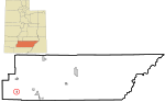
Garfield County is a county in south central Utah, United States. As of the 2020 United States Census the population was 5,083, making it the fifth-least...
16 KB (1,219 words) - 08:33, 20 May 2024

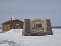
Panguitch (/ˈpæŋɡwɪtʃ/ PANG-gwitch) is a city in and the county seat of Garfield County, Utah, United States. The population was 1,725 at the 2020 census...
19 KB (1,529 words) - 18:30, 11 July 2024

state highway designated an All-American Road located in Garfield County and Wayne County, Utah, United States. Proceeding west to east for 123 miles (nearly...
11 KB (1,015 words) - 07:24, 2 May 2024
Garfield County, Nebraska Garfield County, Oklahoma Garfield County, Utah Garfield County, Washington Defunct Garfield County, Kansas This disambiguation...
329 bytes (68 words) - 00:53, 12 March 2016

Cannonville is a town in Garfield County, Utah, United States, along Utah Scenic Byway 12. As of the 2020 census, the population was 186. Cannonville was...
12 KB (681 words) - 18:26, 11 April 2024

Henrieville is a town in Garfield County, Utah, United States, along Utah Scenic Byway 12. As of the 2020 census, the town population was 221. The community...
10 KB (574 words) - 03:59, 24 July 2024

Tropic is a town in Garfield County, Utah, United States, along Utah Scenic Byway 12. As of the 2020 census, the town had a population of 486. Tropic was...
9 KB (646 words) - 01:24, 1 May 2024

Antimony is a town in Garfield County, Utah, United States. The population was 118 at the 2020 census. According to the United States Census Bureau, the...
9 KB (643 words) - 01:14, 1 May 2024
Hatch is a town in Garfield County, Utah, United States. The population was 132 at the 2020 census. It is 260 miles (420 km) south of Salt Lake City....
10 KB (623 words) - 03:59, 24 July 2024

Lake Powell (category Lakes of Garfield County, Utah)
lies primarily in parts of Garfield, Kane, and San Juan counties in southern Utah, with a small portion in Coconino County in northern Arizona. The northern...
32 KB (3,357 words) - 19:51, 10 July 2024

Bryce Canyon National Park (redirect from Bryce Canyon National Park, Utah)
National Park (/braɪs/) is an American national park located in southwestern Utah. The major feature of the park is Bryce Canyon, which despite its name, is...
36 KB (3,389 words) - 04:12, 14 June 2024
Bryce Canyon City, sometimes shown as Bryce on maps, is a town in Garfield County, Utah, United States, adjacent to Bryce Canyon National Park. The town...
18 KB (1,009 words) - 01:15, 1 May 2024
Pink Cliffs (category Landforms of Garfield County, Utah)
highly dissected cliffs on the Colorado Plateau in Garfield, Iron, and Kane counties in southwestern Utah, United States. Contrary to the implication of the...
6 KB (590 words) - 21:05, 17 March 2024

Garfield County is a county located in the U.S. state of Colorado. As of the 2020 census, the population was 61,685. The county seat is Glenwood Springs...
15 KB (1,109 words) - 22:30, 3 August 2024

Boulder is a town in Garfield County, Utah, United States, 27 miles (44 km) northeast of Escalante on Utah Scenic Byway 12 at its intersection with the...
14 KB (660 words) - 01:15, 1 May 2024
southeastern Garfield County, Utah, United States. The community lies along State Route 276, more than 90 miles (140 km) east of Panguitch, the county seat of...
7 KB (432 words) - 06:57, 29 July 2023

(locally /ˌɛskəˈlænt(i)/ ) is a city in central Garfield County, Utah, United States, located along Utah Scenic Byway 12 (SR-12) in the south-central part...
22 KB (1,701 words) - 03:58, 24 July 2024

Glen Canyon (category Canyons and gorges of Garfield County, Utah)
9 km) length of the Colorado River, mostly in southeastern and south-central Utah, in the United States. Glen Canyon starts where Narrow Canyon ends, at the...
17 KB (2,129 words) - 09:39, 13 May 2024
and Boulder Top) in Utah, United States makes up half of the Aquarius Plateau of South Central Utah in Wayne and Garfield counties. The mountain rises...
14 KB (1,016 words) - 12:39, 18 January 2024

is a 9,187-foot (2,800 m) elevation summit located in northern Garfield County of Utah, United States. Bull Mountain is part of the Henry Mountains which...
4 KB (284 words) - 07:19, 29 May 2024

Lake County is located in the U.S. state of Utah. As of the 2020 United States census, the population was 1,185,238, making it the most populous county in...
88 KB (7,597 words) - 03:57, 30 July 2024

Plateau in the Dixie National Forest of Southern Utah, and is one of the largest lava tubes in Utah. The cave has over 2,200 feet (670 m) of passage and...
2 KB (174 words) - 20:29, 21 May 2022

Hole in the Rock Trail (category Transportation in Garfield County, Utah)
of Historic Places listings in Garfield County, Utah National Register of Historic Places listings in Kane County, Utah National Register of Historic Places...
7 KB (629 words) - 17:02, 13 May 2024
atomic number 51. Antimony may also refer to: Antimony, Utah, a town in Garfield County, Utah Antimony Mountain, a summit in British Columbia Antimony...
753 bytes (137 words) - 14:27, 12 August 2024

Mount Ellen is a mountain located in Garfield County, Utah, United States. Mount Ellen's North Summit Ridge is the highest point in the Henry Mountains;...
4 KB (366 words) - 15:55, 3 July 2023

Waterpocket Fold (category Landforms of Garfield County, Utah)
landform that extends from southern Wayne through Garfield and ending in northern Kane counties of southern Utah, United States. The geologic structure, formed...
3 KB (285 words) - 10:09, 14 January 2023

Whittni Morgan (category People from Garfield County, Utah)
1997) is an American middle distance runner. Originally from Panguitch, Utah, Morgan represents Adidas and debuted at the 2022 Millrose Games 3000 meters...
4 KB (216 words) - 08:24, 9 August 2024

Bryce Canyon Airport (redirect from Garfield County Airport Hangar)
four miles (6 km) north of Bryce Canyon, in Garfield County, Utah, United States. It is owned by Garfield County. The airport is near Bryce Canyon National...
5 KB (561 words) - 23:42, 29 May 2024

Paunsaugunt Plateau (category Landforms of Garfield County, Utah)
100–2,800 m), in southwestern Utah in the United States. Located in northern Kane County and southwestern Garfield County, it is approximately 10 miles...
3 KB (298 words) - 14:37, 4 August 2024
within the Ashley National Forest Mud Lake is a lake located in Garfield County, Utah, situation on the Griffin Top of the Escalante Mountains. The lake...
3 KB (318 words) - 07:44, 12 October 2022