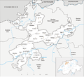
The Hasenmatt is a mountain of the Jura range, located north of Grenchen and Solothurn in the Swiss canton of Solothurn. Reaching a height of 1,445 metres...
2 KB (127 words) - 11:39, 7 October 2020
from Google Earth. The nearest point of higher elevation is east of the Hasenmatt. Seilbahn Weissenstein, the gondola lift operator, in German. Weissenstein...
3 KB (211 words) - 20:12, 15 May 2022
m Mont d’Or France, Doubs 1448 m Crêt au Merle France, Jura 1445 m Hasenmatt Switzerland, Solothurn 1439 m Mont Racine Switzerland, Neuchâtel 1425...
16 KB (1,211 words) - 16:53, 3 November 2024
Altreu Municipality Altreu, with Hasenmatt in the background Location of Altreu Altreu Show map of Switzerland Altreu Show map of Canton of Solothurn...
6 KB (603 words) - 20:00, 22 March 2024
684 ft) 18 Solothurn Hasenmatt 1,445 m (4,741 ft) 47°14′31.44″N 7°27′1.84″E / 47.2420667°N 7.4505111°E / 47.2420667; 7.4505111 (Hasenmatt) Birs, Basel-Land...
13 KB (197 words) - 20:03, 1 April 2024
CHF 65,237 (2020) ISO 3166 code CH-SO Highest point 1,445 m (4,741 ft): Hasenmatt Lowest point 277 m (909 ft): Birs at the cantonal border in Dornach Joined...
16 KB (840 words) - 15:33, 21 October 2024
Bettlachstock Forest (Forêt de la Bettlachstock) 1 Forest reserve Bettlachstock–Hasenmatt Canton of Solothurn Forest reserves of Lodano, Busai and Soladino Valleys...
59 KB (1,753 words) - 08:55, 16 August 2024
Piz Bernina Piz Buin Piz Linard Piz Badile Piz Kesch Piz d'Err Piz Sesvenna Muttler Schesaplana La Dôle Mont Tendre Le Chasseron Chasseral Hasenmatt...
112 KB (1,337 words) - 21:15, 20 July 2024
from Google Earth. The nearest point of higher elevation is north of the Hasenmatt. Media related to Mont Raimeux at Wikimedia Commons Mont Raimeux on Hikr...
2 KB (108 words) - 09:02, 25 April 2024
Highest point Elevation 1,405 m (4,610 ft) Prominence 96 m (315 ft) Parent peak Hasenmatt Coordinates 47°13′47″N 7°23′02″E / 47.22972°N 7.38389°E / 47.22972;...
1 KB (59 words) - 11:02, 12 May 2022
89972°N 9.34417°E / 46.89972; 9.34417 Glarus Alps Graubünden/St. Gallen 11 Hasenmatt 1445 29.6 618 47°14′31″N 07°27′02″E / 47.24194°N 7.45056°E / 47.24194;...
9 KB (124 words) - 14:44, 1 May 2024
stretches from the Aare river, at an elevation of 428 m (1,404 ft), to the Hasenmatt mountain on the edge of the Jura Mountains, at an elevation of 1,445 m...
18 KB (2,007 words) - 23:33, 22 March 2024


