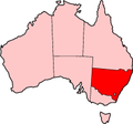
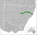
Illawarra Highway is a short state highway in New South Wales, Australia. It connects Wollongong to the Southern Highlands and links Princes Highway and...
11 KB (834 words) - 00:34, 9 September 2024
The Illawarra is a coastal region in the southeast of the Australian state of New South Wales. It is situated immediately south of Sydney and north of...
19 KB (1,764 words) - 04:43, 14 July 2024
route to the highway runs from Aylmerton through Mittagong and Bowral to join Illawarra Highway at Moss Vale and then follows Illawarra Highway through Sutton...
94 KB (10,496 words) - 03:20, 29 October 2024
Macquarie Pass (category Highways in New South Wales)
Macquarie Pass is an eight-kilometre-long section of the Illawarra Highway passing through Macquarie Pass National Park. It was opened in 1898, though...
4 KB (394 words) - 06:05, 12 August 2024
Princes Motorway (category Highway 1 (Australia))
to Wollongong and further south through the Illawarra region to Oak Flats. Part of the Australian Highway 1 network, the motorway is designated route...
33 KB (2,766 words) - 00:31, 9 September 2024
Highway (A4) M5 East Freeway (M5) King Georges Road (A3) Heathcote Road (A6) Illawarra Highway (A48) Kings Highway Snowy Mountains Highway "Highway 1...
11 KB (670 words) - 13:43, 12 December 2024
Robertson, New South Wales (section Illawarra Fly)
Wingecarribee Shire. The town is located on the edge of an elevated plateau (the Illawarra escarpment) about 35 km (22 mi) from the coast. Robertson is known for...
15 KB (1,799 words) - 23:23, 7 August 2024
located around the pass of the same name, which is on the Illawarra Highway and part of the Illawarra escarpment. Macquarie Pass National Park was established...
6 KB (715 words) - 01:56, 1 February 2023
(/ˈwʊlənɡɒŋ/ WUUL-ən-gong; Dharawal: Woolyungah) is a city located in the Illawarra region of New South Wales, Australia. The name is believed to originate...
74 KB (7,759 words) - 10:32, 9 January 2025
The Eastern Suburbs & Illawarra Line (numbered T4, coloured azure blue) is a commuter railway line on the Sydney Trains network in the eastern and southern...
50 KB (4,757 words) - 11:05, 15 December 2024
it, now known as Albion Park Rail. The Illawarra Highway runs through Albion Park and joins the Princes Highway just north of the suburb. This road brings...
8 KB (849 words) - 09:47, 20 July 2024
Wingecarribee Shire. It is located on the Illawarra Highway, which connects to Wollongong and the Illawarra coast via Macquarie Pass. Moss Vale has several...
17 KB (1,477 words) - 00:02, 27 November 2024
Sutton Forest, New South Wales (category Illawarra region geography stubs)
Wingecarribee Shire. It is located 5 km southwest of Moss Vale on the Illawarra Highway. Sutton Forest was originally granted, then owned by Navy Chief officer...
6 KB (575 words) - 23:57, 20 April 2024
carries the majority of traffic. The Princes Highway then enters the northern suburbs of Wollongong and the Illawarra region via the Bulli Pass, whilst Mount...
84 KB (5,311 words) - 22:31, 5 January 2025
Kings Highway is an interstate highway located within the Australian Capital Territory and New South Wales, Australia. The highway connects Canberra with...
19 KB (1,678 words) - 11:22, 31 December 2024
SS Lake Illawarra was a handysize bulk carrier of 7,274 tons in the service of the Australian National Line. This ship is known for causing the Tasman...
8 KB (742 words) - 10:03, 29 December 2024
List of road routes in New South Wales (category Highways in Australia)
designated highways, urban and intercity motorways and arterial roads, and important cross-state roads that have not been declared highways. Route numbers...
77 KB (1,271 words) - 21:50, 1 January 2025
Lawrence Hargrave Drive across the rockface on the Illawarra escarpment, located in the northern Illawarra region of New South Wales, Australia. The balanced...
13 KB (914 words) - 21:46, 19 September 2024
The present highway network in New South Wales, Australia was established in August 1928 when the Main Roads Board (the predecessor of the Department...
9 KB (366 words) - 05:39, 12 August 2024
Pacific Highway is a 790-kilometre-long (491 mi) national highway and major transport route along the central east coast of Australia, with the majority...
139 KB (8,733 words) - 05:41, 30 December 2024
The following highways are numbered 48: Illawarra Highway Alberta Highway 48 Ontario Highway 48 Saskatchewan Highway 48 D48 motorway (Czech Republic) part...
7 KB (473 words) - 16:03, 27 August 2024
Shellharbour Airport (redirect from Illawarra Regional Airport)
City Council. It is located at the intersection of the Princes Highway and Illawarra Highway at Albion Park Rail. The airport is an 80-minute drive from...
18 KB (1,761 words) - 10:46, 12 December 2024
Olympic Highway is a 317-kilometre (197 mi) rural road in the central western and south-eastern Riverina regions of New South Wales, Australia. It services...
18 KB (1,515 words) - 02:57, 24 December 2024
Wingecarribee Swamp is a heritage-listed wetland at Illawarra Highway, Robertson, Wingecarribee Shire, New South Wales, Australia. It was added to the...
14 KB (1,801 words) - 22:33, 9 December 2024
Barrier Highway is a highway in South Australia and New South Wales, and is designated part of route A32. The name of the highway is derived from the...
13 KB (695 words) - 06:00, 13 August 2024
The St. George Illawarra Dragons are an Australian professional rugby league football club, representing both the Illawarra and St George regions of New...
106 KB (9,956 words) - 03:58, 4 January 2025
Newell Highway is a national highway in New South Wales (NSW), Australia. It provides the major road link between southeastern Queensland and Victoria...
30 KB (2,352 words) - 23:07, 7 November 2024
a heritage-listed former residence and now boutique hotel at Old Illawarra Highway, Sutton Forest, Wingecarribee Shire, New South Wales, Australia. It...
51 KB (7,036 words) - 07:16, 9 December 2024
Oxley Highway is a rural highway in New South Wales, Australia, linking Nevertire, Gilgandra, Coonabarabran, Tamworth, and Walcha to Port Macquarie, on...
16 KB (1,281 words) - 06:02, 13 August 2024
The Old Hume Highway, an urban and rural road, may be described as any part of an earlier route of the Hume Highway, which traverses Victoria and New South...
12 KB (1,107 words) - 14:15, 29 August 2024


