
Mineral County is a county located in the U.S. state of Nevada. As of the 2020 census, the population was 4,554, making it the fifth-least populous county...
15 KB (1,164 words) - 13:47, 26 April 2024
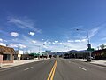
place (CDP) in Mineral County, Nevada, United States. As of the 2020 census, the population was 3,118. It is the county seat of Mineral County. The nearby...
16 KB (922 words) - 14:04, 21 June 2024
Eagleville is a former populated place in Mineral County, Nevada, that is now a ghost town. Mineral deposits were first discovered in the area by the...
7 KB (507 words) - 14:02, 24 June 2024

The Mineral County Museum is located at 400 Tenth Street, Hawthorne, Nevada. It has over 15,000 square feet of display space. The collection includes...
1 KB (70 words) - 17:56, 15 January 2021

Great Basin in western Nevada in the United States. It is 11 mi (17 km) long and 5 mi (8 km) wide, in northwestern Mineral County along the east side of...
17 KB (2,087 words) - 23:00, 26 March 2024
Mineral County is the name of four counties in the United States: Mineral County, Colorado Mineral County, Montana Mineral County, Nevada Mineral County...
241 bytes (59 words) - 19:33, 3 February 2018

Humboldt–Toiyabe National Forest (category Protected areas of Mineral County, Nevada)
southern Nevada and eastern California, in parts of Nye, Lander, Mineral, Lyon, Eureka, Washoe, Douglas, and Clark counties, and Carson City in Nevada, as...
12 KB (847 words) - 22:50, 7 June 2024
Street in Hawthorne, Mineral County, Nevada. Built in 1883 as the Esmeralda County Courthouse, it served as such until 1907 when the county seat was moved to...
5 KB (543 words) - 00:58, 8 August 2023

portion of freeway in the 1960s. U.S. Route 95 enters Nevada near Cal-Nev-Ari in Clark County and heads north towards Railroad Pass, where it meets Interstate...
34 KB (2,404 words) - 22:07, 4 July 2024
pronunciation: [ˈʃʊʁts]) may refer to: Schurz, Nevada, a census-designated place in Mineral County, Nevada, United States Mount Schurz Barbara Schurz (born...
798 bytes (110 words) - 08:28, 20 November 2013
Powell Mountain is a summit in the U.S. state of Nevada. The elevation is 9,524 feet (2,903 m). Powell Mountain was named after A. Powell, a businessperson...
728 bytes (79 words) - 04:22, 16 May 2024

Aurora is a ghost town in Mineral County in the west central part of the US state of Nevada, approximately 22 mi (35 km) southwest of the town of Hawthorne...
13 KB (1,389 words) - 21:11, 24 March 2024
is an unincorporated town and census-designated place (CDP) in Mineral County, Nevada, United States. As of the 2020 census, the population of Walker...
5 KB (155 words) - 13:59, 24 June 2024

northern Clark County, southern Lyon County, most of Lincoln County, a sliver of Churchill County and all of Esmeralda, Mineral, and Nye counties. With a Cook...
16 KB (400 words) - 02:44, 1 April 2024

Hawthorne Army Depot (redirect from Naval Ammunition Depot, Hawthorne, Nevada)
ammunition storage depot located near the town of Hawthorne in western Nevada in the United States. It is directly south of Walker Lake. The depot covers...
11 KB (1,263 words) - 18:03, 24 June 2024

Walker River (redirect from Walker River (Nevada))
Topaz Lake reservoir, enters Nevada in Douglas County, and turns northeast. It flows through Hoye Canyon into Lyon County, then across the Smith Valley...
15 KB (1,575 words) - 12:06, 31 December 2022

an unincorporated community and census-designated place (CDP) in Mineral County, Nevada, United States. The population was 656 at the 2020 census. It is...
9 KB (631 words) - 13:46, 24 June 2024
Eagleville (redirect from Eagleville, Nevada)
Churchill County, Nevada Eagleville, Mineral County, Nevada Eagleville, Ashtabula County, Ohio Eagleville, Wood County, Ohio Eagleville, Centre County, Pennsylvania...
454 bytes (77 words) - 12:28, 10 May 2024

Walker River State Recreation Area (category Protected areas of Mineral County, Nevada)
12,856 acre state park unit of Nevada along the East Walker River near the city of Yerington. The park is one of Nevada's largest and newest state park...
3 KB (164 words) - 06:53, 25 January 2024

Babbitt was a populated place established in Mineral County, Nevada, as a 1941 government housing facility for workers of the neighboring Hawthorne Naval...
9 KB (815 words) - 14:13, 21 June 2024

Walker River Indian Reservation (redirect from Walker River Paiute Tribe of the Walker River Reservation, Nevada)
bulk of the reservation (72.68%) is in Mineral County; with portions in Lyon County (14.37%) and Churchill County (12.95%). The reservation's land area...
6 KB (579 words) - 09:43, 6 April 2024

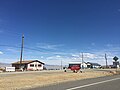
unincorporated community and census-designated place (CDP) in Mineral County in west-central Nevada, United States. It is located along U.S. Route 95 (38° 23'...
13 KB (609 words) - 13:35, 24 June 2024

Candelaria is a ghost town in Mineral County, Nevada. Today the site of Candelaria is dominated by the Kinross Gold Candelaria Mine on Mt. Diablo. Candelaria...
6 KB (378 words) - 14:01, 24 June 2024

There are 16 counties and one independent city in the U.S. state of Nevada. On November 25, 1861, the first Nevada Territorial Legislature established...
10 KB (376 words) - 23:26, 19 April 2024

routed over US 6. Mileposts in Nevada reset at county lines; the start and end mileposts for each county are given in the county column. 57.700 per NDOT January...
18 KB (1,407 words) - 22:18, 20 February 2024
Esmeralda Eureka Humboldt Lander Lincoln Lyon Mineral Nye Pershing Sto Wash White Pine Most ghost towns in Nevada in the United States are former mining boomtowns...
27 KB (489 words) - 20:05, 7 June 2024

White Mountains (California) (category Mountain ranges of Mineral County, Nevada)
The White Mountains of California and Nevada are a triangular fault-block mountain range facing the Sierra Nevada across the upper Owens Valley. They extend...
13 KB (1,131 words) - 00:30, 4 March 2024

districts in Nevada that are listed on the National Register of Historic Places. There is at least one listing in each of Nevada's 16 counties and one independent...
5 KB (332 words) - 02:36, 17 May 2024

Kinkaid is a populated place located in Mineral County. Kinkaid is also known as Kinkead and Kinkaid Siding. Kinkead was a stop on the Carson and Colorado...
2 KB (89 words) - 06:45, 22 October 2020

Madera County - southwest Tuolumne County- west Alpine County - northwest Douglas County, Nevada - north Lyon County, Nevada - northeast Mineral County, Nevada...
48 KB (2,026 words) - 15:18, 23 April 2024