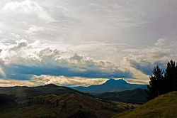
Mount Hikurangi (or Te Ara ki Hikurangi in Māori) is a 1,752 m (5,748 ft) peak in the eastern corner of New Zealand's North Island, about 80 kilometres...
25 KB (2,482 words) - 10:13, 8 February 2025
Mount Hikurangi may refer to: Mount Hikurangi (Gisborne District), New Zealand Mount Hikurangi (Northland), New Zealand Hikurangi, a volcanic cone near...
332 bytes (72 words) - 17:26, 9 December 2021
2007, the Gisborne region was hit by an earthquake of Richter magnitude 6.8, centred in the Hikurangi Trough which is a part of the Hikurangi Margin. The...
20 KB (1,727 words) - 04:03, 22 February 2025
The Hikurangi Margin (also known as the Hikurangi Subduction Zone) is New Zealand's largest subduction zone and fault. The Hikurangi Subduction Zone is...
15 KB (1,404 words) - 06:43, 15 April 2025
Auckland, New Zealand Mount Hikurangi (Gisborne District), a mountain near Ruatoria on the East Coast, New Zealand Mount Hikurangi (Northland), a mountain...
687 bytes (127 words) - 04:45, 11 April 2025
Mount Hikurangi (Gisborne District) – 1,754 m (5,755 ft) (highest peak in the North Island, excluding volcanoes) Ben Lomond – 1,751 m (5,745 ft) Mount Peel...
62 KB (2,587 words) - 02:26, 7 April 2025
mouth of Gisborne harbour) in the south. The Ngāti Porou iwi comprises 58 hapū (sub-tribes) and 48 mārae (meeting grounds). Mount Hikurangi features prominently...
25 KB (2,069 words) - 04:23, 9 March 2025
Waiapu Valley (category Landforms of the Gisborne District)
(670 sq mi). The Raukumara Range forms the western side of the valley, with Mount Hikurangi in the central west. The towns of Ruatoria and Tikitiki are in the...
31 KB (3,253 words) - 12:21, 3 April 2024
Raukūmara Range (category Landforms of the Gisborne District)
the Gisborne-East Cape region". New Zealand Journal of Geology and Geophysics. 10 (1): 217–231. doi:10.1080/00288306.1967.10428192. "Mount Hikurangi - Te...
5 KB (304 words) - 05:54, 13 April 2024
Coriaria pottsiana (redirect from Hikurangi tutu)
slope behind the tramping hut on Mount Hikurangi in the Gisborne Region of New Zealand's North Island. The Mount Hikurangi tramping hut is found at 37°54′22″S...
5 KB (491 words) - 21:16, 10 March 2025
Raukumara Conservation Park (category Protected areas of the Gisborne District)
340 acres) of the Raukumara Range and surrounding area, including Mount Hikurangi and the Mōtū River. The park was established in 1979. "DOC Profile"...
2 KB (87 words) - 07:39, 13 April 2024
Tokomaru Bay (category Populated places in the Gisborne District)
Zealand's North Island. It is 91 km north of Gisborne, on State Highway 35, and close to Mount Hikurangi. The district was originally known as Toka-a-Namu...
13 KB (1,325 words) - 09:22, 12 November 2024
Whakatāne – Mount Edgecumbe – 101.7 FM Taupō – Whakaroa – 101.6 FM Taupō – Mountain Road – 104.8 FM Gisborne – Wheatstone Road – 101.3 FM Gisborne – Wainui...
7 KB (650 words) - 21:24, 9 April 2025
Palmerston North Nelson Rotorua New Plymouth Whangārei Invercargill Whanganui Gisborne The word city took on two meanings in New Zealand after the local government...
34 KB (2,022 words) - 08:05, 25 April 2025
Horahora Broncos Pawarenga Broncos Otaua Valleys Warriors Otaika Eagles Hikurangi Stags Hokianga Pioneers Marist United Manaia RL Club Muriwhenua Falcons...
8 KB (705 words) - 01:35, 8 July 2023
More FM (section Gisborne/Wairoa)
between 6 am – 12 pm. 98-9 More FM Gisborne & Wairoa is a local radio station broadcasting from the heart of Gisborne City. The station was originally branded...
38 KB (5,006 words) - 02:33, 9 March 2025
Havelock Havelock North* Hāwera* Helensville* Henley Herbert Herekino Hikuai Hikurangi* Hikutaia Hinds Hinuera Hokitika* Honikiwi Hope* Horeke Horotiu Horsham...
16 KB (984 words) - 06:13, 25 April 2025
Creek in Gisborne in 1912. Pāoa wished to capture this kiwi and therefore set a giant snare at Tāwhiti-a-Pāoa, with its base at Mount Hikurangi. Rongokako...
10 KB (1,136 words) - 09:14, 1 February 2025
along the eastern side of the North Island between the Gisborne District and Wellington. Mount Raukūmara is clearly visible from a great distance at sea...
1 KB (122 words) - 16:01, 21 July 2024
Omokoroa to Papamoa Beach; and Mount Maunganui to Tauriko and Pyes Pa Rotorua (59,500): Ngongotahā to Owhata Gisborne (37,200): Makaraka to Okitu Napier-Hastings...
63 KB (2,920 words) - 11:19, 16 January 2025
Whakaroa 88.8 FM 2000 Gisborne Gisborne Wheatstone Road 99.7 FM Hawkes Bay Napier Mount Erin 98.3 FM 1999 Taranaki New Plymouth Mount Egmont 94.0 FM 1999...
21 KB (1,722 words) - 02:10, 14 March 2025
parts of Marlborough can pick up analogue television from Wellington's Mount Kaukau transmitter (this ability was most notably demonstrated during the...
5 KB (364 words) - 20:21, 2 November 2021
711556 (Hedgehope) Hikurangi Bay of Islands 35°32′21.2″S 173°54′53.4″E / 35.539222°S 173.914833°E / -35.539222; 173.914833 (Hikurangi) Horokaka Whangārei...
19 KB (1,502 words) - 21:42, 28 February 2025
Mangakahia-Hūkerenui Whangaruru Inlets other Whangārei District Matarau Hikurangi Kauri Maungatapere Kamo West Matapouri-Tutukaka Kiripaka Kamo East Granfield...
62 KB (4,617 words) - 17:37, 13 April 2025
resulting from an oblique convergence with the Pacific Plate in the Hikurangi subduction zone. In this region the Moho discontinuity starts about 25–30 km...
53 KB (4,813 words) - 07:42, 7 January 2025
plate under the other, producing the Puysegur Trench to the south, the Hikurangi Trough east of the North Island, and the Kermadec and Tonga Trenches further...
268 KB (22,071 words) - 20:59, 15 April 2025
Information New Zealand. Retrieved 22 January 2021. "NZGB Gazetteer: Hikurangi / Goulter Hill". Land Information New Zealand. Retrieved 22 January 2021...
99 KB (2,967 words) - 07:18, 21 April 2025
Millicent Amelia Moulden JP – of Te Teko. Kenneth Gordon Skudder JP – of Hikurangi. Victor Raymond Story – sergeant, New Zealand Police. Tome Kite Moana...
15 KB (1,476 words) - 15:18, 5 April 2025
Waiapu County (category Politics of the Gisborne District)
Zealand from 1890 until the council was merged with other councils to form Gisborne District Council in 1989. NB: This section is derived from text in Mackay...
19 KB (2,533 words) - 23:20, 24 February 2025
(2016). 120 days at Astrolabe: the Rena, the Reef, & the Go Canopus. Hikurangi, NZ: Kevin Judkins. ISBN 9780473369316. Wikimedia Commons has media related...
36 KB (3,756 words) - 23:05, 19 February 2025


