
Route nationale 8 (RN 8) is a secondary highway in Madagascar of 198 km, running from Morondava to Bekopaka. Only the first 15km are paved, the remaining...
1 KB (74 words) - 18:59, 11 July 2023

Route nationale 12a (RN 12a) is a primary highway in Madagascar of 232 km, running from Vangaindrano to Tôlanaro (Fort Dauphin). It crosses the regions...
2 KB (194 words) - 16:02, 19 December 2023

Route nationale 35 (RN 35) is a primary highway in Madagascar of 456 km, running from Ivato, Ambositra to Morondava. It crosses the regions of Menabe...
2 KB (168 words) - 16:16, 20 February 2023

Manambolo River (category Rivers of Madagascar)
western Madagascar of 370 km. It crosses the Tsingy de Bemaraha Strict Nature Reserve and the Maningoza Reserve. The unpaved Route nationale 8 (Madagascar) crosses...
3 KB (69 words) - 10:29, 10 August 2024
and upon the independence of Madagascar, it became the national airline. Initially operating services on domestic routes, the airline saw expansion in...
27 KB (2,463 words) - 07:15, 8 August 2024
that time— when it took over the domestic routes operated by these two airlines. Air France and Air Madagascar initially had a 44% and 36% stake in Madair...
15 KB (663 words) - 12:53, 26 July 2024
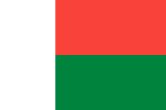
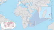
Madagascar, officially the Republic of Madagascar, is an island country comprising the island of Madagascar and numerous smaller peripheral islands. Lying...
225 KB (21,106 words) - 20:56, 12 August 2024

December 2022) Driving in Madagascar Madagascar portal (in French) PLAN NATIONAL DETRANSPORT (2004-2020) (in French) Routes Nationales Atlas mondiale...
24 KB (278 words) - 04:42, 23 June 2024
Antananarivo–Toamasina toll highway (category Infobox road instances in Madagascar)
en route to Toamasina. The highway will intersect with Route nationale 4, where an interchange will be constructed, and will join Route nationale 44 along...
14 KB (1,348 words) - 18:27, 6 July 2024

systems in Madagascar: routes nationales ('national roads'), routes provinciales ('provincial roads'), and routes communales ('communal roads'). Routes nationales...
31 KB (2,969 words) - 02:43, 10 July 2024

Menabe (category Regions of Madagascar)
with the inland by the Route nationale No.35 to Ivato, Route nationale No.34 to Antsirabe and is crossed by the Route nationale No.8 to Bekopaka. Ankavandra...
9 KB (667 words) - 05:55, 23 July 2024

Alaotra-Mangoro (category Regions of Madagascar)
Didy where sapphire and ruby are mined. Route nationale 2 (Antananarivo - Moramanga - Toamasina). Route nationale 44 (Moramanga - Ambatondrazaka - Imerimandroso...
9 KB (426 words) - 05:39, 23 July 2024

British was to deny Madagascar's ports to the Imperial Japanese Navy and to prevent the loss or impairment of the Allied shipping routes to India, Australia...
50 KB (5,527 words) - 05:33, 7 June 2024

Bongolava (category Madagascar geography stubs)
Kiranomena River, Mahajilo River and Manambolo River and the Route nationale 1 (Madagascar). Bongolava Region is divided into two districts, which are...
6 KB (201 words) - 17:55, 26 July 2024
Andasibe-Mantadia National Park (category National parks of Madagascar)
easiest parks in Madagascar to visit from the capital city, Antananarivo, with a 3-hour drive east on a paved road, Route Nationale 2 (RN 2). While Analamazaotra...
7 KB (691 words) - 07:16, 18 April 2024

Politics of Madagascar takes place in a framework of a semi-presidential representative democratic republic, with a pluralist multi-party system. The President...
16 KB (1,652 words) - 22:56, 26 June 2024

Antananarivo (redirect from Antananarivo, Madagascar)
Télé-Enseignement de Madagascar". Archived from the original on January 16, 2021. Retrieved February 3, 2021. "Enquête Nationale sur le Suivi des indicateurs...
87 KB (9,025 words) - 03:19, 8 August 2024
Malagasy language (redirect from Language of Madagascar)
As for their route, one possibility is that the Indonesian Austronesian came directly across the Indian Ocean from Java to Madagascar. It is likely that...
50 KB (4,476 words) - 02:32, 14 August 2024

Juan de Nova Island (category Islands of Madagascar)
Mozambique Channel, about one-third of the way between Madagascar and Mozambique. It is a low, flat island, 4.8 square kilometres (1.9 sq mi) in size. Administratively...
23 KB (2,211 words) - 04:12, 6 July 2024

Antsohihy (category Cities in Madagascar)
of Antsohihy District. It is situated at the junction of Route nationale 6 and Route nationale 32. Antsohihy is served by a local airport. The town is...
5 KB (174 words) - 04:14, 24 September 2023

Fianarantsoa (category Cities in Madagascar)
Fianarantsoa is a city (commune urbaine) in south central Madagascar, and is the capital of Haute Matsiatra Region. It was built in the early 19th century...
13 KB (664 words) - 16:54, 4 May 2024

road from the coast to the capital, Antananarivo. Today, the key route of Route nationale 2 from the capital is located west of Andevoranto. There is a train...
8 KB (334 words) - 15:26, 21 July 2023
Islands, it is located approximately 679 km (422 mi) east of the island of Madagascar and 175 km (109 mi) southwest of the island of Mauritius. As of January...
128 KB (12,600 words) - 13:37, 23 July 2024

Sakaraha (category Sapphire mines in Madagascar)
Atsimo-Andrefana Region, south-western Madagascar. It has a population of 31,183 in 2018. Sakaraha is situated along route nationale No. 7 (Tuléar-Fianarantsoa)...
4 KB (319 words) - 14:05, 14 January 2024
Sambava (category Cities in Madagascar)
was 84,039 in as of the 2018 commune census. Sambava is located on Route Nationale 5a Ambilobe - Antalaha. It is also the starting point of the National...
8 KB (280 words) - 05:35, 14 February 2023
musique et d'art dramatique du Québec, the École nationale de théâtre du Canada and the École nationale de cirque. Notable public agencies to catalogue...
241 KB (23,462 words) - 12:22, 3 August 2024
situated at the route nationale No. 7 (Tuléar-Fianarantsoa) at 70 km from Tuléar and 64 km from Sakaraha and its intersection with Route nationale 10. Estimated...
5 KB (168 words) - 19:47, 11 March 2017
Boriziny (category Cities in Madagascar)
urbaine) in western Madagascar in Sofia Region. The population of the commune urbaine was 22,573 in 2018. It is situated at the Route nationale 6 near the bay...
6 KB (183 words) - 13:31, 17 January 2024
This is a list of bridges and viaducts in Madagascar, including those for pedestrians and vehicular traffic. Kamoro, Mananjary and Betsiboka Bridges are...
12 KB (577 words) - 18:46, 13 February 2024
Tsiroanomandidy (district) (category Madagascar geography stubs)
Route nationale 1b connects the city with Antananarivo (218 km). There is an airport. Tsiroanomandidy has the largest Zebu market in Madagascar. More...
7 KB (301 words) - 19:39, 14 April 2024