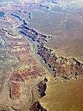
The Shoalhaven River is a perennial river that rises from the Southern Tablelands and flows into an open mature wave dominated barrier estuary near Nowra...
15 KB (1,310 words) - 08:49, 12 October 2024
The City of Shoalhaven is a local government area in the South Coast region of New South Wales, Australia. The area is about 200 kilometres (120 mi) south...
25 KB (1,088 words) - 02:35, 1 October 2024
The Kangaroo River is a perennial river of the Shoalhaven catchment located in the Southern Highlands and Illawarra regions of New South Wales, Australia...
5 KB (271 words) - 08:37, 26 March 2023
HMAS Shoalhaven (K535/M535/F535), named for the Shoalhaven River in New South Wales, was a modified River-class frigate of the Royal Australian Navy. She...
10 KB (977 words) - 02:12, 10 October 2024
people. It has a surfing beach, access to the Shoalhaven River and is surrounded by wineries. Shoalhaven Heads is a small rural holiday town. The town...
4 KB (275 words) - 01:26, 26 June 2024
The Shoalhaven Scheme is a dual-purpose water supply and Pumped-storage Hydroelectricity scheme located on the South Coast region of New South Wales, Australia...
6 KB (660 words) - 06:37, 23 September 2023
Bomaderry, New South Wales (category City of Shoalhaven)
It is on the north shore of the Shoalhaven River, across the river from Nowra, the major town of the City of Shoalhaven, of which Bomaderry is locally...
8 KB (777 words) - 01:32, 26 June 2024
Nowra (category City of Shoalhaven)
region south of the Shoalhaven river was inhabited by the Wandi-Wandandian tribe of the Yuin nation, while the region north of Shoalhaven was inhabited by...
22 KB (2,021 words) - 15:47, 22 October 2024
the Kalang River near Urunga Numbaa Island, in the Shoalhaven River Payne's Island, in Wallaga Lake Peat Island, in the Hawkesbury River Pig Island,...
28 KB (2,214 words) - 01:14, 11 August 2024
Canyon (redirect from River canyon)
Murchison River Gorge, Western Australia Jamison Valley, New South Wales Capertee Valley, New South Wales – the world's second-widest canyon Shoalhaven Gorge...
23 KB (2,211 words) - 17:49, 25 October 2024
Australia. Coolangatta Estate is located on the northern bank of the Shoalhaven River, in the foothills of Coolangatta Mountain. The word 'Coolangatta' is...
13 KB (1,795 words) - 04:38, 18 July 2024
Shoalhaven River and the Crookhaven River now forms the main Shoalhaven River estuary, with the former entrance to the Shoalhaven River at Shoalhaven...
25 KB (2,854 words) - 12:43, 22 June 2024
properties comprising 1,100 hectares (2,700 acres) at Bundanon on the Shoalhaven River to the people of Australia. Held in trust, Boyd later donated further...
27 KB (2,794 words) - 21:54, 30 September 2024
Moss Vale. At Berrima, the river is crossed by the Hume Freeway. The Shoalhaven Scheme pumps water from the Shoalhaven River into the Wingecarribee Reservoir...
6 KB (305 words) - 05:01, 28 July 2022
of Sydney which was approximately bounded by modern Campbelltown, Shoalhaven River and Moss Vale and included the Illawarra. The Bundjalung people are...
111 KB (10,058 words) - 05:20, 26 October 2024
first recorded by surveyor Robert Hoddle on an 1828 expedition of the Shoalhaven River. Following Galbraith's death in 1837, his land holdings were subsequently...
9 KB (724 words) - 08:40, 18 April 2024
junction of the Shoalhaven and Endrick rivers. The Pigeon House Range forms the watershed between the northeast waters of Endrick River and those flowing...
13 KB (1,316 words) - 20:52, 10 March 2024
water, as the Reserve floor flows into the Kangaroo Valley River and the Shoalhaven River, from which the Sydney Water Authority draws water to supply...
27 KB (3,421 words) - 09:24, 30 March 2024
of Moruya River to Nowra. The country the Yuin ancestors occupied, used, and enjoyed reached across from Cape Howe to the Shoalhaven River and inland...
41 KB (4,325 words) - 02:18, 18 September 2024
Shoalhaven in New South Wales, Australia. It is located on the banks of the Shoalhaven River 1 km (0.62 mi) from the Nowra CBD. The secondary health care facility...
10 KB (909 words) - 11:15, 19 April 2024
cut a 209-yard canal between the Shoalhaven River and the Crookhaven River to allow passage of boats into the Shoalhaven. This canal was Australia's first...
16 KB (1,717 words) - 21:57, 8 July 2024
"Bora" is also marked on a 1924 Parish Map of Larbert, on a bend of the Shoalhaven River, just south of where Virginia homestead is located today. This portion...
27 KB (3,859 words) - 19:21, 3 February 2022
1887, and now continues as far south as the town of Bomaderry on the Shoalhaven River. The navigator George Bass first documented the Illawarra coal deposits...
74 KB (7,780 words) - 02:14, 27 October 2024
This page discusses the rivers and hydrography of the state of New South Wales, Australia. The principal topographic feature of New South Wales is the...
21 KB (546 words) - 16:43, 19 December 2023
South Wales. It incorporates almost all of the City of Shoalhaven to the south of the Shoalhaven River, notably Nowra, Ulladulla and Milton. "Mr Henry John...
5 KB (214 words) - 04:54, 28 April 2024
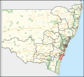
part of Albion Park Rail) and the part of the City of Shoalhaven to the north of the Shoalhaven river (including Bomaderry and Berry). It includes a thinly...
8 KB (480 words) - 00:04, 27 March 2023
tidal flats, islands and a coastal sand barrier built from river silt in the Shoalhaven River delta. It is important areas for migratory waders and sea...
3 KB (212 words) - 09:22, 25 October 2024
south of Sydney Harbour, through Georges River, Botany Bay, Port Hacking and south beyond the Shoalhaven River to the Beecroft Peninsula. Their inland...
12 KB (927 words) - 22:47, 26 August 2024
later in 1797, during his voyage that revealed the existence of the Shoalhaven River to the colonial settlers. The first Europeans working in the area were...
25 KB (2,464 words) - 10:41, 2 October 2024
Bangalee, New South Wales (category City of Shoalhaven)
Bangalee is a suburb of Nowra in the City of Shoalhaven in New South Wales, Australia. It lies north of the Shoalhaven about 7 km to the northwest of Nowra....
2 KB (124 words) - 14:37, 7 September 2021


