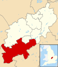
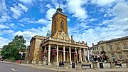
South Northamptonshire was a local government district in Northamptonshire, England, from 1974 to 2021. Its council was based in the town of Towcester...
15 KB (1,200 words) - 22:16, 24 October 2024
Northamptonshire (/nɔːrˈθæmptənʃər, -ʃɪər/ nor-THAMP-tən-shər, -sheer; abbreviated Northants.) is a ceremonial county in the East Midlands of England...
84 KB (7,930 words) - 13:51, 6 November 2024
South Northamptonshire is a constituency represented in the House of Commons of the UK Parliament since 2024 by Sarah Bool. As with all constituencies...
56 KB (1,446 words) - 12:27, 4 November 2024
of Northamptonshire and Leicestershire in a south westerly direction towards Banbury, roughly following the border between West Northamptonshire and...
6 KB (566 words) - 02:07, 10 November 2024
West Northamptonshire is a unitary authority area in the ceremonial county of Northamptonshire, England, and was created in 2021. It contains the county...
33 KB (1,679 words) - 10:18, 8 October 2024
Conservative Party politician who has been the Member of Parliament for South Northamptonshire since 2024. Bool grew up in Rutland and attended English Martyrs...
3 KB (139 words) - 16:22, 14 September 2024
North Northamptonshire is one of two local government districts in Northamptonshire, England. Its council is a unitary authority, being a district council...
25 KB (1,368 words) - 17:48, 4 November 2024
Towcester (redirect from Towcester, Northamptonshire)
the West Northamptonshire unitary authority area of Northamptonshire, England. From 1974 to 2021, it was the administrative centre of the South Northamptonshire...
25 KB (2,606 words) - 10:52, 17 October 2024
West Northamptonshire about 1 mile (1.6 km) southeast of Roade village close to the Northampton to Milton Keynes A508, ca.3 miles (5 km) south of junction...
3 KB (252 words) - 15:03, 15 August 2024
Higham Ferrers Rushden Collyweston East Northamptonshire was a local government district in Northamptonshire, England, from 1974 to 2021. Its council...
13 KB (835 words) - 22:13, 24 October 2024
Borough Council, and South Northamptonshire District Council. 2021 West Northamptonshire Council election 2025 West Northamptonshire Council election Since...
3 KB (138 words) - 12:05, 8 October 2024
Woodend is a small village in West Northamptonshire in the English county of Northamptonshire. The village's name means 'at the end of the wood'. It is...
3 KB (174 words) - 10:51, 14 April 2023
Valley, New Duston, Old Duston, St Crispin, South, and Weston, and the District of South Northamptonshire wards of Brafield, Cogenhoe, Hackleton, Harpole...
32 KB (1,049 words) - 19:02, 3 November 2024
Croughton is a village and civil parish in West Northamptonshire, England, about 3 miles (5 km) southwest of Brackley. The 2011 Census recorded the parish's...
7 KB (769 words) - 22:10, 7 March 2024
page is a list of these buildings in the district of South Northamptonshire in Northamptonshire. The date given is the date used by Historic England as...
38 KB (111 words) - 22:22, 5 October 2024
Whitfield is a village and parish in the south-west of the English county of Northamptonshire in the valley of the River Great Ouse which forms the border...
4 KB (317 words) - 22:18, 2 October 2021
Northampton (redirect from Northampton, Northamptonshire)
authority of West Northamptonshire. The town is situated on the River Nene, 60 miles (97 km) north-west of London and 50 miles (80 km) south-east of Birmingham...
125 KB (12,359 words) - 04:41, 13 November 2024
small village in the shire county of Northamptonshire (Northants), England. It is about 7 miles (11.3 km) south-west of the county town of Northampton...
4 KB (401 words) - 10:52, 17 October 2024
Daventry (UK Parliament constituency) (category Parliamentary constituencies in Northamptonshire)
form of the oldest creation of South Northamptonshire and lasted 32 years until it reverted into "South Northamptonshire". Finally today's seat was recreated...
38 KB (1,098 words) - 09:23, 4 November 2024
Daventry and South Northamptonshire PCT, Northampton Teaching PCT and Northamptonshire Heartlands PCT. They were merged into Northamptonshire Teaching PCT...
5 KB (462 words) - 10:42, 19 June 2024
parish of Cogenhoe and Whiston, in the West Northamptonshire district, in the ceremonial county of Northamptonshire, England. It is 4 miles due east of the...
3 KB (371 words) - 20:58, 27 March 2023
the earliest written reports of iron ore extraction in Northamptonshire. The Northamptonshire Regiment and later Royal Pioneer Corps were stationed at...
11 KB (1,183 words) - 20:07, 9 October 2024
the east, Essex and Hertfordshire to the south, Northamptonshire to the west and Bedfordshire to the south-west. The largest settlement is the city of...
36 KB (3,302 words) - 14:36, 23 October 2024
electoral wards from North Northamptonshire Corby and East Northamptonshire Daventry (part) Kettering South Northamptonshire (part) Wellingborough and...
30 KB (449 words) - 15:47, 20 October 2024
Northamptonshire, England, about 1 mile (1.6 km) north of Towcester. SNC (2010). South Northamptonshire Council Year Book 2010-2011. Towcester: South...
1 KB (43 words) - 19:12, 2 August 2024
Warkworth is a village and civil parish in West Northamptonshire, about 2 miles (3 km) east of Banbury in Oxfordshire and 1 mile (1.6 km) southeast of...
8 KB (808 words) - 18:30, 14 November 2023
Corby (redirect from Corby, Northamptonshire)
Corby is a town and civil parish in the North Northamptonshire district, in Northamptonshire, England, 23 miles (37 km) north-east of Northampton. In 2021...
60 KB (6,117 words) - 14:57, 12 October 2024
Brackley (redirect from Brackley, Northamptonshire)
Brackley is a market town and civil parish in West Northamptonshire, in Northamptonshire, England, bordering Oxfordshire and Buckinghamshire, 19 miles...
27 KB (2,964 words) - 19:51, 31 August 2024
Crick is a village in West Northamptonshire in England. It is close to the border with Warwickshire, six miles (ten kilometres) east of Rugby and 14 miles...
6 KB (676 words) - 12:15, 10 August 2024
Newbottle is a civil parish and largely deserted village in West Northamptonshire, about 4 miles (6.4 km) west of the market town of Brackley. It is close...
6 KB (515 words) - 08:02, 12 May 2023


