
The Vardar Statistical Region (Macedonian: Вардарски Регион) is one of eight statistical regions of North Macedonia. Vardar, located in the central part...
7 KB (186 words) - 03:33, 28 January 2024

The Vardar (/ˈvɑːrdɑːr/; Macedonian: Вардар, Albanian: Vardar/-i, Turkish: Vardar) or Axios (Greek: Αξιός, romanized: Aksiós, Albanian: Asi (historically))...
9 KB (913 words) - 03:13, 26 July 2024

after Vardar, the major river that cuts across the region from northwest to southeast, to distinguish it from both Greek Macedonia and the region around...
7 KB (734 words) - 11:45, 3 August 2024

Map of Vardar Region....
26 KB (309 words) - 01:53, 11 May 2024

FK Vardar (Macedonian: ФК Вардар) is a professional football club based in Skopje, North Macedonia, which competes in the Macedonian First League. They...
44 KB (3,800 words) - 23:53, 11 August 2024
Azot (Macedonian: Азот) is a historical and geographic region in North Macedonia located in the south-west of the city of Veles in the valley of Babuna...
602 bytes (31 words) - 00:18, 1 June 2024

The Vardar Banovina, or Vardar Banate (Macedonian: Вардарска бановина, romanized: Vardarska banovina; Serbian: Вардарска бановина, romanized: Vardarska...
7 KB (570 words) - 14:32, 5 July 2024

Geography of North Macedonia (section River Vardar)
Albania to the west. The country is part of the wider region of Macedonia and makes up most of Vardar Macedonia. The country is a major transportation corridor...
48 KB (4,211 words) - 20:27, 12 June 2024
The Morava-Vardar Canal is a proposed infrastructure project, linking the Vardar river valley in North Macedonia with the Morava river valley in Serbia...
7 KB (713 words) - 15:18, 19 July 2024
Balli Kombëtar (section Kosovo and Vardar)
afraid of murdering their own countrymen. The Ballists in Kosovo and Vardar region rose to prominence following the capitulation of Italy in September...
41 KB (4,308 words) - 22:10, 3 August 2024
Gradsko, North Macedonia (category Vardar Region geography stubs)
18, "... northeastward course through an area of mountains to join the Vardar below Titov Veles near the ancient Paeonian capital of Stobi (Gradsko)....
7 KB (235 words) - 21:10, 11 February 2023

Albania. Internally, it borders the Southwestern and Vardar statistical regions. Pelagonia statistical region is divided into 9 municipalities: Bitola Demir...
6 KB (137 words) - 20:54, 25 January 2024

Malino, Sveti Nikole (category Vardar Region geography stubs)
41.94917°N 21.84250°E / 41.94917; 21.84250 Country North Macedonia Region Vardar Municipality Sveti Nikole Population (2021) • Total 20 Time zone UTC+1...
5 KB (68 words) - 16:24, 10 August 2024

Kosovo. Internally, it borders the Vardar, Polog, Northeastern, Eastern, and Southwestern statistical regions. The region consists of the City of Skopje and...
8 KB (165 words) - 18:58, 14 July 2024

on the right side of the river Vardar. It is about 150 metres (490 ft) above sea level. Negotino is in a vineyard region and the gates of the Tikveš plain...
9 KB (449 words) - 03:16, 9 August 2024

Bogomila (category Vardar Region geography stubs)
21°24′E / 41.650°N 21.400°E / 41.650; 21.400 Country North Macedonia Region Vardar Municipality Čaška Population (2021) • Total 359 Time zone UTC+1 (CET)...
7 KB (160 words) - 04:58, 17 February 2024

Gorno Čičevo (category Vardar Region geography stubs)
21°52′E / 41.667°N 21.867°E / 41.667; 21.867 Country North Macedonia Region Vardar Municipality Gradsko Population (2021) • Total 10 Time zone UTC+1...
4 KB (53 words) - 00:43, 3 April 2023

Giannitsa (redirect from Enidzhe Vardar)
Yenice-i Vardar ('new-town of Vardar', as opposed to Yenice-i Karasu, modern Genisea, near Xanthi and known for tobacco), Turkish Yenice or Vardar Yenicesi...
26 KB (2,644 words) - 01:13, 3 June 2024

Prosek, North Macedonia (category Vardar Region geography stubs)
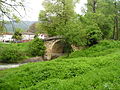
position. The site is located on a limestone plateau surrounded by a curve of Vardar river. The sheer cliffs and the river make the area suitable for defense...
3 KB (283 words) - 13:29, 30 April 2024
Vardar, vardar, värdar, or vårdar in Wiktionary, the free dictionary. Vardar, also known as Axios, is a river in North Macedonia and Greece. Vardar may...
1 KB (180 words) - 14:08, 16 December 2019
borders the Pelagonia, Polog, Skopje, and Vardar statistical regions. The Southwestern Statistical Region is divided into nine municipalities: Centar...
9 KB (152 words) - 23:36, 11 April 2024

Serbs in North Macedonia (redirect from Serbs of Vardar Macedonia)
however, immediately violated the treaty, launching an operation in the Vardar region, conquering the cities of Vranje, Skopje and Tetovo, with much loot...
57 KB (6,326 words) - 20:05, 28 July 2024

Papradište, Čaška (category Vardar Region geography stubs)
41.64139°N 21.43944°E / 41.64139; 21.43944 Country North Macedonia Region Vardar Municipality Čaška Population (2021) • Total 14 Time zone UTC+1 (CET)...
6 KB (96 words) - 20:24, 27 February 2023

Treska (category Tributaries of the Vardar)
is a river in the western part of North Macedonia, a right tributary to Vardar. It is 132 km (82 mi) long, and its basin is 2,350 km2. It rises in the...
2 KB (127 words) - 13:52, 26 November 2023

Oreše (category Vardar Region geography stubs)
619449°N 21.419623°E / 41.619449; 21.419623 Country North Macedonia Region Vardar Municipality Čaška Population (2021) • Total 71 Time zone UTC+1 (CET)...
6 KB (81 words) - 15:49, 2 August 2023

Nežilovo, Čaška (category Vardar Region geography stubs)
41.64139°N 21.43944°E / 41.64139; 21.43944 Country North Macedonia Region Vardar Municipality Čaška Population (2021) • Total 33 Time zone UTC+1 (CET)...
6 KB (104 words) - 20:26, 27 February 2023
Rosoman (category Vardar Region geography stubs)
9497222322°E / 41.5161111211; 21.9497222322 Country North Macedonia Region Vardar Municipality Rosoman Population (2021) • Total 2,553 Time zone UTC+1...
8 KB (363 words) - 13:07, 19 May 2024

Beleštevica (category Vardar Region geography stubs)
41.76306°N 21.69806°E / 41.76306; 21.69806 Country North Macedonia Region Vardar Municipality Veles Population (2002) • Total 4 Time zone UTC+1 (CET)...
5 KB (72 words) - 11:29, 22 February 2023
Bulgaria. Internally, it borders the Vardar and Eastern statistical regions. The Southeastern statistical region is divided into 10 municipalities: Bogdanci...
7 KB (143 words) - 13:28, 12 June 2024
Constantine III (641) transferred a part of the Slavs from the Balkans (Vardar region) to Asia Minor. There these migrants founded the city of Gordoservon...
16 KB (1,860 words) - 10:53, 2 August 2024