
Haboro (羽幌町, Haboro-chō) is a town located in Rumoi Subprefecture, Hokkaido, Japan. As of September 2016, the town has an estimated population of 7,338...
15 KB (827 words) - 03:55, 8 June 2024
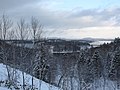
Haboro Dam (Japanese: 羽幌ダム) is an earthfill dam located in Hokkaido Prefecture in Japan. The dam is used for irrigation. The catchment area of the dam...
1 KB (75 words) - 19:16, 1 October 2023

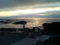
northwest of Haboro Bay in Haboro, Hokkaido. The island, along with neighboring Teuri Island on its west side, belongs to the town of Haboro in Rumoi Subprefecture...
13 KB (748 words) - 23:36, 10 December 2023

Island (天売島 Teuri-tō) is an island in the Sea of Japan 30 km west of Haboro port in Haboro, Tomamae District, in the Rumoi Subprefecture in Hokkaido. The Island...
5 KB (497 words) - 10:12, 3 March 2024
Karuho Shiina 椎名軽穂 Born (1975-10-23) October 23, 1975 (age 48) Haboro, Hokkaido Area(s) Shōjo manga Notable works Kimi ni Todoke Awards 32nd Kodansha Manga...
3 KB (250 words) - 18:54, 3 October 2024

is located to the very south of the town on its border with the towns Haboro and Horokanai. Pisshiri is the highest peak in the Teshio Mountains, and...
19 KB (1,501 words) - 22:24, 4 October 2024

Furubira 古平町 188.41 3,265 Shiribeshi Subprefecture Furubira District Town Haboro 羽幌町 472.49 7,338 Rumoi Subprefecture Tomamae District Town Hamanaka 浜中町...
140 KB (7,517 words) - 07:48, 11 October 2024

and a density of 12.28 persons per km2. The total area is 1,207.03 km2. Haboro Shosanbetsu Tomamae 44°18′36″N 141°52′12″E / 44.31000°N 141.87000°E /...
876 bytes (65 words) - 19:55, 17 July 2024
Line [ja] Bifuka - Niupu 21.2 km (13.2 mi) closed on September 17, 1985 Haboro Line [ja] Rumoi - Horonobe 141.1 km (87.7 mi) closed on March 30, 1987 Hiroo...
15 KB (1,570 words) - 16:47, 22 July 2024
Hokkaido Government Office, and under the leadership of the Hoboro (now Haboro town) branch police station, a sniper team was organized. Guns and volunteers...
21 KB (3,070 words) - 09:11, 31 July 2024
Type Map Rōmaji Kanji Enbetsu 遠別町 590.86 2,966 5.02 Teshio District Town Haboro 羽幌町 472.49 7,338 15.53 Tomamae District Town Mashike 増毛町 369.64 4,634 12...
8 KB (255 words) - 16:11, 12 April 2024
71 Obira 小平町 Hokkaido Rumoi 627.22 Tomamae 苫前町 Hokkaido Tomamae 454.60 Haboro 羽幌町 Hokkaido Tomamae 472.65 Enbetsu 遠別町 Hokkaido Teshio 590.80 Teshio 天塩町...
148 KB (122 words) - 00:34, 2 May 2024
Yoshifumi), is a painter and illustrator born on November 10, 1951, in Haboro, Hokkaidō Prefecture, Japan. He is best known for his watercolor paintings...
7 KB (648 words) - 20:53, 18 July 2023
known as Ogopogo. 37 3 "Ghosts of Haboro/Mngwa" September 23, 2010 (2010-09-23) N/A Josh goes ghost hunting in Haboro, an abandoned mining town on Japan's...
35 KB (296 words) - 08:46, 3 March 2024

Ryuhyo Monbetsu; For Takinoue and Monbetsu Haboro; For Mashike Station, Rumoi Station, Obira, Tomamae, Haboro, Shosanbetsu, Enbetsu, Teshio, and Toyotomi...
13 KB (950 words) - 10:02, 22 July 2024

volcanic arc ≥ 10 108.9 X6 7 Kussharo Hokkaidō 175 117.5 Kp-4, Kutcharo Haboro Ash 7 Emmons Lake caldera SW Alaska, Aleutian Arc 220 124 Old Craw Tephra...
68 KB (1,155 words) - 10:55, 6 October 2024
Japan. Established in 1974, the park spans the municipalities of Enbetsu, Haboro, Horokanai, and Shibetsu. Lake Shumarinai was created artificially in 1943...
5 KB (137 words) - 01:31, 17 April 2024
Chitose Mimpō (Chitose) Yūbari Times (Yūbari) Nemuro Shimbun (Nemuro) Haboro Times (Haboro) Kahoku Shimpō Aomori Tōō Nippō Iwate Iwate Nippō Akita Akita Sakigake...
23 KB (1,584 words) - 05:52, 2 June 2024
Pisshiri-zan) is the tallest mountain in the Teshio Mountains. It is located on the border of Haboro and Horokanai, Hokkaidō, Japan. Geographical Survey Institute...
1 KB (28 words) - 19:34, 29 July 2024
517 (Esashi, Menashidomari) JP005 [12] Teuri Island 天売島 Teuri-tō Hokkaidō Haboro 0–85 metres (0–279 ft) 546 hectares (1,350 acres) A4i, A4ii, A4iii Rhinoceros...
11 KB (131 words) - 21:25, 30 September 2024
Rishirifuji (Rishiritou) Island of Flower Rebun (Rebuntou) Island of Flower Haboro (Yagishiritou) Island of Flower Kaibatou Island of Flower Hyogoslavia Takarazuka...
15 KB (1,113 words) - 19:32, 21 June 2024
Hokuriku Railroad - Ishikawa Line Awagasaki - Uchinada National Route 470 Haboro, Hokkaido, Japan Wujiang District, Suzhou, China Uchinada Multipurpose Park...
10 KB (762 words) - 14:47, 4 October 2024

Tempoku Line (天北線, Tempoku-sen). June 30, 1935: Teshio Line (III), later Haboro Line [ja] from Horonobe opened. August 25, 1945: Chihaku Ferry ceased operation...
27 KB (1,412 words) - 18:09, 25 July 2024
Line [ja] Hokkaidō Bifuka – Niupu 21.2 km (13.2 mi) September 17, 1985 Haboro Line [ja] Hokkaidō Rumoi – Horonobe 141.1 km (87.7 mi) March 30, 1987 Hiroo...
65 KB (3,982 words) - 13:06, 1 October 2024

Government Railways 8620形 88623 Japanese National Railways 8620形 88623 Haboro, Hokkaido Scrapped 2009 884 1926 Jinchū Railway 3形 3 Jinchū Ry 3形 3 Sotetsu...
22 KB (162 words) - 15:51, 7 July 2024

was proposed from Shumarinai [ja] on that line to Chikubetsu [ja] on the Haboro Line [ja] north of Rumoi with construction commencing in 1959. A substantial...
36 KB (2,464 words) - 03:39, 3 September 2024

Rumoi-Horonuka National Route 233 – Haboro, Central Rumoi, Fukagawa, Hekisui 44.9 27.9 6 Rumoi-Owada National Route 233 – Haboro, Central Rumoi, Fukagawa, Hekisui...
5 KB (276 words) - 08:04, 16 September 2024

Line Yūmō Line Shihoro Line Ise Line (Ise Railway) Saga Line Shibushi Line Haboro Line Horonai Line Matsumae Line Utashinai Line Shibetsu Line Tempoku Line...
4 KB (110 words) - 23:02, 14 March 2024

Hokkaido Seabird Center (category Haboro, Hokkaido)
is a seabird research, conservation, and public engagement facility in Haboro, Hokkaido, Japan. The centre opened in 1997 and is operated by the Ministry...
3 KB (141 words) - 17:57, 29 October 2023

Line Yūmō Line Shihoro Line Ise Line (Ise Railway) Saga Line Shibushi Line Haboro Line Horonai Line Matsumae Line Utashinai Line Shibetsu Line Tempoku Line...
7 KB (533 words) - 14:54, 22 August 2024