
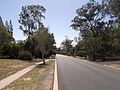
Larapinta Drive is a designated state route in the Northern Territory of Australia. It runs in a westerly direction from Alice Springs to the community...
5 KB (385 words) - 09:37, 20 July 2022

Finke River (redirect from Larapinta (TV series))
The Finke River, or Larapinta in the Indigenous Arrernte language, is a river in central Australia, whose bed courses through the Northern Territory and...
14 KB (1,355 words) - 08:23, 9 August 2024

MacDonnell National Park. Like Larapinta Drive, from which it branches off, it is part of the Red Centre Way. Namatjira Drive is named after Albert Namatjira...
1 KB (64 words) - 14:27, 19 December 2020

throughout the Stuart Highway. Previously, drivers were simply required to drive at a safe speed to suit the conditions. Thus, the Northern Territory section...
31 KB (2,524 words) - 09:10, 27 March 2024

is located 321 kilometres (199 mi) southwest of Alice Springs via Larapinta Drive (only accessible by 4WD), or 474 kilometres (295 mi) along the Stuart...
11 KB (1,269 words) - 07:24, 23 June 2024

total length of 835 km, consisting of roads named Namatjira Drive, Luritja Road, Larapinta Drive and parts of the Lasseter Highway. Beginning in the city...
1 KB (86 words) - 14:09, 18 December 2020

also facilitated the development of the Larapinta Trail. To the east of Alice Springs, within an hour's drive, are sites important to the local Arrernte...
10 KB (708 words) - 08:19, 19 November 2023

Watarrka National Park. It is part of the Red Centre Way and connects Larapinta Drive with the Lasseter Highway. The road is named after the Aboriginal Luritja...
1 KB (52 words) - 06:34, 10 October 2022

with an Alphanumeric Route State Route 2 B7 Namatjira Drive Larapinta Drive, Hugh Larapinta Drive, Namatjira 156 km (97 mi) State Route 12 B12 Plenty Highway...
24 KB (541 words) - 09:41, 31 March 2024

River Road Dorat Road Ernest Giles Road Gun Point Road Jim Jim Road Larapinta Drive Litchfield Road Luritja Road Mt Denison Road Nathan River Road Ranken...
4 KB (297 words) - 22:07, 27 December 2023

546 961 Ross Highway (B8) – Arltunga Historical Reserve 1,550 960 Larapinta Drive (B6) – Hermannsburg, Mereenie MacDonnell Region Burt Plain 1,570 980...
9 KB (314 words) - 05:03, 11 February 2024

Honeymoon Gap is a small gap 1 km south of Larapinta Drive, 14 km west of Alice Springs, on Roe Creek, 8 km south of where it cuts through Simpsons Gap...
6 KB (676 words) - 21:09, 18 August 2024

now a historical reserve, is located at the base of Mount Gillen on Larapinta Drive in the Alice Springs suburb of Flynn. The grave is also used as a marker...
8 KB (819 words) - 08:39, 6 May 2024

these locations. The gorges can be accessed from the nearby Larapinta and Namatjira drives. "Place Names Register Extract for Fleming (locality)". NT Place...
3 KB (140 words) - 08:49, 5 April 2020
becoming a Myer department store. It was the first drive-in shopping centre in Australia. It was the first drive-in shopping centre in Australia. It is now the...
45 KB (4,381 words) - 06:30, 6 August 2024
Kaytetye, Amatyerre, Alywarre Special purpose lease Yarrenyty-Arltere Larapinta YARR-WRENCH ARL-DER-AH White devil dog Arrernte, Pertame, Luritja Special...
11 KB (813 words) - 09:09, 26 July 2024

Botanic Gardens and Sir Thomas Brisbane Planetarium, as well as a mountain drive, bike trails, parks including a waterfall, and television and radio towers...
38 KB (3,527 words) - 13:19, 7 August 2024
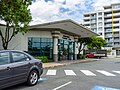
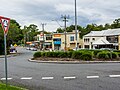
through the suburb from the south-west (Greenbank) to the north (Heathwood/Larapinta). Forestdale is named as such due to the lack of tree clearance compared...
6 KB (568 words) - 08:47, 3 June 2024

4405°S 153.0561°E / -27.4405; 153.0561 (Hamilton Reach)). Kingsford Smith Drive enters the suburb at its south-west corner (from Albion) and runs along...
38 KB (3,474 words) - 14:42, 22 July 2024

to Bayswater, to Milton to Castlemaine Brewery, and is within 10 minutes drive of the city on a tip-top road." In May 1920, "Drysllwyn Estate" made up...
15 KB (1,358 words) - 08:42, 24 June 2024
the Northern Territory, after he went missing while hiking along the Larapinta Trail. Human remains discovered by police during an unrelated operation...
658 KB (56,362 words) - 10:32, 7 September 2024

[citation needed] The Logan West Community Centre is located at 2 Wineglass Drive (27°40′30″S 153°01′44″E / 27.67499°S 153.02902°E / -27.67499; 153.02902...
10 KB (946 words) - 04:54, 24 August 2024

Red Bank Gorge and Glen Helen Gorge. The 223-kilometre-long (139 mi) Larapinta Trail follows the West MacDonnell Ranges and is considered among the world's...
81 KB (8,251 words) - 18:22, 6 September 2024

River. Along the riverside are a number of transport links: Coronation Drive, the Regatta ferry wharf, and the Bicentennial Bike Path (a bike and walkway)...
56 KB (6,011 words) - 12:06, 6 September 2024
-27.5005; 153.011 (Union College)): Union College. 99 Sir Fred Schonnel Drive (27°29′40″S 152°59′55″E / 27.4945°S 152.9986°E / -27.4945; 152.9986...
27 KB (2,847 words) - 05:51, 27 August 2024

number of properties in Charlotte Street, Brisbane Coronation Drive: Coronation Drive retaining wall 15 Countess Street: Roma Street railway station...
35 KB (3,253 words) - 12:44, 8 August 2024

secondary (Early Childhood-12) school for boys and girls at 94 Capitol Drive (27°32′32″S 152°56′31″E / 27.5421°S 152.9419°E / -27.5421; 152.9419...
16 KB (1,493 words) - 23:59, 12 June 2024
adjoining suburb of Kilgariff who lived on the south side of Colonel Rose Drive. "Connellan". NT Place Names Register. Northern Territory Government. Retrieved...
4 KB (179 words) - 01:16, 16 August 2024

Triad Temple 60 Hudson Street: former Albion Flour Mill 2 Kingsford Smith Drive: Breakfast Creek Hotel 17 Lever Street: Herberton Cottage 16 McLennan Street:...
35 KB (3,349 words) - 07:36, 1 September 2024

institution for the mentally ill since 1865. It is at the corner of Ellerton Drive and Wolston Park Road (27°36′03″S 152°54′36″E / 27.6007°S 152.9100°E...
31 KB (3,152 words) - 23:18, 12 June 2024