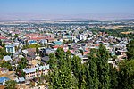
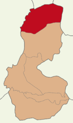
Muş (pronounced [muʃ]; Armenian: Մուշ; Kurdish: Mûş) is a city in eastern Turkey. It is the seat of Muş Province and Muş District. Its population is 120...
23 KB (1,814 words) - 11:41, 12 January 2025
Muş Province (Turkish: Muş Vilayeti; Kurdish: Parêzgeha Mûşê; Armenian: Մուշի մարզ, romanized: Mushi marz) is a province in the east Anatolia region of...
12 KB (961 words) - 13:26, 8 November 2024
Varto (category Populated places in Muş Province)
The Varto Basin (Muş) With Geomorphic Indices" (PDF) (in Turkish). Bingöl University. March 2019. p. 1. "Göller". mus.ktb.gov.tr. Muş İl Kültür ve Turizm...
7 KB (498 words) - 21:15, 19 November 2024
Muş District (also: Merkez, meaning "central" in Turkish) is a district of the Muş Province of Turkey. Its seat is the city of Muş. Its area is 2,818 km2...
4 KB (248 words) - 19:53, 25 April 2024
Akdoğan Mountains (category Landforms of Muş Province)
"Muş il fiziki haritası" (PDF) (in Turkish). Harita genel müdürlüğü. September 28, 2023. Archived (PDF) from the original on August 18, 2023. "Muş ili'nde...
7 KB (491 words) - 20:39, 17 December 2024
Mercimekkale is a village in the Muş District, Muş Province, in east Turkey. Within the boundaries of the village, there is the Mercimekkale Mound, one...
2 KB (156 words) - 16:26, 30 August 2024
Otluk Mountains (category Landforms of Muş Province)
Üçsırt village of Muş central district. "Muş'un coğrafi yapısı". Muş İl Kültür ve Turizm Müdürlüğü (in Turkish). Retrieved 2023-09-30. "Muş il fiziki haritası"...
3 KB (154 words) - 09:00, 22 November 2024
Malazgirt (category Populated places in Muş Province)
Bulanık-Malazgirt basin (Muş)" (in Turkish). Istanbul University. May 14, 2019. p. 1. "60 dakikalık Muş il brifingi" (PDF) (in Turkish). Muş Valiliği. February...
14 KB (1,079 words) - 14:48, 1 January 2025
The Muş Plain (Turkish: Muş Ovası; Kurdish: Deşta Mûşe; Armenian: Մշոյ դաշտ), is located in the northeast of the city center of Muş. It is one of the...
4 KB (396 words) - 14:16, 2 November 2024
Varto District (category Districts of Muş Province)
The Varto Basin (Muş) With Geomorphic Indices" (PDF) (in Turkish). Bingöl University. March 2019. p. 1. "Göller". mus.ktb.gov.tr. Muş İl Kültür ve Turizm...
7 KB (330 words) - 15:59, 9 January 2024
Şerafettin Mountains (category Landforms of Muş Province)
point of the provincial border of Bingöl and Muş. Şerafettin Mountains are ruggled to the west of the Muş provincial area. Most of them stay in Bingöl...
2 KB (126 words) - 07:03, 4 November 2024
Barley and wheat are cultivated on the plain. "Vadiler ve Ovalar". mus.ktb.gov.tr. Muş İl Kültür ve Turizm Müdürlüğü. p. 1. "Doğu Anadolu Ovaları ve Yaylaları"...
1 KB (112 words) - 13:54, 3 November 2024
Bilican Mountains (category Landforms of Muş Province)
özellikleri" (PDF) (in Turkish). Van Yüzüncü Yıl University. April 2020. "Muş il fiziki haritası" (PDF) (in Turkish). Harita genel müdürlüğü. September 28...
2 KB (139 words) - 04:44, 4 November 2024
Fakültesi Tarih Dergisi. June 30, 2022. p. 12. "Vadiler ve Ovalar". mus.ktb.gov.tr. Muş İl Kültür ve Turizm Müdürlüğü. p. 1. "Bulanık ve Malazgirt Ovaları"...
2 KB (241 words) - 00:38, 20 November 2024
Ardahan, Beyoğlu, Çatalca, Dersim, Ergani, Gelibolu, Genç, Kozan, Oltu, Muş, Siverek and Üsküdar provinces were transformed into districts. In 1927,...
31 KB (560 words) - 15:31, 14 January 2025
Karaçavuş Mountains (category Landforms of Muş Province)
(Turkish: Karaçavuş Dağları), is a mountain range in the south of Muş province. The city of Muş is located at the foot of the mountain. The highest point of...
2 KB (124 words) - 08:47, 22 November 2024
Cemalverdi Mountains (category Landforms of Muş Province)
Malazgirt basin and it forms the eastern border of the Malazgirt Plain. "Muş il fiziki haritası" (PDF) (in Turkish). Harita genel müdürlüğü. September 28...
3 KB (138 words) - 23:19, 3 November 2024
Lake Kaz (category Muş Province)
(PDF) (in Turkish). Orman ve Su işleri Bakanlığı. 2017. p. 69. "Göller". Muş İl Kültür ve Turizm Müdürlüğü (in Turkish). Retrieved 2023-09-27. "Bulanık-Malazgirt...
2 KB (93 words) - 02:43, 16 January 2025
Haspet Castle (category History of Muş Province)
turizme kazandırılıyor". aa.com.tr (in Turkish). Retrieved 2023-09-02. "Kaleler". Muş İl Kültür ve Turizm Müdürlüğü (in Turkish). Retrieved 2023-10-02....
2 KB (70 words) - 21:20, 3 November 2024
Bitlis Vilayet in 1892. Later it became part of Muş sanjak in Bitlis vilayet, and remained part of Muş until 1927. It was one of the districts of Siirt...
5 KB (314 words) - 13:03, 4 February 2023
Bulanık District (category Districts of Muş Province)
Bulanık District is a district of the Muş Province of Turkey. Its seat is the town of Bulanık. Its area is 1,948 km2, and its population is 74,591 (2022)...
4 KB (273 words) - 15:25, 9 January 2024
Lake Akdoğan (category Landforms of Muş Province)
Caspian turtle and European green lizard. Lake Nemrut "Göller". mus.ktb.gov.tr. Muş İl Kültür ve Turizm Müdürlüğü. Hamurpet Gölü, Sevan Nişanyan. Retrieved...
6 KB (526 words) - 05:51, 18 November 2024
Mount Göztepe (category Landforms of Muş Province)
Pleurotus eryngii var. ferulae mushrooms In the high parts of the mountain. "Muş il fiziki haritası" (PDF) (in Turkish). Harita genel müdürlüğü. September 28...
4 KB (242 words) - 08:56, 22 November 2024
Yakupağa Mountains (category Landforms of Muş Province)
The Yakupağa mountains are seen as an extension of the Süphan mountain. "Muş il fiziki haritası" (PDF) (in Turkish). Harita genel müdürlüğü. September 30...
2 KB (97 words) - 09:23, 22 November 2024
Commandant P. Mus, conseiller politique de Leclerc, il [ Jacques Massu ] obtient la reddition des Caodaistes (8 novembre). (With Maj. P. Mus, political advisor...
13 KB (1,051 words) - 06:01, 1 November 2024
Giovanni Boccaccio (redirect from Il Filocolo)
Karakaya ve V. Baydar (Ed.), in 2nd International Muş Symposium Articles Book (pp. 48–64). Muş: Muş Alparslan University. Source Archived 18 May 2021...
25 KB (2,805 words) - 12:36, 28 November 2024
Highest-ranked team eliminated was Batman Petrolspor (77). Edirnespor v Çorluspor Muş 1984 Muşspor v Ağrı 1970 Spor Çatalcaspor v Büyükçekmece Tepecikspor Balıkesirspor...
95 KB (1,896 words) - 21:57, 11 January 2025
Elazığ, Bingöl, Muş plains and the Van Lake basin. The largest plain in the region is the Iğdır Plain. The second largest plain is the Muş Plain. Lake Balık...
19 KB (1,856 words) - 19:31, 12 January 2025
district in the southwest, Bulanık district of Muş in the south and southeast, and Malazgirt district of Muş in the east. The district center is built on...
5 KB (265 words) - 18:32, 6 November 2024
This is the List of municipalities in Muş Province, Turkey as of March 2023[update]. İl Belediyesi, Turkey Civil Administration Departments Inventory...
2 KB (48 words) - 11:46, 18 April 2023


