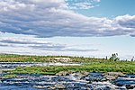
The Koksoak River (French: rivière Koksoak) is a river in northern Quebec, Canada, the largest river in the Nunavik region. The Inuit village and region's...
6 KB (497 words) - 02:24, 1 November 2024
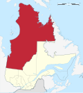
Rivière-Koksoak is a very large unorganized territory in the Kativik Regional Government territory in the Nord-du-Québec region of Quebec. It is named...
3 KB (147 words) - 05:40, 28 January 2023
the Koksoak River. "Rivière Larch". Geographical Names Data Base. Natural Resources Canada. Retrieved 3 March 2023. Kuuvik River Expedition "Rivière aux...
2 KB (307 words) - 20:20, 3 March 2023
physical features, including much of the central uplift. It is located in Rivière-Koksoak, in the Kativik territory. "La Moinerie". Earth Impact Database. Planetary...
2 KB (153 words) - 02:09, 22 February 2024
it to the east is the other large unorganized territory in Kativik, Rivière-Koksoak. Its population in the Canada 2021 Census was 5; enclaved within it...
3 KB (143 words) - 03:05, 28 January 2023
assistant surveyor David Eaton. Administratively it is located in Rivière-Koksoak, Kativik, Quebec. Gouvernement de Québec: Commission de toponymie -...
2 KB (124 words) - 17:04, 3 November 2024
Nation, Quebec Lac Kénogami: Kenogami means "long water" in Montagnais. Rivière Koksoak Quqsuaq means "Yellowish" in Inuktitut Kuujjuaq Kuujjuaq means "the...
91 KB (10,413 words) - 00:44, 18 November 2024
of Ungava Bay. The Nedlouc River flows in the unorganized territory Rivière-Koksoak, in the region of Nunavik, in the administrative region of Nord-du-Québec...
4 KB (492 words) - 15:08, 17 July 2024
des Communications et de la Condition féminine (MCCCF), along La Grande Rivière basin, the Otish Mountains sector and in the coastal areas of Quaqtaq,...
31 KB (1,631 words) - 16:57, 16 December 2024
January 1, 2000. Retrieved May 29, 2011. Benke and Cushing, p. 896 "Rivière Koksoak" (in French). Gouvernement du Québec. Retrieved May 16, 2011. "Churchill...
63 KB (2,899 words) - 22:40, 3 June 2024
is named after him. A road in Petite-Rivière-Saint-François is named after him. A lake in Rivière-Koksoak is named after him. Paul Gladu (October 1993)...
14 KB (1,505 words) - 00:48, 29 July 2024
The Caniapiscau River (French: rivière Caniapiscau) is a tributary of the Koksoak River in Nunavik, Quebec, Canada. In Cree the name of the river means...
6 KB (673 words) - 15:33, 24 October 2024
the following municipal units: the unorganized territories (NO) of: Rivière-Koksoak Baie-d'Hudson the Naskapi village (VK) of: Kawawachikamach (but not...
4 KB (230 words) - 03:19, 15 November 2023
Rivière Beurling (Beurling River) is a tributary of the Caniapiscau River (watershed of Ungava Bay), in the unorganized territory of Rivière-Koksoak,...
510 bytes (101 words) - 03:50, 4 April 2021
List of rivers of Quebec (section Basse-Laurentides – Lac des Deux Montagnes and rivière des Mille Îles)
rivers. Quebec has 2% of all fresh water on the planet. Rivière au Saumon (Baie James) Rivière au Phoque (Baie James) Désenclaves River Roggan River Corbin...
104 KB (9,399 words) - 19:26, 22 October 2024
Lake Wakuach Lake Wakuach Location Rivière-Koksoak, Kativik, Quebec Coordinates 55°33′46″N 67°32′35″W / 55.56278°N 67.54306°W / 55.56278; -67.54306...
832 bytes (15 words) - 22:07, 25 September 2023
Cap Jaseux Parc de la Rivière Batiscan Parc de Gros Cap Parc de la gorge Coaticook – Parc Découverte nature Parc de la Rivière-des-Mille-Iles Parc d’escalade...
24 KB (630 words) - 14:21, 9 March 2024
Mékinac 35906 Rivière-de-la-Savane Mauricie Mékinac 99904 Baie-d'Hudson Nord-du-Québec Administration régionale Kativik 99902 Rivière-Koksoak Nord-du-Québec...
16 KB (54 words) - 22:19, 19 November 2024
reserved land), Waswanipi (Cree reserved land), Wemindji (Cree reserved land), Whapmagoostui (Cree reserved land); Baie-d'Hudson, Rivière-Koksoak (part)...
13 KB (239 words) - 09:21, 16 December 2024
Retrieved 11 April 2024. "Rivière Kogaluc". Canadian Geographical Names Database. Government of Canada. Retrieved 12 April 2024. "Rivière Innuksuac". Canadian...
13 KB (1,018 words) - 21:46, 23 August 2024
Uashat; Caniapiscau, Lac-Jérôme, Lac-Juillet, Lac-Vacher, Lac-Walker, Petit-Mécatina, Rivière-Mouchalagane, Rivière-Nipissis, Rivière-Koksoak (part)...
19 KB (309 words) - 04:50, 8 December 2024
Lake Bienville Lake Bienville Location Rivière-Koksoak / Baie-James, Quebec Coordinates 55°04′45″N 72°51′40″W / 55.07917°N 72.86111°W / 55.07917; -72...
4 KB (338 words) - 17:52, 30 October 2024
Lake Nedlouc Lake Nedlouc Location Rivière-Koksoak, Nunavik, Quebec Coordinates 57°23′30″N 72°45′47″W / 57.39167°N 72.76306°W / 57.39167; -72.76306...
2 KB (138 words) - 22:06, 25 September 2023
James Bay Project (redirect from Water-resource system La Grande Rivière)
On the other hand, the reduced flow of the Caniapiscau River and the Koksoak River has permanently reduced the risk of natural floods on the lower Caniapiscau...
62 KB (7,203 words) - 04:28, 23 October 2024
demonstrated its feasibility in 1834, but along a more circuitous route up the Koksoak. Lacking Innu guides, McLean's expedition ended in failure with the discovery...
25 KB (2,327 words) - 22:58, 14 November 2024
the Larch River downstream from Calcaire (Limestone) Falls to create the Koksoak River that flows into southern Ungava Bay. Although the caribou regularly...
51 KB (5,967 words) - 19:29, 21 December 2024
began to drain northward into the Caniapiscau River, a tributary of the Koksoak River, and ultimately into Ungava Bay. Prior to impoundment, Lake Caniapiscau...
8 KB (855 words) - 21:51, 31 October 2024
52,000 Lukenie River Tributary river Africa Congo River 133,432 51,518 Koksoak River Primary river North America Ungava Bay 133,400 51,500 Orkhon River...
76 KB (1,453 words) - 02:12, 9 December 2024
Retrieved June 22, 2021. "Arroyo Blanco". Washington Post. "Riviere Soliette". Paho. "Riviere Soliette". The Independent UK. De la Fuente, Santiago (1976)...
39 KB (1,362 words) - 09:51, 8 December 2024
River Rivière aux Outardes Rivière des Prairies Richelieu River Romaine River Saguenay River Saint-François River Saint-Maurice River Koksoak River Caniapiscau...
41 KB (3,578 words) - 23:04, 24 October 2024


