King's Highway 118, commonly referred to as Highway 118, is a provincially maintained highway in the Canadian province of Ontario. The route travels across...
24 KB (1,967 words) - 17:49, 25 July 2024
List of secondary highways in Thunder Bay District (redirect from Ontario Route 527)
in the Canadian province of Ontario, which serves to connect the small community of Hurkett to Highway 17, the main route of the Trans-Canada Highway...
30 KB (1,905 words) - 15:53, 3 September 2023
List of secondary highways in Kenora District (redirect from Ontario Route 116)
maintained secondary highway in the Canadian province of Ontario. Located in Kenora District, the route branches off Highway 17, the Trans-Canada Highway, between...
30 KB (2,153 words) - 02:37, 7 July 2023
List of secondary highways in Algoma District (redirect from Ontario Route 546)
populated areas in the Algoma District of northeastern Ontario. Some of the shorter ones are also access routes for communities with moderate amounts of tourism...
35 KB (2,703 words) - 03:04, 20 June 2024
in the Canadian province of Ontario. Comprising a privately leased segment as well as a publicly owned segment, the route spans the entire Greater Toronto...
107 KB (8,355 words) - 22:20, 4 August 2024
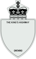
as "Main Street Ontario" and was one of the first roads in what would later become Ontario. It was devised as an overland military route between York (Toronto)...
132 KB (9,529 words) - 17:50, 25 July 2024
was a provincially maintained highway in the Canadian province of Ontario. The route travelled across Muskoka between Highway 11 north of Bracebridge and...
8 KB (699 words) - 17:49, 25 July 2024
List of secondary highways in Timiskaming District (redirect from Ontario Route 558)
province of Ontario. The highway is 7.6 kilometres (4.7 mi) in length, connecting Highway 112 in Dane with the now abandoned Adams Mine site. The route was designated...
17 KB (982 words) - 16:49, 10 April 2023
extension of Highway 118. Highway 121 was a 133.7 km (83.1 mi) route that connected several communities through southcentral Ontario. As it exists today...
20 KB (1,526 words) - 15:56, 28 July 2021
List of secondary highways in Cochrane District (redirect from Ontario Route 572)
connecting Iroquois Falls, Ontario to Highway 11/Trans Canada Highway, and to Highway 101. This provides a very direct route for Timmins-Iroquois Falls...
18 KB (1,354 words) - 10:20, 11 August 2022
It is also a Core Route in the National Highway System of Canada. The route is maintained by the Ministry of Transportation of Ontario (MTO) and patrolled...
232 KB (16,301 words) - 01:29, 5 August 2024
Ontario Highway 118 Prince Edward Island Route 118 National Route 118 National Highway 118 (India) Route 118 (Japan) East London A118 U.S. Route 118 (former)...
4 KB (289 words) - 23:34, 4 April 2024
List of secondary highways in Rainy River District (redirect from Ontario Route 600)
a secondary highway in the Canadian province of Ontario, located in Rainy River District. The route connects Highway 71 (the Trans-Canada Highway) with...
8 KB (525 words) - 15:52, 3 September 2023

enters rural southwestern Ontario, and is dominated by farmland for much of its length through Essex County. The now four-laned route becomes divided as it...
77 KB (6,473 words) - 23:54, 5 August 2024

as Kawartha Lakes Road 35. Ontario portal Highways in Ontario List of Ontario Tourist Routes Breithaupt 1919, p. 62. Ontario Commission on Municipal Institutions...
42 KB (4,201 words) - 16:30, 17 August 2023
provincially maintained highway and the primary route of the Trans-Canada Highway through the Canadian province of Ontario. It begins at the Manitoba boundary, 50 km...
89 KB (6,792 words) - 16:11, 25 July 2024
Canadian province of Ontario. The southwest–northeast route extends from Highway 7 east of Peterborough, to Highway 41 in Denbigh. The route passes over undulating...
21 KB (1,475 words) - 19:33, 26 February 2024

Toronto (redirect from Toronto Municipality, Ontario)
including Georgian Bay, Lake Simcoe, and several rivers. A portage route from Lake Ontario to Lake Huron running through this point, known as the Toronto...
255 KB (21,439 words) - 01:36, 5 August 2024
List of secondary highways in Parry Sound District (redirect from Ontario Route 559)
maintained secondary highway in the Canadian province of Ontario. It is a short and lightly travelled route that connects Highway 69 with the community of Britt...
25 KB (1,585 words) - 21:30, 1 September 2022
Highway 2A Scarborough, Ontario – Was once an expressway in the 1940s until Highway 401 took over most of its current route in 1952. Windsor – Tilbury...
34 KB (3,672 words) - 18:36, 11 July 2024
List of secondary highways in Sudbury District (redirect from Ontario Route 553)
provincially maintained highway in the Canadian province of Ontario, in French River Provincial Park. The route connects Highway 607 to Bon Air and French River...
7 KB (491 words) - 20:51, 31 March 2022
made to the route of Highway 6 in 1997, but it was largely untouched by provincial downloading. Highway 6 is one of two highways in Ontario (the other...
74 KB (5,520 words) - 22:12, 5 August 2024
List of secondary highways in Manitoulin District (redirect from Ontario Route 540)
the isolated and sparsely populated areas in the Manitoulin District of Ontario. Secondary Highway 540, commonly referred to as Highway 540, is the primary...
11 KB (764 words) - 00:18, 19 June 2024
smaller towns and communities. Once the primary east–west route across the southern portion of Ontario, most of Highway 2 was bypassed by Highway 401, which...
85 KB (5,555 words) - 15:06, 2 August 2024
Trans-Canada Highway (TCH), the Georgian Bay Route, and is part of the highest-capacity route from southern Ontario to the Canadian West, via a connection with...
81 KB (6,078 words) - 03:57, 2 August 2024
border between the provinces of Ontario and Quebec, east of which the four lane freeway continues as Autoroute 40. The route proceeds west, south of the former...
63 KB (5,150 words) - 03:11, 4 August 2024
colloquially as the 427, is a 400-series highway in the Canadian province of Ontario that runs from the Queen Elizabeth Way (QEW) and Gardiner Expressway in...
51 KB (4,565 words) - 01:29, 5 August 2024
the southwestern portion of the Canadian province of Ontario. The 91.4-kilometre (56.8 mi) route links Chatham and Sarnia via Wallaceburg, following close...
41 KB (3,728 words) - 17:51, 25 July 2024

eastern terminus of the highway is designated as part of the Central Ontario Route of the Trans-Canada Highway. Travelling east from Donald Cousens Parkway...
84 KB (5,126 words) - 16:13, 25 July 2024
and from the Lake Ontario shoreline in the north to the Ontario and Seneca county lines in the south. The first digit of each route's designation indicates...
31 KB (279 words) - 16:56, 9 February 2024