
Ministère des transports, "Distances routières", page 81, Les Publications du Québec, 2005 Official Transport Quebec Road Map Route 209 at Google Maps v t e...
4 KB (171 words) - 16:18, 14 April 2023

Peninsula. This highway is known as the Navigator's Route. It passes through the Montérégie, Centre-du-Québec, Chaudière-Appalaches, Bas-Saint-Laurent and Gaspésie...
36 KB (575 words) - 14:09, 13 February 2025
are numbered 209: Manitoba Provincial Road 209 Nova Scotia Route 209 Prince Edward Island Route 209 Quebec Route 209 Saskatchewan Highway 209 China National...
3 KB (197 words) - 20:56, 23 January 2025
40 in Quebec" (Map). Google Maps. Retrieved March 19, 2018. Ministère des transports, "Distances routières", page (?), Les Publications du Québec, 2005...
30 KB (633 words) - 08:47, 1 December 2024
Réaménagement de la route 185 en autoroute". Archived from the original on 2018-09-25. Retrieved 2016-10-26. Canada portal Roads portal Transports Québec autoroutes...
8 KB (548 words) - 06:27, 3 March 2025

List of Quebec provincial highways Ministère des transports, "Distances routières", page 79, Les Publications du Québec, 2005 "Route 201 in Quebec" (Map)...
7 KB (228 words) - 22:55, 27 February 2025

Route 117, the Trans Canada Highway Northern Route, is a provincial highway within the Canadian province of Quebec, running between Montreal and the Quebec/Ontario...
18 KB (762 words) - 02:22, 3 December 2024
Canadian French). Gouvernement du Québec. June 14, 2023. Retrieved June 16, 2023. "Réseau routier du Centre-du-Québec : investissement majeur et mise en...
20 KB (681 words) - 13:14, 13 December 2024

Publications du Québec, 2005 Wikimedia Commons has media related to Quebec Route 203. Official Transports Quebec road map (in French) Route 203 on Google...
3 KB (160 words) - 14:19, 2 May 2024

79, Les Publications du Québec, 2005 Provincial Route Map (Courtesy of the Quebec Ministry of Transportation) (in French) Route 202 in Google Maps v t...
9 KB (180 words) - 13:40, 19 December 2022

US border Route 221 runs through historic Odelltown locality. Ministère des transports (2005). Distances routières. Les Publications du Québec. pp. 83–84...
3 KB (185 words) - 00:07, 11 May 2023
the route as "Highway 2-20". "Autoroute 20 in Quebec". Retrieved January 9, 2020. "Répertoire des autoroutes du Québec" (in French). Transports Québec. Retrieved...
48 KB (1,814 words) - 16:08, 25 January 2025
Montreal. Route 2C, now Route 138 in Quebec City. Route 3, now Route 132 between New York State and Levis. Route 3A, now Route 201. Route 4 from New...
11 KB (962 words) - 16:30, 14 November 2024
boulevard Pie XII and the other at Route 201. "Répertoire des autoroutes du Québec - Transports et Mobilité durable Québec". Ministère des Transports (in...
24 KB (1,468 words) - 17:49, 25 April 2025

80, Les Publications du Québec, 2005 Provincial Route Map (Courtesy of the Quebec Ministry of Transportation) (in French) Route 205 in Google Maps v t...
4 KB (107 words) - 02:07, 25 January 2023

Ministère des transports, "Distances routières", page 81, Les Publications du Québec, 2005 Official Transport Quebec Road Map Route 210 on Google Maps v t e...
4 KB (178 words) - 02:07, 25 January 2023

Malone. At the north end it connects to Vélo Québec Quebec Route Verte No.2. New York State Bicycle Route 14 runs from the border of Yates and Ontario...
28 KB (2,399 words) - 05:03, 24 April 2025

), Les Publications du Québec, 2005 Provincial Route Map (Courtesy of the Quebec Ministry of Transportation) (in French) Route 293 on Google Maps v t...
2 KB (91 words) - 02:01, 25 January 2023
restaurants, gift shops, a school and a hospital. It is also home to a huge Hydro-Québec employee facility, from where guided tours to the Robert-Bourassa power...
8 KB (631 words) - 17:18, 17 March 2025

route is in Memphrémagog RCM. List of Quebec provincial highways Ministère des transports, "Distances routières", page 81, Les Publications du Québec...
3 KB (100 words) - 02:07, 25 January 2023
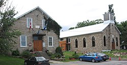
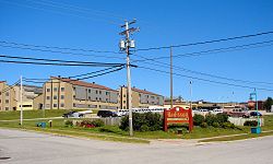
88917 (Saint-Antoine-Abbé, Franklin, QC)) – a village located along Quebec Route 209. The first settler, Asa Smith, came to this area circa 1788. He was...
11 KB (689 words) - 15:02, 6 October 2024

home to most government offices for the county, including the Sûreté du Québec, and has French and English elementary schools. Campbell's Bay is in the...
10 KB (552 words) - 21:34, 1 December 2024

Churubusco–Franklin Centre Border Crossing (category 1933 establishments in Quebec)
via southbound Quebec Route 209 at this location, but they must return via another route instead of taking northbound New York State Route 189. This is...
3 KB (230 words) - 22:19, 25 January 2025

Longueuil (redirect from Longueil, Québec)
"Banque de noms de lieux du Québec: Reference number 36793". toponymie.gouv.qc.ca (in French). Commission de toponymie du Québec. "Fêtes du 350e de Longueuil —...
65 KB (3,884 words) - 00:03, 23 April 2025

Montréal–Trudeau International Airport (redirect from P.E. Trudeau Airport, Quebec)
airport. It is the nearest station on the Québec City-Windsor Corridor and offers inter-city rail connections to Quebec City, Ottawa, Kingston and Toronto as...
113 KB (7,248 words) - 14:49, 26 April 2025
Clinton from a junction with U.S. Route 11 (US 11) to the Canada–US border, where it continues into Quebec as Route 209. In between, the two-lane NY 189...
8 KB (748 words) - 03:23, 17 January 2025

Roquemont.: 108, 209–211 Kirke was knighted in 1633. "KIRKE, SIR DAVID, adventurer, trader, colonizer, leader of the expedition that captured Quebec in 1629,...
7 KB (830 words) - 11:12, 10 April 2025

Roussillon Regional County Municipality (redirect from Rousillon County Regional Municipality, Quebec)
References: 2021 2016 2011 Highways and numbered routes that run through the municipality, including external routes that start or finish at the county border:...
9 KB (200 words) - 02:15, 4 December 2024

Canada which comprises the northern third of the province of Quebec, part of the Nord-du-Québec region and nearly coterminous with Kativik. Covering a land...
34 KB (3,074 words) - 05:55, 15 February 2025

cities in Quebec "Banque de noms de lieux du Québec: Reference number 55854". toponymie.gouv.qc.ca (in French). Commission de toponymie du Québec. "Répertoire...
12 KB (638 words) - 01:14, 18 April 2025