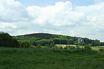
The Vaalserberg (Dutch pronunciation: [ˈvaːlsərˌbɛr(ə)x]) is a hill with a height of 322.4 metres (1,058 ft) above NAP and is the highest point in the...
7 KB (585 words) - 12:28, 6 December 2024
Keutenberg (163 metres; 535 ft) Mount Saint Peter (171 metres; 561 ft) Vaalserberg (322.4 metres; 1,058 ft) Vrouwenheide (211 metres; 692 ft) List of volcanoes...
2 KB (134 words) - 05:23, 25 January 2024
−7 m (−23 ft), below sea level. highest point on European mainland: Vaalserberg 322.7 m (1,059 ft) above sea level. highest point (including the Caribbean...
20 KB (1,613 words) - 12:14, 27 June 2024
far southeast, up to a height of no more than 322 m (1,056 ft) at the Vaalserberg, and some low hill ranges in the central parts. Most of the areas below...
210 KB (20,219 words) - 00:30, 12 December 2024
(900 acres). After 1830, the territory's northernmost border point at Vaalserberg connected it to a quadripoint shared additionally with the Dutch Province...
28 KB (2,571 words) - 10:13, 29 September 2024
Drielandenpunt and very near the highest point in the Netherlands, the Vaalserberg. The Vaalserberg was previously known as "Hubertusberg", so named for the eighth...
15 KB (1,163 words) - 19:41, 12 October 2024
the south, Limburg is bordered by the Belgian province of Liège. The Vaalserberg is on the extreme southeastern point, marking the tripoint of the Netherlands...
54 KB (5,541 words) - 21:33, 13 December 2024
the exact point is in a lake, but a marker is built on that point) the Vaalserberg of the Netherlands, Germany, and Belgium the "Dreiländereck" of Germany...
11 KB (1,182 words) - 13:41, 11 December 2024
22778°E / 53.18028; 7.22778 (East: Nieuweschans)) Highest Point — Vaalserberg (327.5 m above sea level) (50°45′17″N 6°01′15″E / 50.75472°N 6.02083°E...
4 KB (550 words) - 02:21, 22 November 2024
foothills of the High Fens, with the university hospital visible, from the Vaalserberg, the highest elevation in Aachen and of the European part of the Netherlands...
110 KB (10,231 words) - 01:49, 14 November 2024
Republic claim all of Western Sahara. Borders China. The summit of the Vaalserberg at 322.7 m (1059 ft) is the highest point in the European Netherlands...
50 KB (2,114 words) - 23:49, 20 December 2024
it. The eastern end point is the tripoint (together with Germany) at Vaalserberg. The border between Belgium and the Netherlands came into existence with...
8 KB (926 words) - 07:38, 22 December 2024
from flooding. Previously, the highest point of the Netherlands was the Vaalserberg in Limburg at only 322.7 m (1,059 ft), but with the constitutional reform...
85 KB (8,381 words) - 13:41, 19 December 2024
estuary in the north to the Belgium–Germany–Netherlands tripoint at Vaalserberg. The length of the border is around 570 kilometres (350 mi) in length...
11 KB (1,388 words) - 13:01, 7 November 2024
corners No Man's Heath Tres Fronteras Triple Frontier Three-Country Cairn Vaalserberg "Shared Solution: Four Corners". NGS Survey Monument Data Sheet. United...
30 KB (2,679 words) - 03:05, 23 October 2024
411 ft) 44 Belarus Dzyarzhynskaya Hara 345 m (1,132 ft) 45 Netherlands Vaalserberg 321 m (1,053 ft) 46 Estonia Suur Munamägi 318 m (1,043 ft) 47 Latvia...
12 KB (515 words) - 17:55, 22 November 2024
media related to Mount Scenery. List of volcanoes in the Netherlands Vaalserberg - the highest point in the Netherlands in Europe "Hoogste punt Nederland...
21 KB (1,830 words) - 17:03, 21 December 2024
Fells England (Cumbria) Mount Kinka (Gifu) 329 1,079 Gifu, Japan Vaalserberg 321 1,053 Netherlands (Limburg) Mount Bates 319 1,047 Norfolk Island...
139 KB (176 words) - 00:16, 8 December 2024
convergence of Belgium, Prussia/Germany, the Netherlands, and Moresnet at Vaalserberg. Moresnet was never truly a country but rather only a neutral territory...
51 KB (5,537 words) - 00:55, 2 November 2024
contains the highest point above sea level in mainland Netherlands, the Vaalserberg being 322.5 metres (1,058 ft) above sea level (the highest point of the...
7 KB (475 words) - 23:47, 25 December 2023
entirely within the boundaries of Dutch Limburg, except right after the Vaalserberg climb, there is a short passage through Gemmenich in Belgium. Past editions...
44 KB (3,276 words) - 11:39, 28 August 2024
7°13′40″E South: 50°45′01.5″N 5°54′54.0″E West: 51°18′57″N 3°21′30″E High: Vaalserberg 322 m (1,056 ft) Low: Zuidplaspolder −6.7 m (−22 ft) Land boundaries:...
15 KB (1,165 words) - 11:31, 15 November 2024
originates in Germany below the tripoint Germany-Belgium-Netherlands at Vaalserberg and flows through Vaalserquartier. From Vaals through Lemiers to Mamelis...
3 KB (286 words) - 16:08, 16 September 2020
m) Hochtumskopf (510 m) Côte de Stockeu (506 m) Croix Scaille (505 m) Vaalserberg (323 m) Côte de La Redoute (292 m) Croix de Charneux (269 m) Bovenste...
3 KB (370 words) - 18:07, 12 April 2023
the Netherlands, because from the top you can see over the top of the Vaalserberg, to see the even higher hills from the German Eifel. On the Vrouwenheide...
4 KB (382 words) - 15:52, 30 May 2022
52°28′28″N 3°56′17″W / 52.4745°N 3.93816°W / 52.4745; -3.93816 322 m Vaalserberg Heuvelland Netherlands road Vaals & Plombières & Aachen The highest...
22 KB (238 words) - 19:17, 11 December 2024
06°08′15″E / 50.12972°N 6.13750°E / 50.12972; 6.13750 Europe - West Vaalserberg Belgium Germany Netherlands 50°45′16″N 06°01′15″E / 50.75444°N 6...
32 KB (587 words) - 08:28, 2 December 2024
155 km/h Eschen Luxembourg 144 km/h Wincrange Netherlands 116 km/h Vaalserberg Poland 176 km/h Śnieżka Sweden 145 km/h Karlskrona Switzerland 164...
16 KB (1,258 words) - 07:54, 29 March 2024
into the Belgian State Forest, and its western part, in the region of Vaalserberg hills, into the Dutch State Forest. The ridge runs from west to east...
7 KB (745 words) - 15:45, 11 October 2024
Siebengebirge Drachenfels (321 m), Rhine-Sieg district, Siebengebirge Vaalserberg (322.50 m), Germany-Belgium-Netherlands border, Aachen Forest Heidbrink...
31 KB (2,447 words) - 23:06, 27 February 2024


