
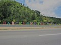
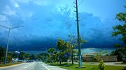
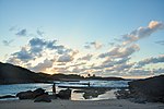
Manatí (Spanish pronunciation: [manaˈti]) is a city and municipality of Puerto Rico on the northern coast, north of Morovis and Ciales; east of Florida...
33 KB (2,263 words) - 16:52, 30 September 2024
Karst region of Puerto Rico, on the shores of the Atlantic Ocean. It is bordered by the municipalities of Arecibo, Florida, and Manatí. In terms of physical...
34 KB (2,727 words) - 21:20, 27 September 2024
Manatí barrio-pueblo is a barrio and the administrative center (seat) of Manatí, a municipality of Puerto Rico. Its population in 2010 was 5,746. Manatí...
11 KB (863 words) - 20:22, 13 August 2024
Coto Norte (redirect from Coto Norte, Manatí, Puerto Rico)
the municipality of Manatí, Puerto Rico. Its population in 2010 was 11,250. Coto Norte was in Spain's gazetteers until Puerto Rico was ceded by Spain in...
8 KB (523 words) - 18:34, 11 January 2024
Tierras Nuevas Poniente (redirect from Tierras Nuevas Poniente, Manatí, Puerto Rico)
municipality of Manatí, Puerto Rico. Its population in 2010 was 3,614. Tierras Nuevas Poniente was in Spain's gazetteers until Puerto Rico was ceded by Spain...
8 KB (485 words) - 07:10, 1 January 2024

Puerto Rico (USA)". Sea Around Us. Retrieved February 24, 2024. "Ley Núm. 257 de 2011: Ley del "Día de la Conservación del Manatí Caribeño en Puerto Rico" y...
44 KB (4,017 words) - 14:41, 17 October 2024

eleven bridges destroyed. Flooding forced the closure of Puerto Rico Highway 2 between Manatí and Barceloneta. The depression left more than $40 million (1970 USD$...
92 KB (8,678 words) - 12:24, 14 October 2024

Bajura Afuera (redirect from Bajura Afuera, Manatí, Puerto Rico)
the municipality of Manatí, Puerto Rico. Its population in 2010 was 677. Bajura Afuera was in Spain's gazetteers until Puerto Rico was ceded by Spain in...
6 KB (396 words) - 14:31, 27 December 2023

Manatí Bridge at Mata de Plátano, also known as Puente Juan José Jiménez and listed as Bridge #321 in Puerto Rico's bridge inventory, was built in 1905...
7 KB (533 words) - 20:13, 19 September 2024

Río Arriba Saliente (redirect from Río Arriba Saliente, Manatí, Puerto Rico)
municipality of Manatí, Puerto Rico. Its population in 2010 was 3,592. Río Arriba Saliente was in Spain's gazetteers until Puerto Rico was ceded by Spain...
7 KB (429 words) - 06:41, 1 January 2024

municipality located on the coast of north central Puerto Rico. It is north of Morovis, east of Manatí, and west of Vega Alta. Vega Baja is spread over 14 barrios...
35 KB (2,996 words) - 00:59, 13 August 2024

Tierras Nuevas Saliente (redirect from Tierras Nuevas Saliente, Manatí, Puerto Rico)
municipality of Manatí, Puerto Rico. Its population in 2010 was 6,757. Tierras Nuevas Saliente was in Spain's gazetteers until Puerto Rico was ceded by Spain...
10 KB (728 words) - 07:11, 1 January 2024

municipality of Puerto Rico located in the karst region north of Ciales, south of Barceloneta, east of Arecibo, and west of Manatí. Florida is not like...
26 KB (2,208 words) - 20:48, 27 September 2024

Río Arriba Poniente (redirect from Río Arriba Poniente, Manatí, Puerto Rico)
municipality of Manatí, Puerto Rico. Its population in 2010 was 1,857. Río Arriba Poniente was in Spain's gazetteers until Puerto Rico was ceded by Spain...
7 KB (404 words) - 15:39, 18 January 2024

Bajadero, Sector Cuesta Manatí, Sector El Maga, and Siverio Apartments. Puerto Rico portal List of communities in Puerto Rico List of barrios and sectors...
9 KB (656 words) - 04:56, 7 February 2024

Coto Sur (redirect from Coto Sur, Manatí, Puerto Rico)
the municipality of Manatí, Puerto Rico. Its population in 2010 was 8,184. Coto Sur was in Spain's gazetteers until Puerto Rico was ceded by Spain in...
7 KB (484 words) - 04:21, 28 December 2023

Bajura Adentro (redirect from Bajura Adentro, Manatí, Puerto Rico)
the municipality of Manatí, Puerto Rico. Its population in 2010 was 2,436. Bajura Adentro was in Spain's gazetteers until Puerto Rico was ceded by Spain...
6 KB (392 words) - 14:30, 27 December 2023

and municipality of Puerto Rico, located on the Central Mountain Range, northwest of Orocovis; south of Florida and Manatí; east of Utuado and Jayuya;...
59 KB (4,965 words) - 20:23, 27 September 2024
Civic Architecture in Porto Rico, 1920 Having been a Spanish possession until 1898, the system of local government in Puerto Rico bears more resemblance...
122 KB (1,777 words) - 00:55, 18 September 2024

town and municipality of Puerto Rico located in the central region of the island, north of Orocovis, south of Manatí, Vega Baja and Vega Alta; east of...
39 KB (3,007 words) - 16:56, 30 September 2024

the south of Manatí and the north region of Coamo. By 1823 Orocovis was a barrio of Barranquitas while Morovis (previously part of Manatí) had a barrio...
31 KB (2,540 words) - 20:33, 30 September 2024

league represents Puerto Rico in the annual Caribbean World Series. The LBPRC currently has six teams: Atenienses de Manatí (Manatí Athenians) Cangrejeros...
50 KB (6,447 words) - 21:57, 3 October 2024

The flag of Puerto Rico (Spanish: Bandera de Puerto Rico), officially the flag of the Commonwealth of Puerto Rico (Spanish: Bandera del Estado Libre Asociado...
137 KB (13,420 words) - 08:54, 17 October 2024

The 1899 Puerto Rico census (Porto Rico was also used) was a national population census held in Puerto Rico and first under U.S. control by the U.S. Census...
16 KB (721 words) - 03:39, 12 July 2024

the agricultural industry of Puerto Rico when Hurricane Maria hit Puerto Rico on September 20, 2017. The Manatí Bridge at Mata de Plátano, built in 1905...
12 KB (1,029 words) - 03:55, 16 July 2024

Retrieved 2018-12-29. "Report of the Census of Porto Rico 1899". War Department Office Director Census of Porto Rico. Archived from the original on July 16,...
11 KB (839 words) - 01:38, 6 February 2024

1911 a new line going through Condado in Santurce is constructed by the Porto Rico Railway, Light & Power Co. Locally referred to as the Trolley de San Juan...
28 KB (3,318 words) - 16:35, 20 August 2024

Río Cañas, Río Cibuco, Río Grande de Manatí, Río Guadiana and Río Mavilla. Like all municipalities of Puerto Rico, Naranjito is subdivided into barrios...
28 KB (2,154 words) - 00:58, 13 August 2024

transferred to bigger hospitals in nearby towns such as Bayamón or Manatí. Puerto Rico Highway 22 provides access to Dorado from the far away city of Mayagüez...
92 KB (10,462 words) - 00:52, 18 October 2024

Río Grande de Manatí, Piñonas, Río Hondo, and Río Usabón. There are 14 bridges in Barranquitas. Like all municipalities of Puerto Rico, Barranquitas is...
36 KB (2,483 words) - 19:55, 27 September 2024