
of São Paulo Brazilian Highway System "Tudo sobre a Rodovia Raposo Tavares". Rodovia Raposo Tavares (in Portuguese). Retrieved 12 February 2024. v t e...
4 KB (178 words) - 15:47, 12 February 2024
Look up Tavares in Wiktionary, the free dictionary. Tavares may refer to: Tavares, Paraíba Tavares, Rio Grande do Sul Rodovia Raposo Tavares, the longest...
834 bytes (127 words) - 16:17, 11 October 2019

The city is at an elevation of 853 m. Cotia is linked with the Rodovia Raposo Tavares highway. The municipality is made up of the headquarters and the...
7 KB (431 words) - 12:39, 8 October 2024

population is 25,479 (2020 est.) in an area of 1028 km². The highway Rodovia Raposo Tavares passes south of the city. There is controversy about the meaning...
6 KB (340 words) - 03:20, 28 May 2024

connecting to Rodovia Castelo Branco and Rodovia Raposo Tavares. SP-332: Rodovia General Milton Tavares de Souza to Paulínia. SP-101: Rodovia Francisco Aguirre...
7 KB (725 words) - 01:28, 28 May 2024
Presidente Dutra Rodovia Ayrton Senna Rodovia Castelo Branco Rodovia Fernão Dias Rodovia Raposo Tavares Rodovia Régis Bittencourt Rodoanel Mário Covas...
14 KB (512 words) - 21:27, 12 September 2024

altitude of 771 m. São Roque is connected by two main highways: Rodovia Raposo Tavares and Rodovia Castelo Branco. It is located 60 km west from the state capital...
6 KB (344 words) - 18:34, 27 May 2024

For example, the longest highway in the state of São Paulo, the Rodovia Raposo Tavares, is designated as SP-270 and SP-295. Canada is divided into provinces...
16 KB (1,776 words) - 01:35, 5 August 2024
Rodovia Marechal Cândido Rondon SP-270: Rodovia Raposo Tavares SP-075: Rodovia Santos Dumont SP-310: Rodovia Washington Luís Other important double- or...
11 KB (1,192 words) - 12:07, 8 August 2024

Roads of Osasco: Rodovia Castelo Branco (SP-280), Rodovia Anhangüera (SP-330), Rodoanel Mário Covas (SP-21) and Rodovia Raposo Tavares (SP-270). São Paulo...
28 KB (1,857 words) - 09:01, 27 September 2024

links Via Anchieta and Rodovia dos Imigrantes directly to Rodovia Régis Bittencourt (heading South of Brazil), Rodovia Raposo Tavares (westbound of São Paulo...
33 KB (2,953 words) - 11:54, 5 October 2024

It is connected with São Paulo by two major highways, the Rodovia Raposo Tavares and Rodovia Castelo Branco. Several companies offer bus services to neighbouring...
7 KB (421 words) - 17:43, 27 May 2024

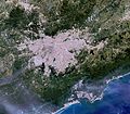
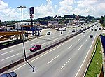
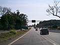
(2 lanes or more of traffic in each direction). With 654 km, the Rodovia Raposo Tavares (SP-270) is the longest highway in the state and connects the capital...
182 KB (17,495 words) - 01:55, 18 October 2024
often referred to as Granja Viana as well. It can be accessed via the Raposo Tavares Highway. In Cotia itself, it occupies an area of 50 km2, with a population...
10 KB (1,040 words) - 12:53, 9 October 2024
ones being "101 FM" and "98 FM". SP-270 Rodovia Raposo Tavares SP-425 Rodovia Assis Chateaubriand SP-501 Rodovia Júlio Budisk Presidente Prudente has scheduled...
12 KB (719 words) - 12:38, 30 August 2024

The Rodovia Anchieta (Anchieta Highway, official designation SP-150) is a highway connection between São Paulo and the Atlantic coast, the cities of Cubatão...
3 KB (354 words) - 15:33, 3 May 2024

concession to three private companies: SPVias, Rodovias das Colinas and ViaOeste. Together with the Raposo Tavares Highway (SP-270), it links the capital of...
5 KB (480 words) - 04:50, 24 November 2023

including the BR-116, Rodovia dos Bandeirantes, Rodovia Raposo Tavares, the Rodovia Anhangüera, Rodovia dos Imigrantes, Rodovia Castelo Branco, and Via...
18 KB (2,140 words) - 11:22, 11 August 2024

The Rodovia Castelo Branco passes just north of the city, in Barueri. It is also possible to access Carapicuíba from the Rodovia Raposo Tavares, which...
12 KB (1,093 words) - 10:12, 11 October 2024

The Rodovia Presidente Dutra, (BR-116 – or SP-060 in the state of São Paulo), colloquially known as Via Dutra is a federal highway which runs through...
7 KB (495 words) - 04:48, 4 April 2024

Avenida/Rodovia Benedito Pires (Benedito Pires Highway/Avenue) - Connects Assis to Cândido Mota. Four-lane highway. SP-270 - Rodovia Raposo Tavares (Raposo Tavares...
20 KB (1,604 words) - 03:35, 29 September 2024
state of São Paulo, Brazil. Until 2010, this highway was called Rodovia General Milton Tavares de Souza. Just 23 km long, this double-lane highway has a high...
3 KB (171 words) - 07:17, 11 March 2023

Soares (Sorocaba - Piedade) SP-91/270 - Rodovia Dr. Celso Charuri (interligação entre as rodovias Raposo Tavares e Senador José Ermírio de Morais (Castelinho)...
33 KB (3,304 words) - 03:47, 2 September 2024

The Rodovia dos Imigrantes (official designation SP-160) is a highway in the state of São Paulo, Brazil. The highway connects the city of São Paulo to...
5 KB (484 words) - 02:10, 28 May 2024

'Rodovia Régis Bittencourt is a section of the BR-116 that connects the cities of Taboão da Serra and Curitiba, Paraná. It is considered one of the most...
4 KB (270 words) - 11:13, 8 June 2024

The Rodovia Anhanguera (official designation SP-330) (In English: Anhanguera Highway) is a highway in the state of São Paulo, Brazil. It is one of the...
8 KB (853 words) - 17:23, 21 July 2024
The Rodovia Fernão Dias (official designation BR-381 or SP-010 in the state of São Paulo) is a federal highway which runs in the Brazilian states of São...
4 KB (195 words) - 07:11, 10 March 2023
SP-215 (São Paulo highway) (redirect from Rodovia Luís Augusto de Oliveira)
consists of the Rodovia Luís Augusto de Oliveira, Rodovia Dr. Paulo Lauro and Rodovia Deputado Vicente Botta. "Pesquisa de Rodovias". DER/SP. Retrieved...
680 bytes (46 words) - 15:52, 24 August 2024
SP-55 (São Paulo highway) (redirect from Rodovia Padre Manuel da Nóbrega)
up to Pedro de Toledo (BR-116) The highway is split into four sections: Rodovia Manuel Hipólito Rego, Doutor - from - to: Ubatuba - Bertioga Unnamed section...
2 KB (135 words) - 23:52, 26 May 2024

From the village of São Paulo, the bandeirantes headed by Antônio Raposo Tavares, Manuel Preto, and André Fernandes [pt], among others, departed.[full...
58 KB (6,394 words) - 02:01, 17 August 2024