
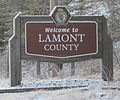
Wostok (Russian: Восток) is a hamlet in Alberta, Canada within Lamont County. It is located on Range Road 173, approximately 5 kilometres (3.1 mi) south...
5 KB (157 words) - 03:49, 10 September 2023

Vostok Island (redirect from Wostok Island)
Island, Bostock Island, Leavitts Island, Reaper Island, Wostock Island or Wostok Island. The island was first sighted in 1820 by the Russian explorer Fabian...
10 KB (1,003 words) - 14:59, 1 July 2024

original on 2014-07-24. Retrieved 2014-07-25. "Separatystycznym batalionem Wostok dowodził były dowódca ukraińskiego specnazu" (in Polish). Wiadomosci.gazeta...
21 KB (1,397 words) - 08:20, 8 February 2024
No. 516 was incorporated, uniting the three smaller districts of Pines, Wostok, and Leslie. The office was at the town of Lamont and the first council...
12 KB (617 words) - 03:43, 2 May 2022

working for photography agency Wostok in September 2002 where he initially began photographing demonstrations. After leaving Wostok in 2005, Ochlik founded the...
22 KB (2,043 words) - 05:08, 28 June 2024

Alberta - after Stryi, Stryi Raion, Lviv Oblast. Ukalta, Alberta, north of Wostok off Secondary Highway 855 near the North Saskatchewan River - possibly a...
65 KB (6,493 words) - 20:57, 30 June 2024

With a land area of 5.6 km2 (2.2 sq mi), it had a population density of 194.3/km2 (503.2/sq mi) in 2021. Cypress County indicates that the population of...
6 KB (397 words) - 06:02, 13 July 2024

Municipalities and Their Communities" (PDF). Alberta Municipal Affairs. June 3, 2024. Retrieved June 14, 2024. "Population and dwelling counts, for Canada...
9 KB (504 words) - 02:37, 24 October 2023
reporter-photographer during the French presidential campaign in 2007 for Wostok Press agency. He was awarded a grant from the Pulitzer Center on Crisis...
5 KB (333 words) - 00:46, 11 July 2023

Commission". "County Council Meeting (minutes)" (PDF). Ponoka County. September 3, 2013. p. 2. Archived from the original on May 12, 2015. Retrieved December...
17 KB (1,205 words) - 03:31, 10 September 2023
central Alberta, Canada within Parkland County. It is located 5 kilometres (3.1 mi) south of Highway 16, approximately 30 kilometres (19 mi) west of Spruce...
5 KB (259 words) - 01:19, 9 May 2022

population of 432 living in 189 of its 213 total private dwellings, a change of 3.3% from its 2016 population of 418. With a land area of 1.55 km2 (0.60 sq mi)...
12 KB (980 words) - 03:12, 27 January 2024

of 1,280 metres (4,200 ft). The hamlet is located in Census Division No. 3 and in the federal riding of Lethbridge. In the 2021 Census of Population...
9 KB (395 words) - 03:47, 10 November 2023

Louise, Duchess of Argyll, it lies in Alberta's Rockies on the Bow River, 3 km (1.9 mi) northeast of the lake that shares its name. Initially settled...
12 KB (837 words) - 19:46, 27 June 2024

List of municipal districts in Alberta (redirect from Wostok No. 546, Alberta)
Areas Board "2024 Municipal Codes" (PDF). Alberta Municipal Affairs. June 3, 2024. Retrieved June 14, 2024. "Municipal Government Act". Alberta Queen's...
70 KB (1,217 words) - 19:48, 19 May 2024

1944, the M.D. of Pines No. 516 was united with the municipal districts of Wostok and Leslie to form the M.D. of Lamont No. 516.[citation needed] It was later...
9 KB (517 words) - 16:40, 8 March 2024

32% change from its 2011 population of 562. With a land area of 9.53 km2 (3.68 sq mi), it had a population density of 77.9/km2 (201.7/sq mi) in 2016....
15 KB (902 words) - 22:22, 5 March 2024
having representation on Mackenzie County Council by two councillors. Ward 3, which is west of 99 Street, is represented by Peter Braun, while Ward 4,...
15 KB (982 words) - 19:32, 18 May 2024
With a land area of 21.68 km2 (8.37 sq mi), it had a population density of 3.4/km2 (8.8/sq mi) in 2016. It is based mainly around the oil and gas industry...
7 KB (309 words) - 14:23, 5 January 2024

Sewage Systems 2009 Standard of Practice Handbook: Appendix A.3 Alberta Design Data (A.3.A. Alberta Climate Design Data by Town)" (PDF) (PDF). Safety Codes...
17 KB (1,153 words) - 16:43, 17 June 2024
Ukrainian priests in Canada. In 1896, a group of Russophile Ukrainians from Wostok, Northwest Territories wrote to the Russian Bishop of Alaska asking for...
6 KB (690 words) - 18:09, 3 June 2024

Group. Of the five coal seams at Nordegg, two were mined: the No. 2 and No. 3 Seams, which averaged 7.75 feet (2.36 m) and 15.92 feet (4.85 m) thick, respectively...
19 KB (1,253 words) - 04:09, 10 September 2023

(Glenmore Trail) and Highway 797, approximately 6 km (3.7 mi) south of the Trans Canada Highway and 7 km (4.3 mi) north of Highway 22X. It has an elevation of...
19 KB (1,344 words) - 18:04, 9 June 2024
within Alberta's Rockies at Highway 1 exit 98, approximately 7 kilometres (4.3 mi) southeast of Canmore and 78 kilometres (48 mi) west of Calgary. A variety...
11 KB (872 words) - 20:30, 22 April 2024
approximately 90 kilometres (56 mi) west of downtown Calgary and 15 kilometres (9.3 mi) east of Canmore, Exshaw is situated within the Bow River valley north...
18 KB (1,575 words) - 18:22, 9 June 2024

270 of its 290 total private dwellings, a 3.2% change from its 2011 population of 661. With a land area of 3.58 km2 (1.38 sq mi), it had a population density...
13 KB (935 words) - 18:59, 27 June 2024

Canada (April 3, 2013). "1971 Census of Canada : population : vol. I - part 3 = Recensement du Canada 1971 : population : vol. I - partie 3. Ethnic groups"...
39 KB (2,234 words) - 19:39, 8 May 2024
Municipalities and Their Communities" (PDF). Alberta Municipal Affairs. June 3, 2024. Retrieved June 14, 2024. "Population and dwelling counts, for Canada...
6 KB (313 words) - 03:06, 10 September 2023
Municipalities and Their Communities" (PDF). Alberta Municipal Affairs. June 3, 2024. Retrieved June 14, 2024. Marden, Ernest G.; Marden, Austin (2010)....
5 KB (272 words) - 02:23, 9 May 2022

population of 298 living in 153 of its 178 total private dwellings, a change of -0.3% from its 2016 population of 299. With a land area of 2.8 km2 (1.1 sq mi)...
8 KB (430 words) - 20:00, 1 March 2024