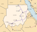
Ad-Damazin (Arabic: الدمازين, romanized: Ad-Damāzīn) is the capital city of Blue Nile, Sudan. It is the location of the Roseires Dam and power generation...
11 KB (522 words) - 23:51, 2 November 2024
11°47′03″N 34°20′44″E / 11.78403°N 34.34567°E / 11.78403; 34.34567 Ad Damazin is a district of Blue Nile state, Sudan, with a total population of 186...
4 KB (105 words) - 14:17, 20 October 2022
the bridge between Roseires and Ad-Damazin on July 15, preventing refugees from fleeing. All roads to and from Ad-Damazin were closed as well. Fighting...
32 KB (3,462 words) - 18:49, 7 September 2024
sub-divided into six districts (with 2006 Census populations shown hereafter): Ad-Damazin (212,712) Al Kormok (110,815) Ar Roseires (215,857) Tadamon (77,668) Bau...
9 KB (696 words) - 14:13, 23 October 2024
Managil Al-Sireha Al Qadarif Atbara Babanusa Berber Buwaidhaa Delgo Dongola Ad-Damazin Ed Dueim El Ait El Gebir En Nahud El-Obeid Er Rahad Foro Baranga Geneina...
3 KB (215 words) - 14:38, 27 October 2024
governor of the town of Asosa, Ahmed Khalifa, on 7 July 2007 fled to Ad-Damazin, the capital of the Blue Nile State, in Sudan. Khalifa was accused by...
13 KB (760 words) - 07:44, 16 September 2024
The Roseires Dam (Arabic: خزان الروصيرص) is a dam on the Blue Nile at Ad Damazin, just upstream of the town of Er Roseires, in Sudan. It consists of a...
4 KB (321 words) - 20:15, 2 November 2024
Other lines connect Atbarah and Sannar with Port Sudan, and Sannar with Ad Damazin. A 1,400-kilometer line serves the al Gezira cotton-growing region. A...
36 KB (3,452 words) - 04:46, 20 June 2024
Other lines connect Atbara and Sennar with Port Sudan, and Sennar with Ad-Damazin. A 1,400-kilometer line serves the Al Jazirah cotton-growing region. There...
32 KB (3,203 words) - 21:42, 15 August 2024
speak the Gaam language. They live around the Tabi Hills, southwest of Ad-Damazin and northwest of Kurmuk in the Blue Nile Province. The capital of the...
11 KB (1,529 words) - 07:05, 12 April 2024
City State Population (2008) Ad-Damazin Blue Nile 136,800 Ad-Du'ayn East Darfur 137,100 Al-Fashir North Darfur 217,800 Al-Junaynah West Darfur 134,300...
66 KB (493 words) - 13:59, 28 October 2024
(20,444 sq mi) 2,519,071 5 Blue Nile النيل الأزرق (an-Nīl al-Azraq) NB ad-Damazin 45,844 km2 (17,700 sq mi) 1,108,391 6 North Darfur شمال دارفور (Shamāl...
14 KB (729 words) - 15:11, 19 August 2024
of the plains surrounding the reservoir of the Roseires Dam located at Ad-Damazin, just as the Tekeze Dam, by retaining a reservoir in the deep gorges of...
98 KB (10,787 words) - 05:15, 3 November 2024
Russia CN Tower Toronto, Canada Norcem silos Brevik, Norway Roseires Dam Ad Damazin, Sudan Wanapum Dam Washington, US LNG tanks South Hook, Wales Ringhals...
63 KB (6,093 words) - 08:33, 25 September 2024
Khartoum 21 2013 Al-Merrikh SC 2–0 (awarded) Al-Hilal Club Ad Damazin Stadium, Ad Damazin 22 2014 Al-Merrikh SC 3–1 Al-Hilal Club Khartoum Stadium, Khartoum...
8 KB (49 words) - 18:18, 25 June 2024
Sudanese military said that the SPLM-N militants attacked army positions in Ad-Damazin, the capital of Blue Nile state, on 1 September. Governor of Blue Nile...
193 KB (19,592 words) - 23:47, 12 September 2024
District Butana District Qala al-Nahl District [ar] Al-Quresha District [ar] Ad Damazin District Al Roseires District Geissan District Baw District Al Kurumik...
7 KB (424 words) - 03:14, 15 July 2024
about 50 kilometres (31 mi) from the capital of the Blue Nile region, Ad-Damazin, and approximately 511 kilometres (318 mi) from Sudan's capital, Khartoum...
11 KB (1,021 words) - 14:35, 20 October 2024
University of Blue Nile Type Public Established 1995 Location Ad-Damazin , Blue Nile , Sudan 11°47′06″N 34°20′49″E / 11.785°N 34.347°E / 11.785; 34...
2 KB (100 words) - 19:59, 29 October 2024
also exists between Hayya and Sennar via Kassala. Other lines connect Ad-Damazin with Malakal in South Sudan and Nyala with Geneina and al-Fashir. Modest...
26 KB (3,506 words) - 02:44, 12 July 2024
"IATA Airport Code Search". International Air Transport Association. Retrieved April 11, 2016. AIP Argentina - AD 1.3 INDICE DE AERODROMOS Y HELIPUERTOS...
43 KB (229 words) - 13:26, 24 October 2024
Atbara Airport Carthago Red Sea HSCG Carthago Airport Damazin (Ad Damazin) Blue Nile HSDZ RSS Damazin Airport Dilling (Dalang) South Kurdufan HSDL Dilling...
7 KB (199 words) - 04:57, 11 November 2023
1934 and then worked in Omdurman, Khartoum, Juba, Yei, Sinja, Sennar, Ad-Damazin, Gedaref and El-Obeid.[citation needed] Shaddad worked in the Omdurman...
8 KB (596 words) - 06:10, 23 October 2024
Archived from the original on April 22, 2019. Retrieved May 8, 2020. "Damazin General Hospital" (Map). Google Maps. Retrieved January 18, 2021. "Baraha...
10 KB (282 words) - 17:20, 12 March 2022
currently inaccessible by land. In 2009, 37th such event was held near Ad-Damazin where over 1,500 patients were treated. Pakistan and Sudan regularly engage...
114 KB (5,659 words) - 16:35, 23 October 2024
Kamashi Zone on the east. The major settlement in this woreda is Holma. Ad-Damazin transit center, housing 14,431 displaced Sudanese, is also located in...
4 KB (496 words) - 03:48, 2 April 2024
currently inaccessible by land. In 2009, 37th such event was held near Ad-Damazin where over 1,500 patients were treated. In 2016, Senator Raja Zafar ul...
6 KB (553 words) - 00:13, 19 September 2024
(PDF) (in German). Deutscher Wetterdienst. Retrieved 3 November 2016. "Damazin Climate Normals 1961–1990". National Oceanic and Atmospheric Administration...
26 KB (836 words) - 04:35, 27 May 2024
Blue Nile in the southeastern corner of Sudan, in the area surrounding Ad-Damazin and Er Roseires, and just south-southeast of (across the river from) Famaka...
2 KB (183 words) - 03:45, 21 November 2023
international donors. At Kosti around 72,000 squatters were evicted and at Ad-Damazin 23,000. In 1992, the United States Agency for International Development...
8 KB (849 words) - 16:35, 2 April 2024


