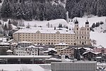
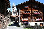
Sumvitg (Romansh pronunciation: [ˈsumvitɕ] ; German: Somvix) is a municipality in the Surselva Region in the canton of Graubünden in Switzerland. Sumvitg...
9 KB (870 words) - 17:48, 27 October 2024
German: Kapelle des Heiligen Benedikt) is a Roman Catholic church located in Sumvitg, Surselva Region, canton of Graubünden, Switzerland. After a 1984 avalanche...
2 KB (189 words) - 22:19, 19 October 2024
Sumvitg-Cumpadials railway station (German: Bahnhof Sumvitg-Cumpadials) is a railway station in the municipality of Sumvitg, in the Swiss canton of Graubünden...
4 KB (192 words) - 19:10, 3 November 2024
Maighels, Rein da Cristallina, Rein da Nalps, Rein da Plattas, Rein da Sumvitg, Rein da Vigliuts, Valser Rhine Posterior Rhine basin: Rein Posteriur/Hinterrhein...
95 KB (10,782 words) - 17:30, 14 November 2024
built for archaeological excavations in Chur and St Benedict's Chapel in Sumvitg. When first shown in exhibition, those photos ignited a lively debate that...
25 KB (2,588 words) - 16:31, 21 October 2024
im Domleschg Sils im Engadin/Segl Silvaplana Soazza St. Moritz Sufers Sumvitg Surses Tamins Thusis Trimmis Trin Trun Tschappina Tschiertschen-Praden...
7 KB (632 words) - 00:18, 21 August 2024
Chapel of S. Maria in Acletta and the Punt Russein bridge (shared with Sumvitg) are listed as Swiss heritage sites of national significance. Chapel of...
17 KB (1,544 words) - 00:46, 16 April 2024
Cumpadials (category Sumvitg)
municipality of Sumvitg, Graubünden, Switzerland. It has a station on the Disentis - Reichenau line of the Rhätische Bahn railway. Sumvitg municipality 46°43′23″N...
639 bytes (52 words) - 06:40, 30 August 2023
Breil/Brigels 11,253 50.64 Disentis/Mustér 2,009 90.99 Medel (Lucmagn) 344 136.22 Sumvitg 1,104 101.88 Tujetsch 1,183 133.91 Trun 1,161 51.9 Obersaxen Mundaun 1...
10 KB (723 words) - 12:11, 1 November 2024
Valais further west). Consequently, its main tributaries, the Rein da Sumvitg, the Glenner and the Rabiusa, all come from the south, or right side of...
10 KB (883 words) - 12:49, 1 November 2024
Erft Right Vorderrhein Rein da Tuma Rein da Curnera Rein da Medel Rein da Sumvitg Glogn Rabiusa Hinterrhein Ragn da Ferrera Albula/Alvra Alpine Rhine Hinterrhein...
5 KB (474 words) - 21:22, 16 October 2024
Rabius-Surrein railway station (category Sumvitg)
(German: Bahnhof Rabius-Surrein) is a railway station in the municipality of Sumvitg, in the Swiss canton of Graubünden. It is an intermediate stop on the 1...
4 KB (156 words) - 21:55, 3 November 2024
Punt Russein (shared with Sumvitg)...
67 KB (191 words) - 23:59, 4 January 2024
Lavaz (2,524 metres), a pass connecting the northern valleys of Medel and Sumvitg. A hut has been erected on the pass by the Swiss Alpine Club, the Medel...
3 KB (229 words) - 02:50, 5 May 2022
Piz Posta Biala (category Sumvitg)
Posta Biala (3,074 m) is a mountain of the Glarus Alps, located north of Sumvitg in the canton of Graubünden. It lies on the range between the Val Russein...
1 KB (62 words) - 16:52, 17 May 2022
Paraguay Piz Posta Biala, a mountain of the Glarus Alps, located north of Sumvitg in the canton of Graubünden Posta del Chuy, a historic inn situated 12...
2 KB (339 words) - 21:07, 4 April 2024
Graubünden. It lies north of Piz Medel, between the Val Medel and the Val Sumvitg. Retrieved from the Swisstopo topographic maps and Google Earth. The key...
1 KB (58 words) - 11:42, 1 May 2022
Sufers Graubünden Suhr Aargau Sulgen Thurgau Sullens Vaud Sumiswald Bern Sumvitg Graubünden Surpierre Fribourg Sursee Lucerne Surses Graubünden Suscévaz...
72 KB (50 words) - 19:02, 4 October 2024
Tödi (category Sumvitg)
Politically, the Tödi is split between the municipalities of Disentis and Sumvitg (Graubünden), and Glarus Süd (Glarus). The central mass of the mountain...
8 KB (991 words) - 16:34, 3 November 2024
Tenigerbad in the canton of Graubünden. It lies north of Piz Medel, in the Val Sumvitg. Retrieved from the Swisstopo topographic maps. The key col is the Fuorcla...
1 KB (54 words) - 11:44, 1 May 2022
Piz Gren (category Sumvitg)
Its summit (2,890 metres (9,480 ft)) lies near the tripoint between Val Sumvitg, Val Gronda, and Val Miedra. Retrieved from the Swisstopo topographic maps...
1 KB (63 words) - 14:07, 4 November 2024
Greina (category Sumvitg)
is a high mountain pass across the western Lepontine Alps, connecting Sumvitg in the canton of Graubünden in Switzerland and Olivone in the canton of...
2 KB (157 words) - 18:51, 21 April 2022
Engadin/Segl Silvaplana Soazza Sufers Sumvitg Surses Tamins Thusis Trimmis Trin...
81 KB (555 words) - 01:00, 15 November 2024
no permanent settlements until the 9th century), Sutsassiala included Sumvitg, Trun and Breil/Brigels. The subjects of Disentis Abbey first used their...
2 KB (319 words) - 10:30, 3 July 2022
jurisdictions (courts): Disentis, Tujetsch, Brigels with Medel, and Trun with Sumvitg. In 1617 the abbey became a member of the recently formed Swiss Congregation...
10 KB (1,088 words) - 15:18, 23 October 2024
code(s) 7149 SFOS number 3606 ISO 3166 code CH-GR Surrounded by Blenio (TI), Lumbrein, Medel (Lucmagn), Sumvitg, Vals Website www.vrin.ch SFSO statistics...
12 KB (1,255 words) - 21:11, 5 November 2024
Cavistrau The south side of the Brigelser Hörner as seen from Val Sumvitg across the Surselva Highest point Peak Cavistrau Grond Elevation 3,251 m (10...
2 KB (124 words) - 11:57, 2 May 2022
Romansh, Switzerland's fourth official language. Candidas was born in Ilanz/Sumvitg and graduated with a Matura from high school in Chur. He worked for health...
6 KB (485 words) - 09:07, 25 October 2024
CH-GR Localities Curaglia, Platta Surrounded by Blenio (TI), Disentis/Mustér, Quinto (TI), Sumvitg, Tujetsch, Vrin Website www.medel.ch SFSO statistics...
7 KB (732 words) - 13:16, 29 March 2024
Piz Avat (category Sumvitg)
Piz Avat is a mountain of the Glarus Alps, located north of Sumvitg in the canton of Graubünden. It overlooks the Val Russein on its west side. Retrieved...
1 KB (55 words) - 03:34, 30 April 2022


