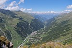
The Navizence is a 23-kilometer-long Swiss river located in the Anniviers Valley, in the canton of Valais. It is a left-bank tributary of the Rhône River...
35 KB (2,879 words) - 00:16, 31 October 2024
tributaries of the Rhône are, from source to mouth: Massa (right) Vispa (left) Navizence (left) Sionne (left) Drance (left) Trient (left) Venoge (right, Lake Geneva)...
26 KB (2,808 words) - 06:31, 21 October 2024
Martigny) Sionne - 11 km (6.8 mi) - 27.64 km2 (10.67 sq mi) (in Sion) Navizence - 27.9 km (17.3 mi) - 255.54 km2 (98.66 sq mi) (in Chippis) Lonza (in...
27 KB (2,567 words) - 19:31, 2 August 2024
caused by flooding, mudslides and inundation in the Val d'Anniviers. The Navizence valley river carried about as much water as during the last serious flood...
24 KB (2,649 words) - 22:24, 22 September 2024
Valais in Switzerland. In 1973 it had an area of 6.39 km2. List of glaciers in Switzerland Swiss Alps Navizence Swiss glacier monitoring network v t e...
936 bytes (51 words) - 12:28, 4 November 2024
sides of the Weisshorn range, the water end up in the Rhone, through the Navizence (west) and the Vispa (east). The Weisshorn and the Dom are only two of...
20 KB (2,109 words) - 07:15, 10 October 2024
Length 35 km (22 mi) North Geology Type U-shaped valley Geography Coordinates 46°12′N 7°35′E / 46.200°N 7.583°E / 46.200; 7.583 Rivers Navizence...
10 KB (893 words) - 16:51, 23 November 2023
Switzerland List of glaciers Retreat of glaciers since 1850 Swiss Alps Navizence Wikimedia Commons has media related to Zinal Glacier. Swiss glacier monitoring...
1 KB (88 words) - 02:32, 4 November 2024
located at the entrance to the Val d'Anniviers, on the right bank of the Navizence, on a rocky spur about 500 metres (1,600 ft) above Chippis and at an elevation...
26 KB (2,903 words) - 10:20, 2 September 2024


